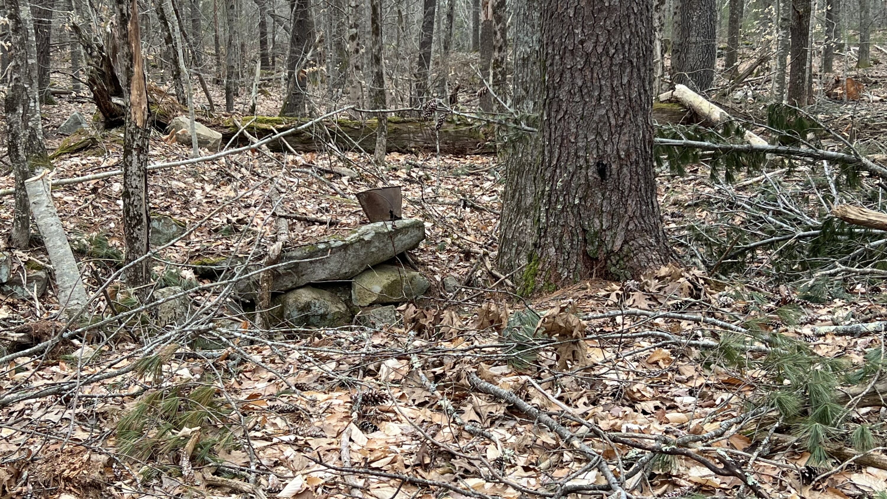
Ron Nowell and I took a walk along Old Bell Marsh Road, yesterday, looking for a Shaw cellar hole that we did not find. Jack Parsons told Ron of another cellar hole near a fresh cut by the York Land Trust. We found this cellar hole, quite small but very characteristic to others in the area. It appears to be on what is known as the Davis-McIntire Property, though a search through the registry of deeds reveals no names. It doesn’t appear on the 1872 cadastral map of York. If you have any information please let us know.
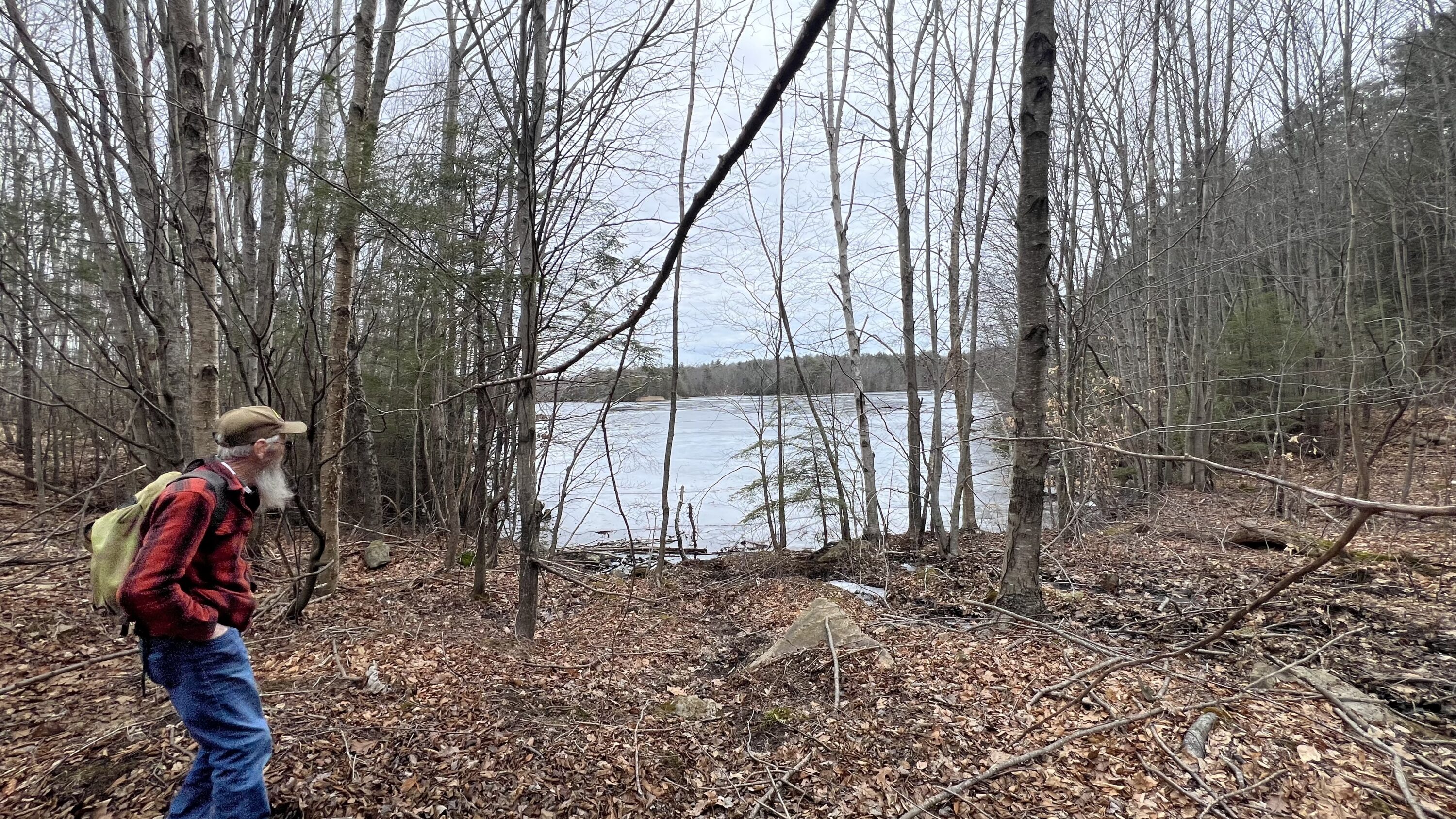
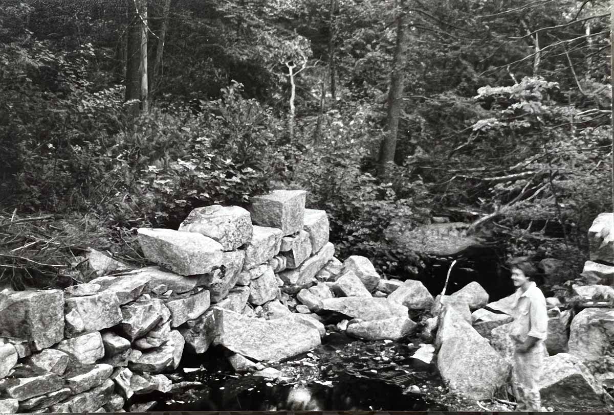
Ron Nowell observing Bell Marsh Reservoir from near Old Bell Marsh RoadUnknown cellar hole revealed along path with partial debris covering
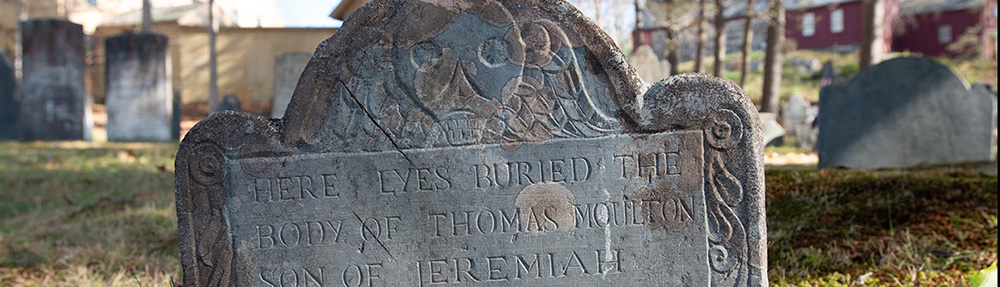
The exhumation of a gravesite by the Kittery Water District in York, Maine.
by Kevin Freeman
Almost weekly, for the last year, Ron Nowell has invited me out into the woods around the Mount Agamenticus area and southerly towards the York River. I have been an eager beneficiary of Ron’s love of local history and nature, listening with great interest to Ron’s renderings of local lore. Many stories have caught my imagination, leading me to pursue a deeper understanding through additional research. Between hikes, Ron and I will often talk on the phone, exchanging additional information, adding further interest and curiosity.
After we had covered a lot of area east of Mountain Road, our attention turned to the southwest of Mountain Road leading us to the Horse Hills and Bell Marsh. We followed cart paths, streams, bushwhacked and stumbled a few times on the lookout for ancient dwelling sites, dams, natural anomalies and native orchids, especially the illusive Small Whorled Pogonia.
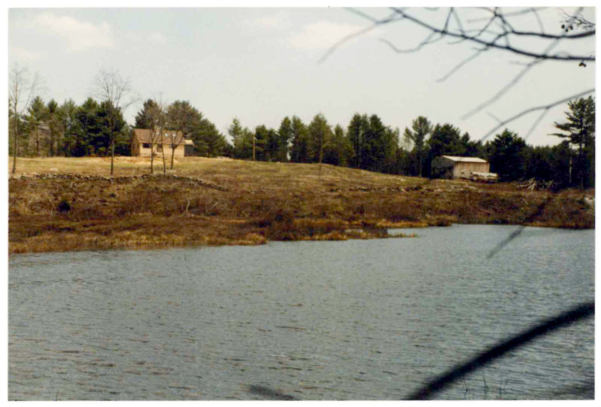
Although the old tote roads we traveled were not marked, Ron guided me on several trips from Mountain Road to Beechwood Road to near Bell Marsh. At some point and after crisscrossing other trails we arrived at Old Bell Marsh Road. I don’t know exactly where these paths become Old Bell Marsh Road. Old Bell Marsh Road was replaced by Bell Marsh Road as recently as the mid 19th Century. Both roads lie parallel to each other, the old road on the eastern side of the reservoir and the newer road on the west. The Old Bell Marsh Road, an early town three rod road, is lined on both sides with stone walls. When followed to Bell Marsh Reservoir it submerges into the reservoir and disappears making it appear to be an ideal boat launch, though boats are not allowed. As one stands on the north shore and looks about 300 yards across the water, the road reemerges on the opposite shoreline and the old road continues to Linscott Road. The newer Bell Marsh Road begins at a point on Mill Lane, ending Mill Lane, off Route 91.
The forest in this area has been cut many times since the first colonizers arrived. There are some large trees in some places though I am quite certain they are not virgin. We have stopped at many and just marveled at them. Solitary and towering above the others, they are a testimony of what happens when nature is left alone for one or two hundred years. Ron and I ponder how these trees were spared the axe or saw. The diversity of terrain between Mountain Road and Bell Marsh is quite spectacular. There are many vernal pools, dramatic ledges including Hedgehog Hills, rolling hills and a forest with a multiplicity of species. I am sad to say the forest is spotted with many Hemlock trees in varying states of disease and decay from the invasion of the woolly adelgid. The old stone walls, often but not always prolific, are a constant reminder that humans occupied this area with the interest of raising sheep.
As I researched the deeds in this area, property owners included the families of Paul, Shaw, Nowell, Junkins, Parsons, Ramsdell, Mitchell, Garey and Hooper who were likely recipients of land divisions when the Town of York began breaking it up for private ownership in the early eighteenth century. Today, a big portion is owned by the Kittery Water District, York Land Trust, and the State of Maine and fortunately it is mostly conserved for the future.
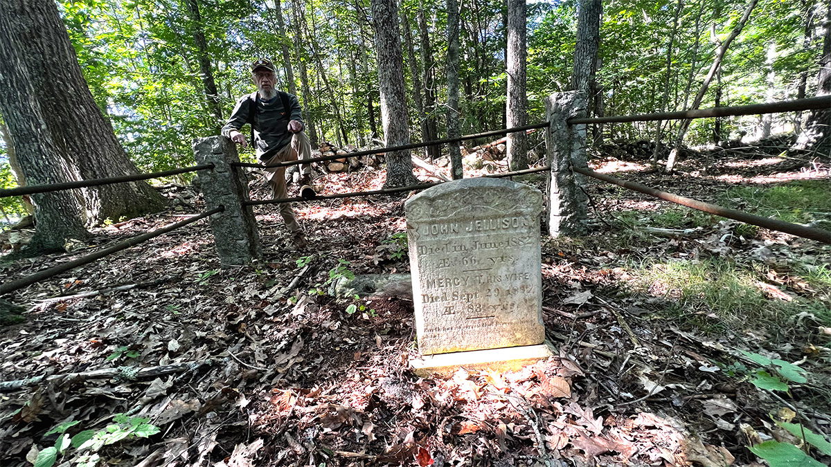
Ron Nowell leans on gravesite rail of John and Mercy Jellison. Cemetery #198
In John Eldridge Frost’s, The Nowells of York and South Berwick, Ron had read about some places that he hadn’t seen before in the Bell Marsh area. Ron was especially interested in a Jellison Cemetery, #198 on the York Cemeteries and Family Burial Grounds Map, and the homestead of Samuel Shaw. Frost also mentioned School House Number 7 that captured my imagination and can be seen on Sanford, Everts, & Co 1872 map of York. But it wasn’t as easy as just walking into the woods and finding these places. A typical hike, with Ron, is from four to eight miles. We would be in the woods walking and resting for about five or six hours. We each carried a back pack with our lunch, desert and coffee. We never knew exactly what to expect and after I once witnessed Ron tumble off a cliff and get pretty roughed up, I began carrying a fifty foot rope that could serve in a dramatic rescue attempt as well as in the many caves we searched for. Whether we found anything or not, I felt a natural kinship to Ron. It was obvious to me, that we both loved being in the woods, enjoying nature — everything else was icing on the cake.
During the summer of 1983, plus or minus a year or two, I worked with my best buddy building a stone foundation for Larry Willey’s home on Garey Mill Lane, off Bell Marsh Road. We also built a large fireplace in his living room that had a cathedral ceiling. We consumed a lot of rocks for both projects. We picked stones from the Garey Mill dam site and from the many stone walls that were at the time on the Willey property. From my first encounter I was impressed seeing the large hewn stones placed in a way that created the skeleton of a mill that would have turned raw materials into economic viability.
Kevin Freeman standing at the Garey Mill site off Garey Mill Lane, circa 1983
More than 40 years later, I returned to this remote area once inhabited by families whose names I listed above. As we walked, Ron’s stories of those who had lived here in the 19th century inspired me. The only evidence of settlement was stonewalls and a few cellar holes that are settling back into the earth and names on a few old maps that listed a few inhabitants. Mostly however, on the old map, staring back at me, I was captivated by School House Number 7. We were fairly certain of its likely general location but not conclusively. None-the-less, I used my imagination to fill in all that I could not see. In my mind the building was modest in size and I painted it white, a bell near the door, children frolicking around the yard, the teacher calling the children back into class, all on a warm sunny fall day. I couldn’t resist this romanticized version though in reality it didn’t exist. In reality there was a road leading from the schoolhouse that disappeared into a reservoir.
Additionally, there was one graveyard that haunted us and it was from another reference by John Frost in his, The Nowells of York and South Berwick. He wrote the graves had been exhumed and the bodies moved. When the Bell Marsh Reservoir was built and flooded, it was likely the gravesite had been submerged. We began examining the property plans that are available online (York County Registry of Deeds). When we weren’t hiking in the woods, Ron would often be hunting down “old timers” and picking their brains about what they knew of the area we were exploring. This would add more interest and clarity to what we were observing on our hikes. Ron made inquiries at the Kittery Water District. After a few months of inquiry and research, we began to piece things together and better understand what had happened at the grave site and the hopeful final resting place of the bodies. Frustrated that we could not locate the burial site we assumed it was underwater and that we would never see it.
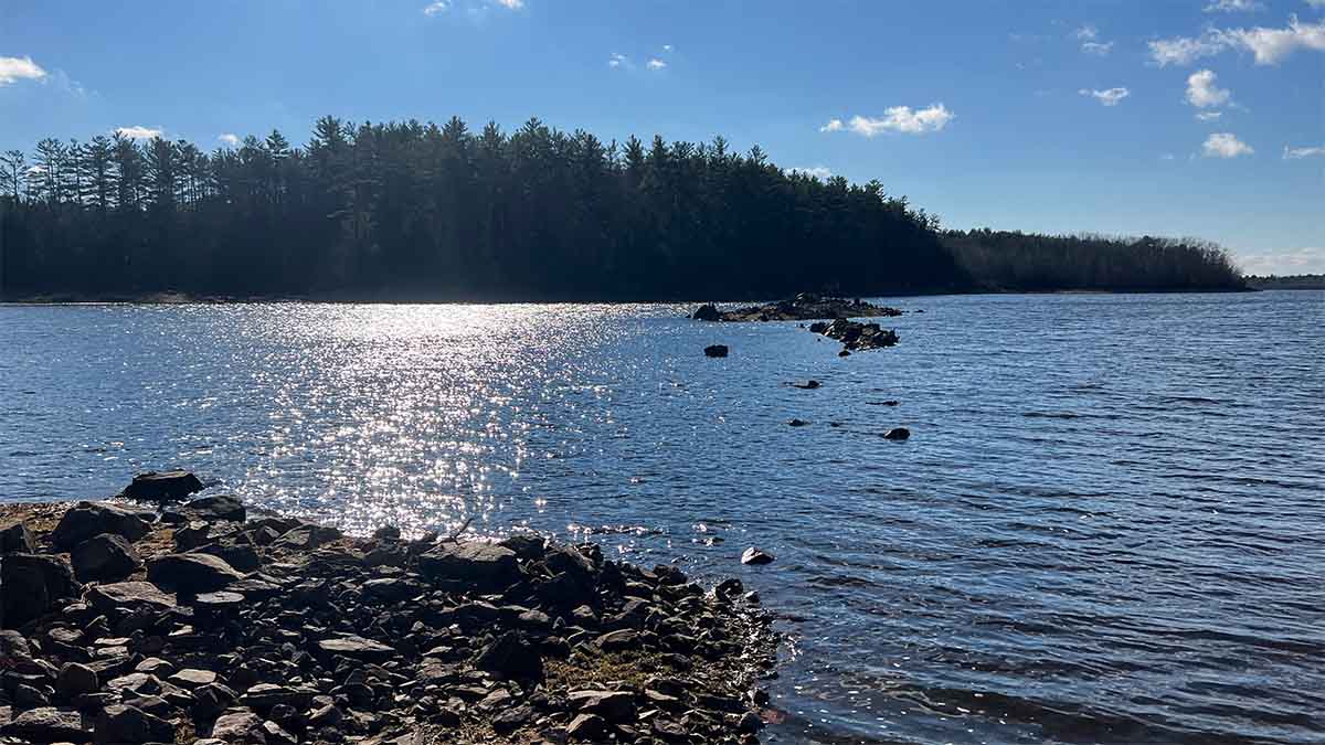
This photo was taken when the water had receded exposing more of Old Bell Marsh Road. The old wall can be seen here cresting above the water surface.
Back at the northern submersion site of Old Bell Marsh Road, standing, facing south at the water’s edge, Ron pointed to what appears to be a rock, or two, cresting just above the surface about 150 feet in front of us. He said that is part of the stone wall that lines the road. The idea of submerging a road and all the history it keeps secret becomes extraordinary in my mind. What is implied? School House Number 7 was directly behind us, the old road submerged in front of us. We sit down on the edge of the reservoir, in the shade of a maple tree and we eat the lunch we carried in. We sip coffee and Ron tells me more stories about the Shaw Family and the Nowell family each living here, making a living, generation after generation.
It was a hot summer day as we walked back, towards our vehicles parked on Bell Marsh Road. The road was dusty as our feet scuffed along the gravel surface. Part of the road was resurfaced by the Kittery Water Department to better access a logging yard toward the Horse Hills. This part of the road is wide and packed hard with stone and gravel, enabling it to support large logging trucks coming and going. As we walk out carrying our empty packs, we also carry out our heads full of questions and exchange hypotheticals with each other, reviewing from memory what he have read in old deeds and trying to recreate what this place must have been like when it was inhabited. The bigger question, that I always returned to was, why did people live out here and why did they leave?
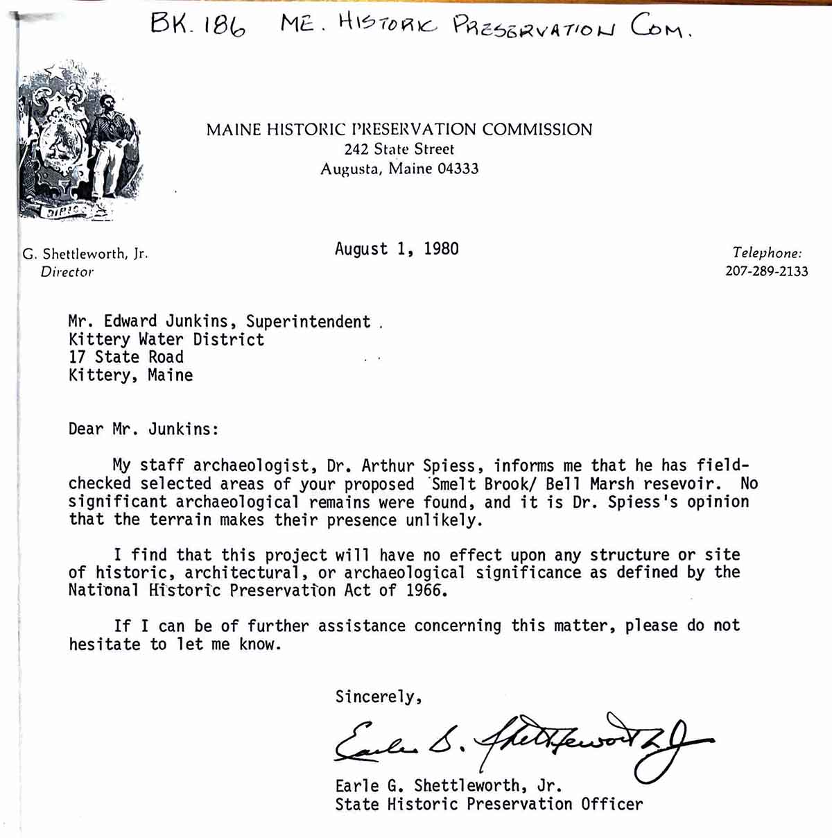
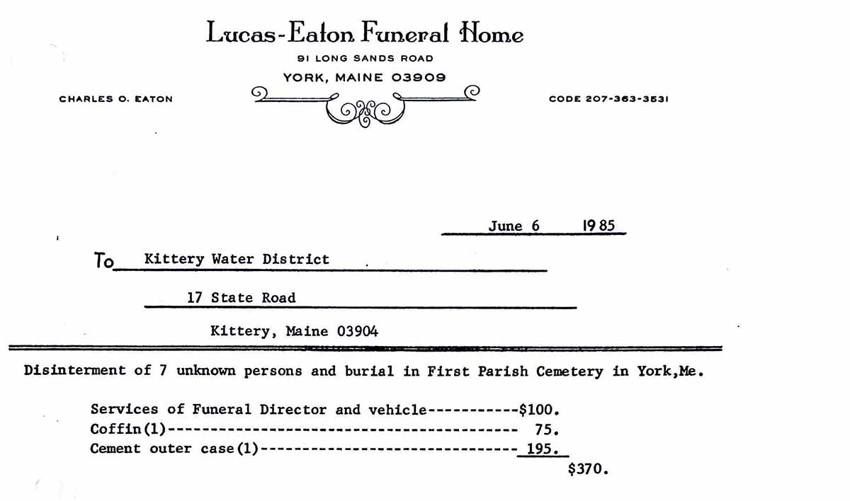
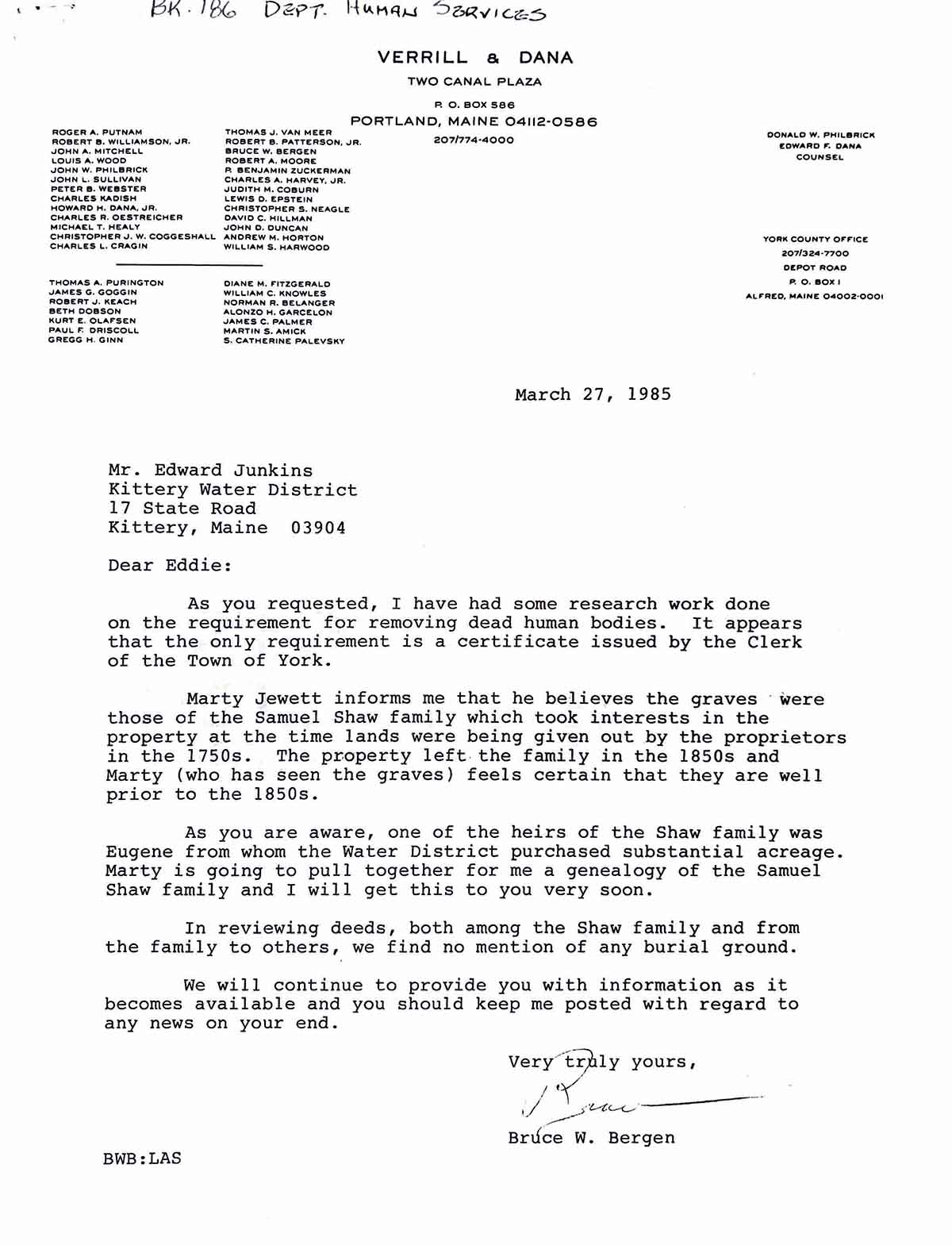
Ron called a few days after our hike and said that he had spoken with a local who told him School House Number 7 was at the intersection of Old Bell Marsh Road and Gerry Mill Lane, in the triangular section of the crossroads. I felt satisfaction that the exact location was known. After studying a map by Beatrice Warren Lane, we discovered there were likely three mill sites that were also submerged that would have been on Bell Marsh Stream, also called Smelt Brook. Ron then spoke with the retired Superintendent of the Kittery Water District, who was in charge of the creation of the Reservoir. He had been present at the exhumation of the graveyard and told Ron the bodies had been taken to the First Parish Cemetery in York Village. Ron checked with the Superintendent at the First Parish Cemetery and no records existed for the internment of the bodies.
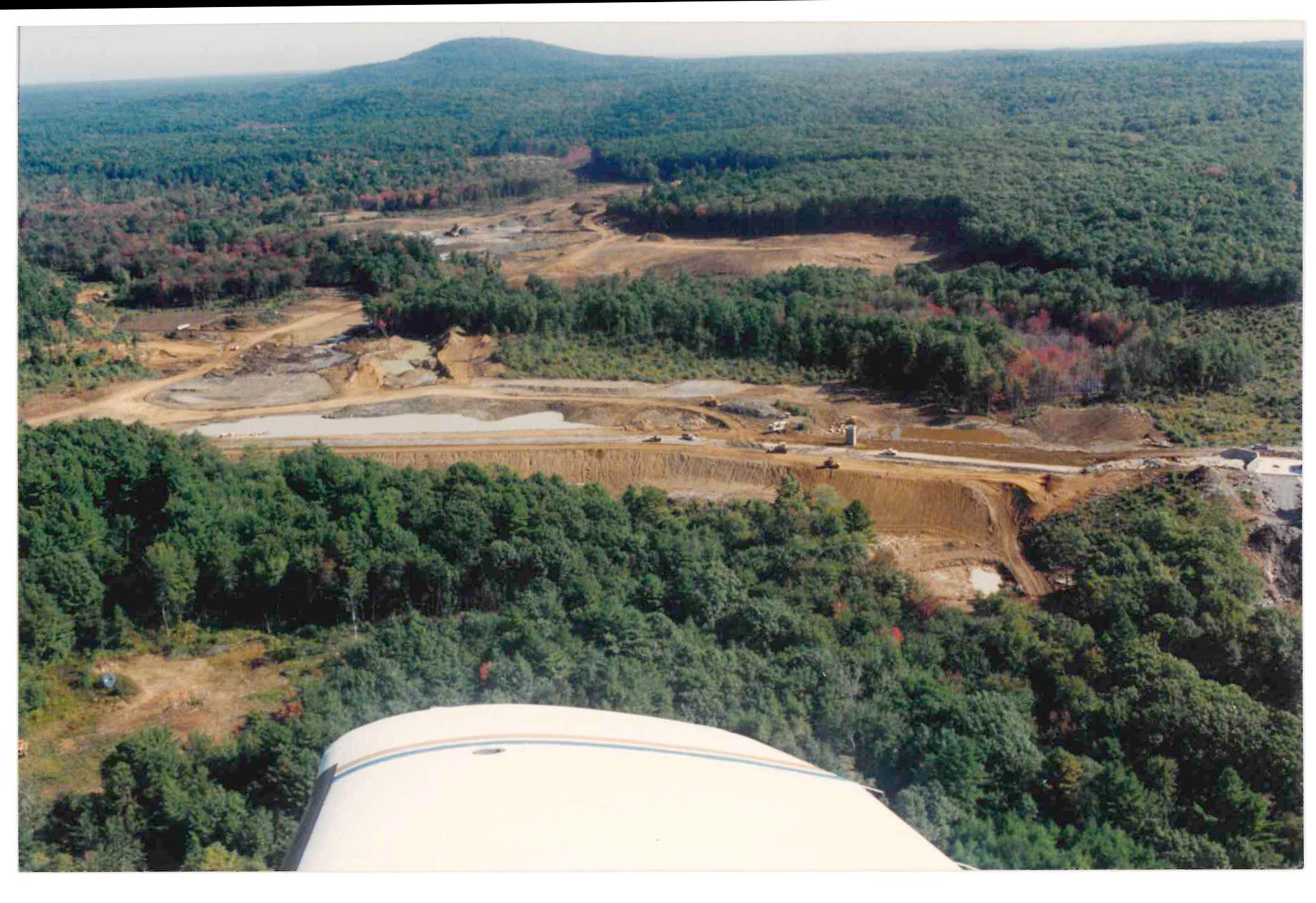
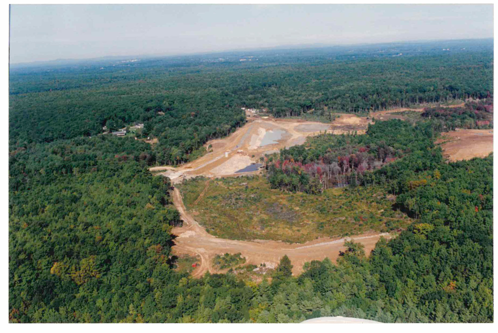
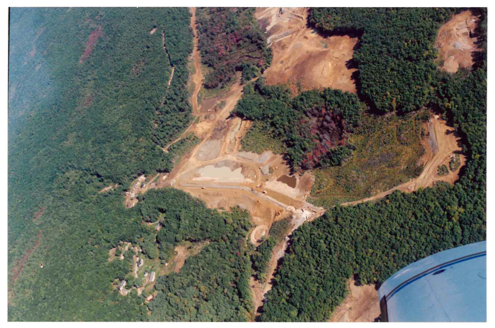
It is difficult to get a grasp on the size of the Bell Marsh Reservoir project and the reasons for its creation, that is a story unto itself. As Ron and I pursued more information, I was hopeful that we might come across some photos of the construction site in progress. That maybe we could see what the Bell Marsh Brook liked before it was flooded and if indeed the three dams we suspect were present before the flooding would be visible. Our hiking continued and we eventually covered the area around Bell Marsh Reservoir and discovered an absolutely stunning water fall whose sources begin in the Horse Hills. We also found a stone causeway near a very large wetland. As we were making more discoveries our determination persisted to better understand the exhumed gravesite. We talked about waiting for the reservoir to freeze over and if the ice was clear enough and supportive, we could look through it, following the old road below.
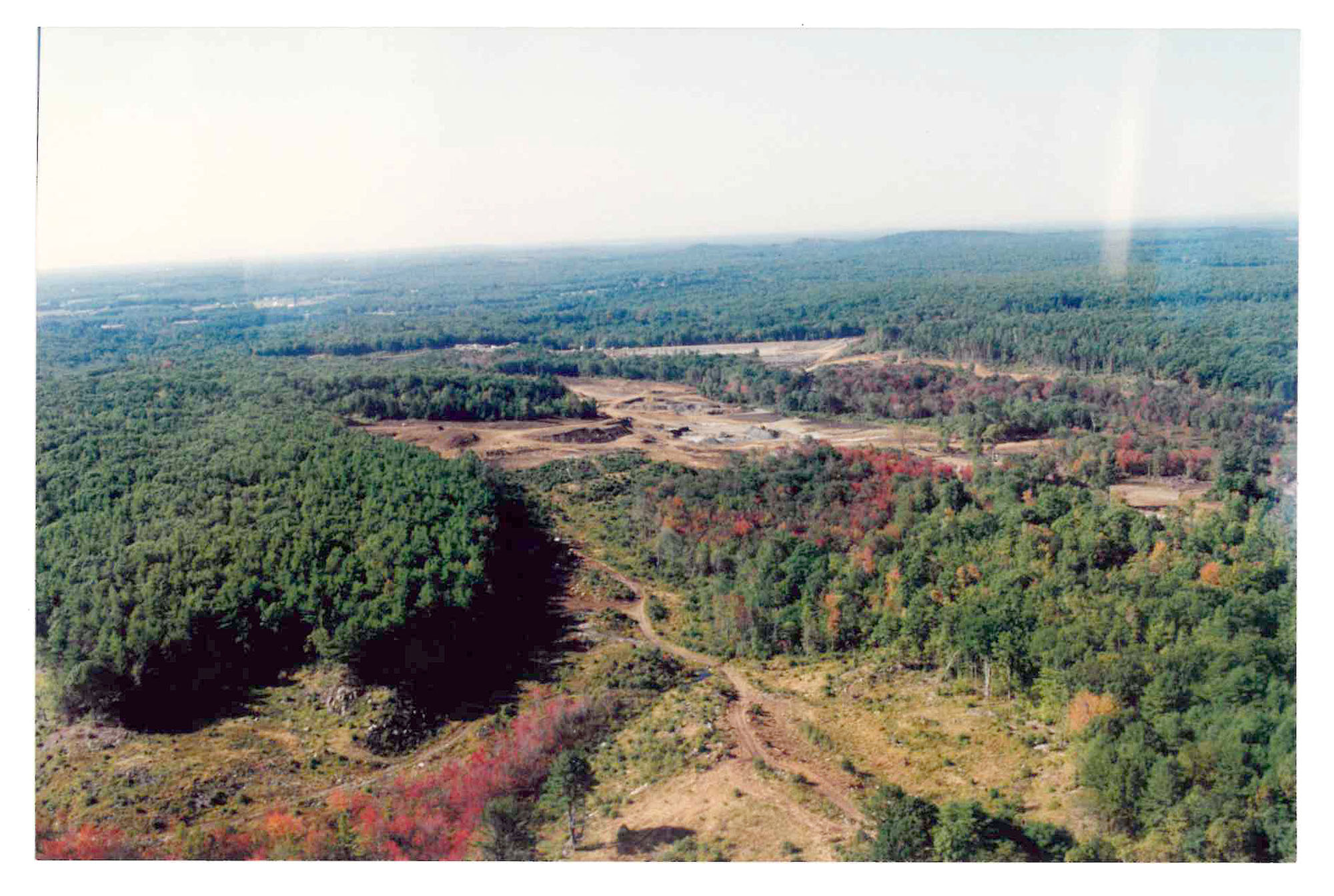
Exhumed Gravesite, records of Kittery Water DistrictExhumed gravesite records of Kittery Water DistrictHome of Larry Willey, replaced with new homeAriel View of Bell Marsh Reservoir under constructionAriel View of Bell Marsh Reservoir under constructionAriel View of Bell Marsh Reservoir under constructionAriel View of Bell Marsh Reservoir under construction
Over the end of summer and early fall the mystery of the gravesite, the exhumed bodies and the internment at First Parish Cemetery fueled our research interest. Ron had requested more information from the Kittery Water District but went without a reply until we thought it would be a dead end. That is when Ron received a packet with most, if not all of the information about the research and action taken to exhume the bodies as reported from the Kittery Water District. When Ron shared the packet with me it was quite a revelation. We had nearly given up hope about the many details that we assumed had been recorded for the exhumations but doubted we would ever see. Key, was a plan titled, Condemnation Plan of Kittery Water District Bell Marsh Reservoir, York, Maine, March 5, 1985, Rooney E. Chadbourne, 1125, Registered Land Surveyor. This plan (see above) was not found in the York County Registry of Deeds, by me, after much searching. It was the revelation that we had hoped for. The approximate location of the submerged gravesite is represented in about the center of the plan, though the description is vague. It seemed reasonable to assume that since the gravesite was in the center of the plan it would be in the center of the reservoir, so I thought. By chance, and as the plan didn’t show anticipated water levels, I decided to scan the plan and overlay an arial image of the reservoir into place upon the plan using Photoshop. To my surprise I found that the gravesite may or may not be submerged and it is very close to the Spinney gravesite, lot 6 on the Cemeteries and Family Burial Grounds map for the Town of York’s Comprehensive Plan 2006.
As of today, April 6, 2023, I am not certain if the gravesite, with the exhumed bodies is accessible or submerged below the water’s surface but I am looking forward to hiking out there and looking closely. I feel this story is important due to the fact that the seven persons buried at the gravesite are now unknown. With the small amount of information we do have, we cannot be certain of who they were, when thy were buried or other facts that are critical to a better understanding of the past. Below are a few documents provided by the Kittery Water District.
By the account told to Ron Nowell by Ed Junkins, the Kittery Water District Superintendent at the time of exhumation, the bodies were removed with a tractor and placed into a plastic container and interred in the First Parish Cemetery very near the Pauper Cemetery which is along the gravel road on the Eastern side. A cement liner was used and the body parts were all placed together. The exact location is not known.
Ron Nowell’s determination to find the details presented above have made this paper possible. Without Ron’s relentless pursuit and sharing of York, Maine history, myself and many others would be far less informed. Thanks to Ron, to whom I have dedicated this paper.
Also, the Kittery Water District has been forthcoming and considerate in providing information, documents and photos that have aided our research. We are grateful to them and for their friendly demeanor.