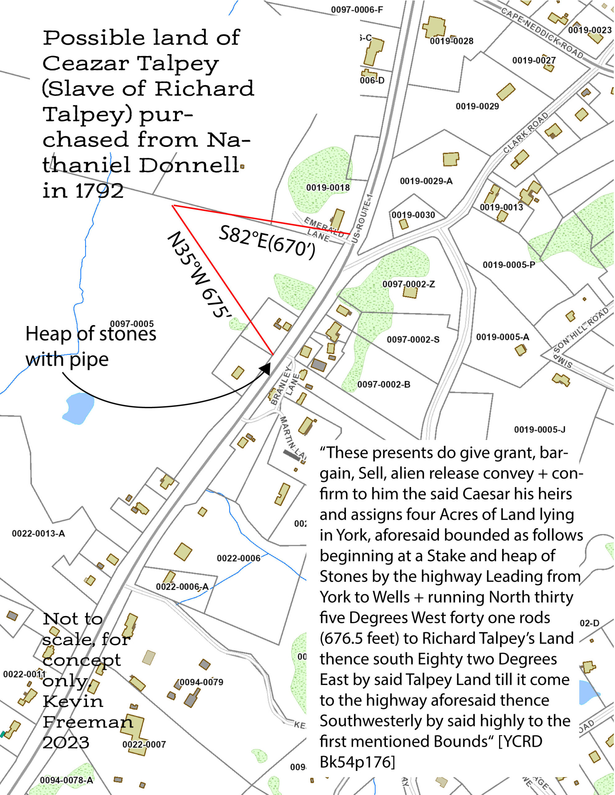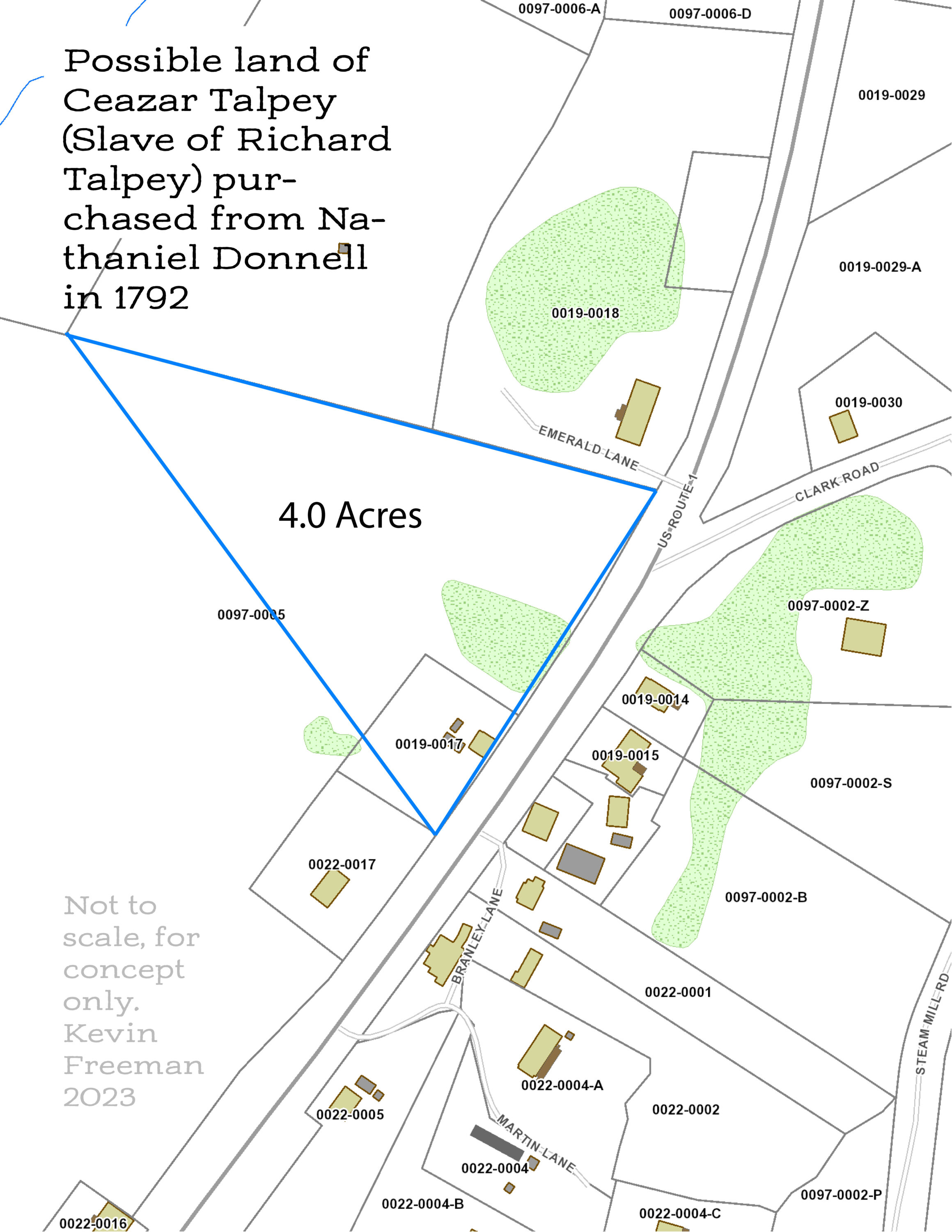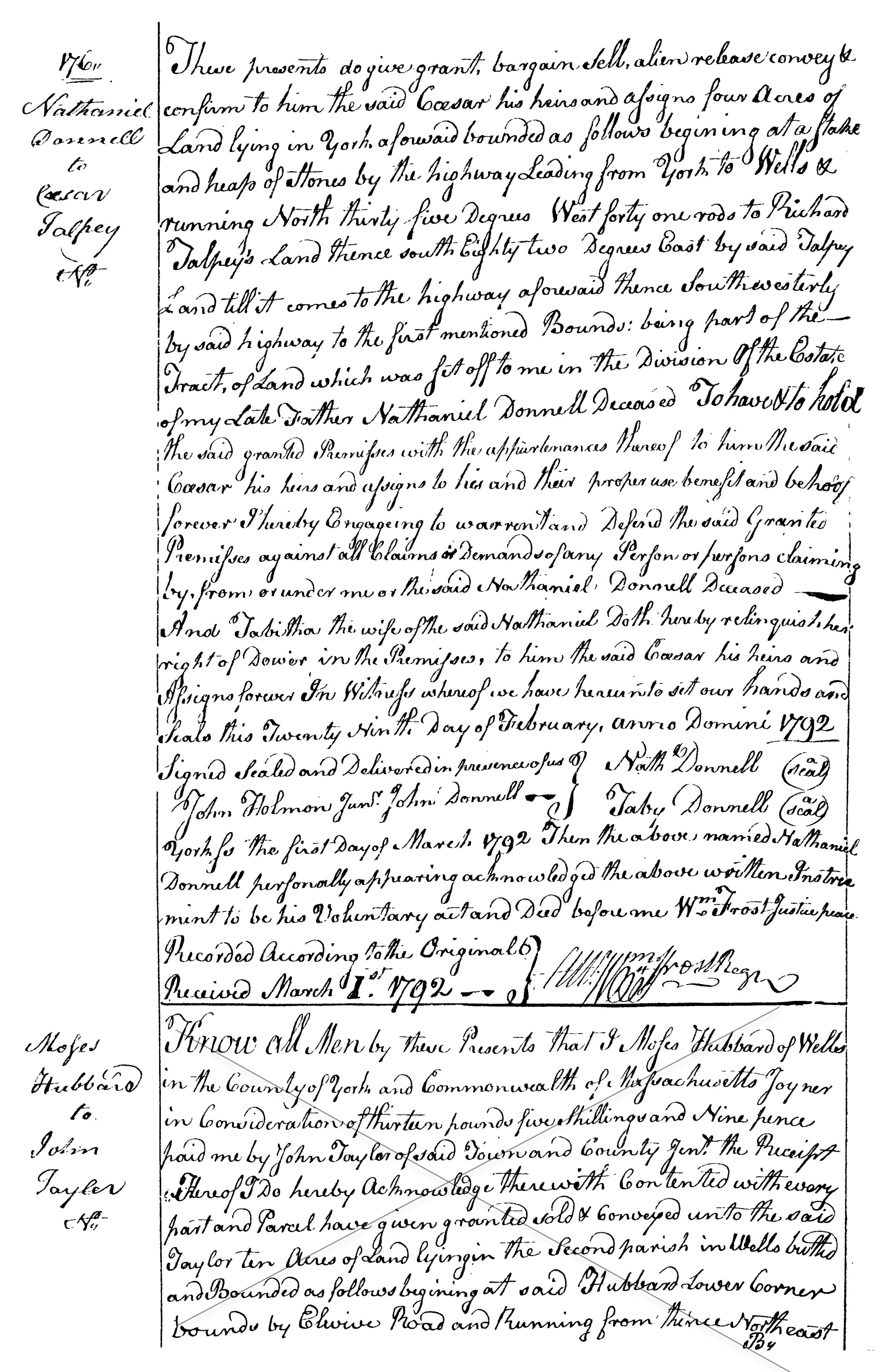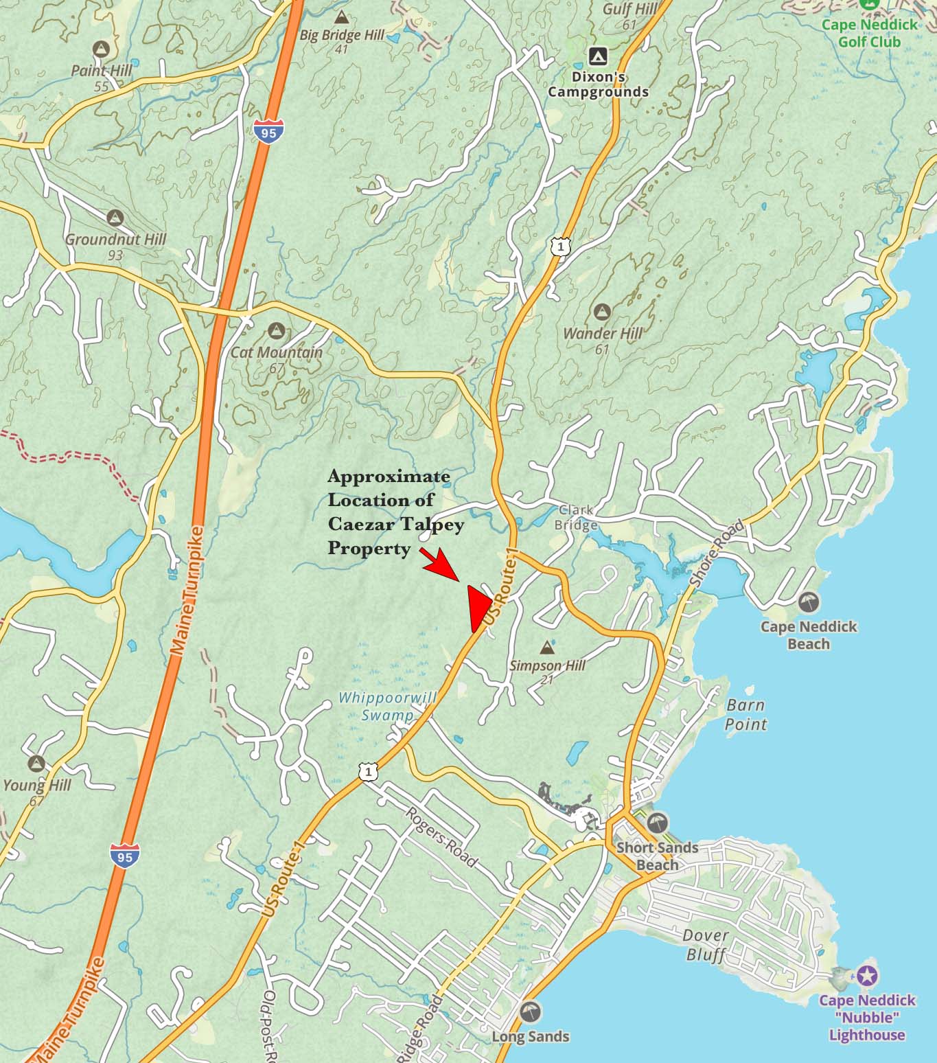
Ron Nowell and I have been compiling a list of Slaves in York, Maine and one Slave, Caezar Talpey has caught our imagination. Caezar purchased land from Nathaniel Donnell in 1792, bounded by his owner, Richard Talpey, to the North. We can assume Caezar was freed when Slavery became illegal in Massachusetts in the 1780’s. From the deed (YCRD book 54 page 176) I have used the tools on the Town of York tax maps to draw the location of the property lines taken from the deed. The first drawing represents the measurements as accurately as possible from the deed reference. The second drawing shows 4 acres with a slight liberty to tweak the triangle into conforming. This effort is preliminary and not conclusive but it gives us a general idea of where a Slave owned property and lived in Cape Neddick in the later part of the 18th Century. Here is the description in the the deed… “These presents do give grant, bargain, Sell, alien release convey + confirm to him the said Caesar his heirs and assigns four Acres of Land lying in York, aforesaid bounded as follows beginning at a Stake and heap of Stones by the highway Leading from York to Wells + running North thirty five Degrees West forty one rods (676.5 feet) to Richard Talpey’s Land thence south Eighty two Degrees East by said Talpey Land till it come to the highway aforesaid thence Southwesterly by said highly to the first mentioned Bounds”