The following maps are in the public domain. You can right click and open new tab or window to view full resolution images.
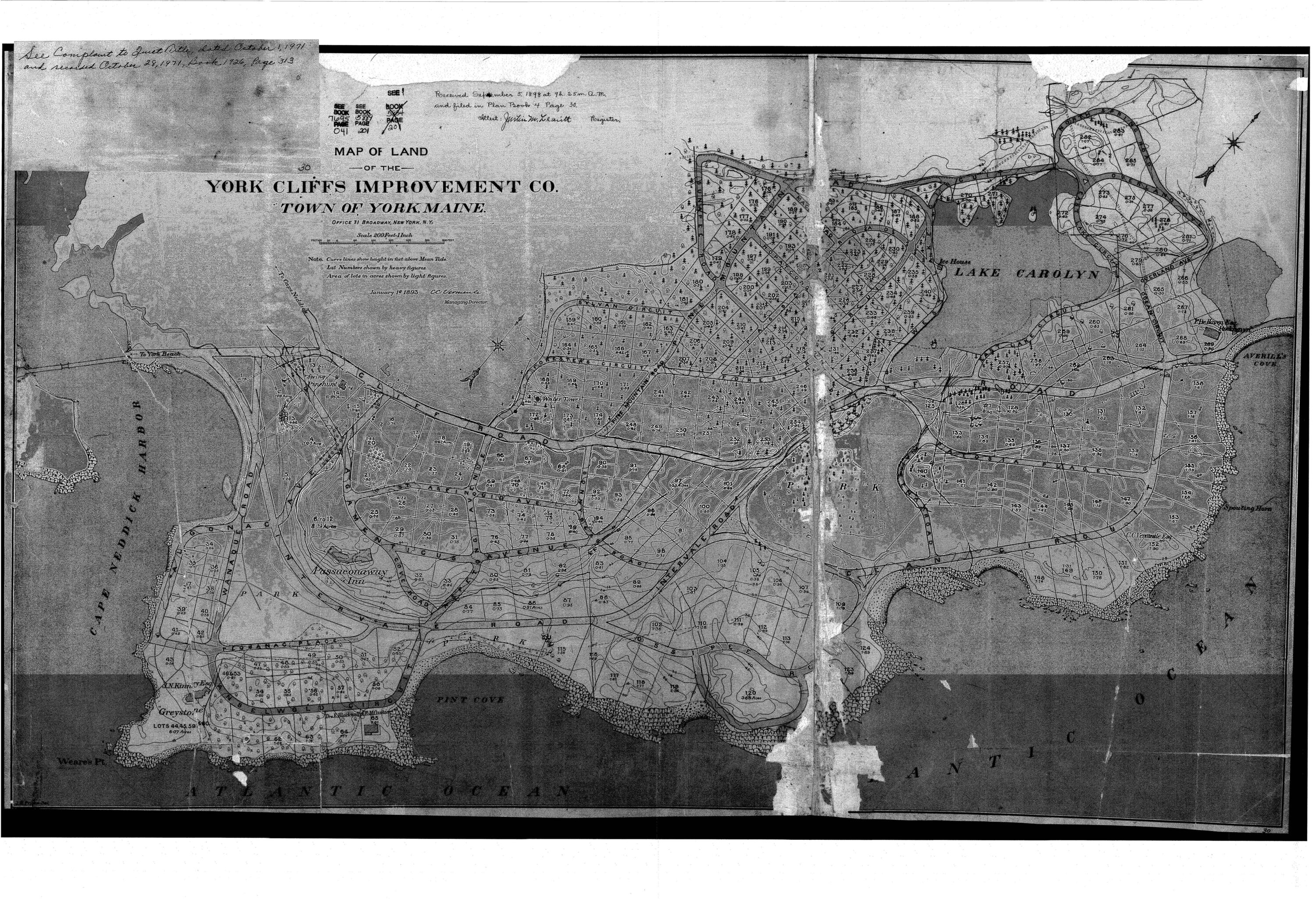
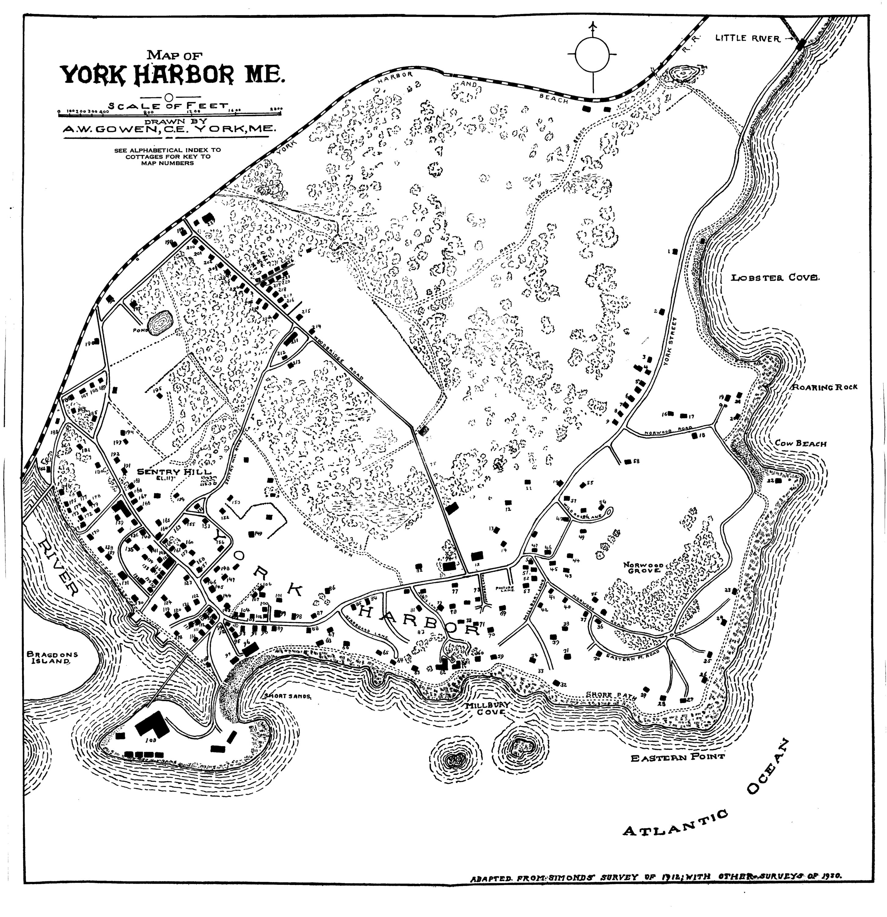
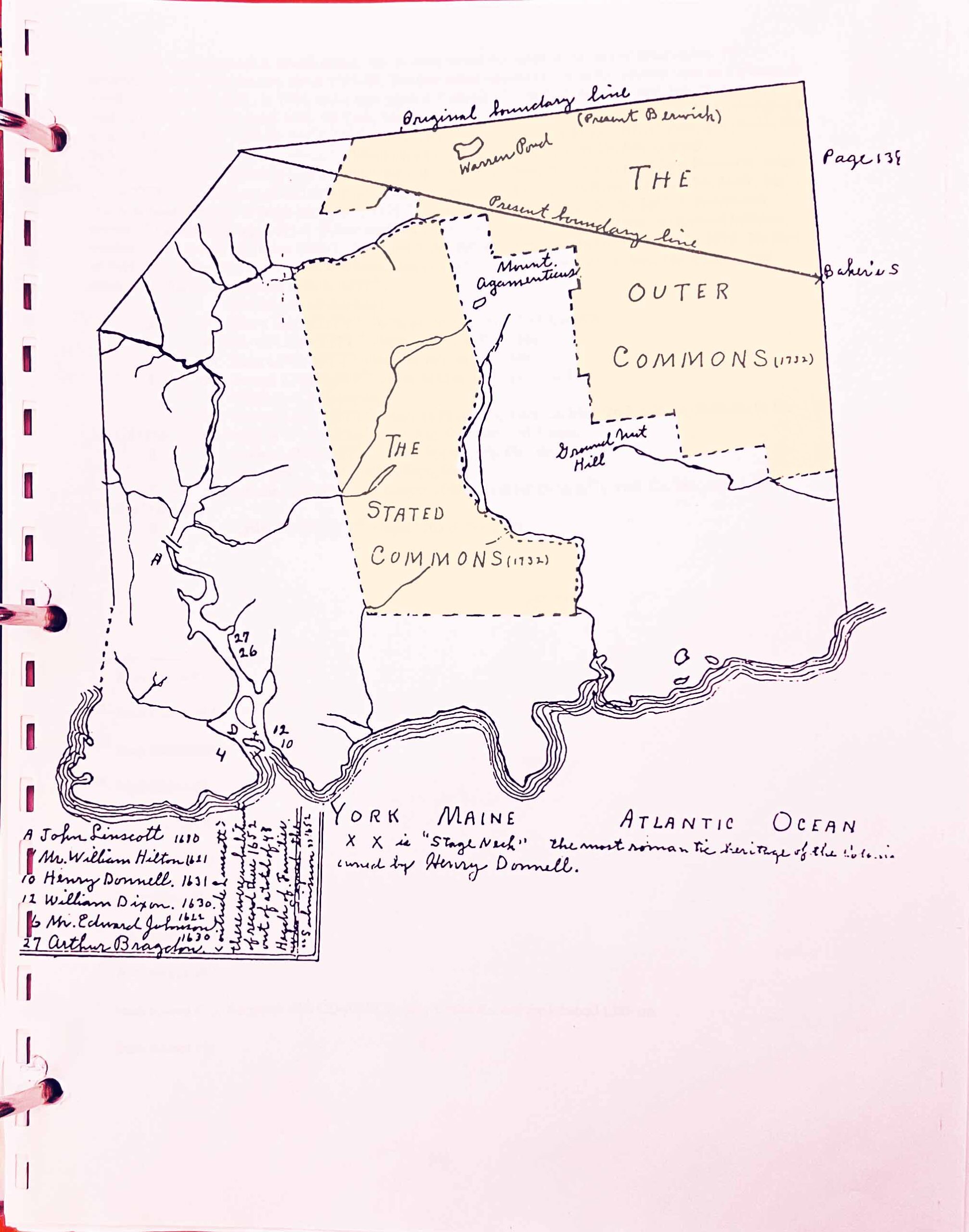
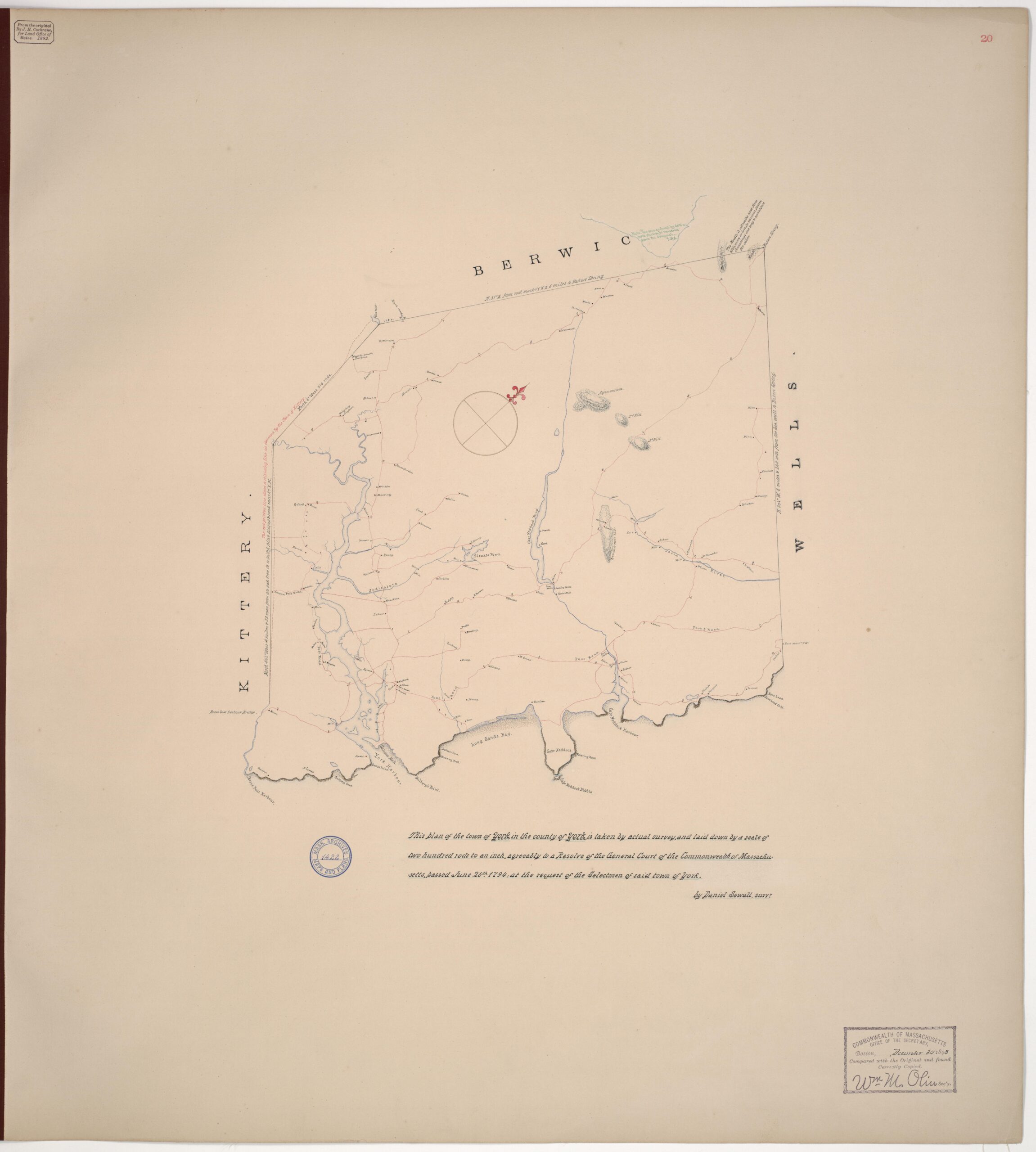
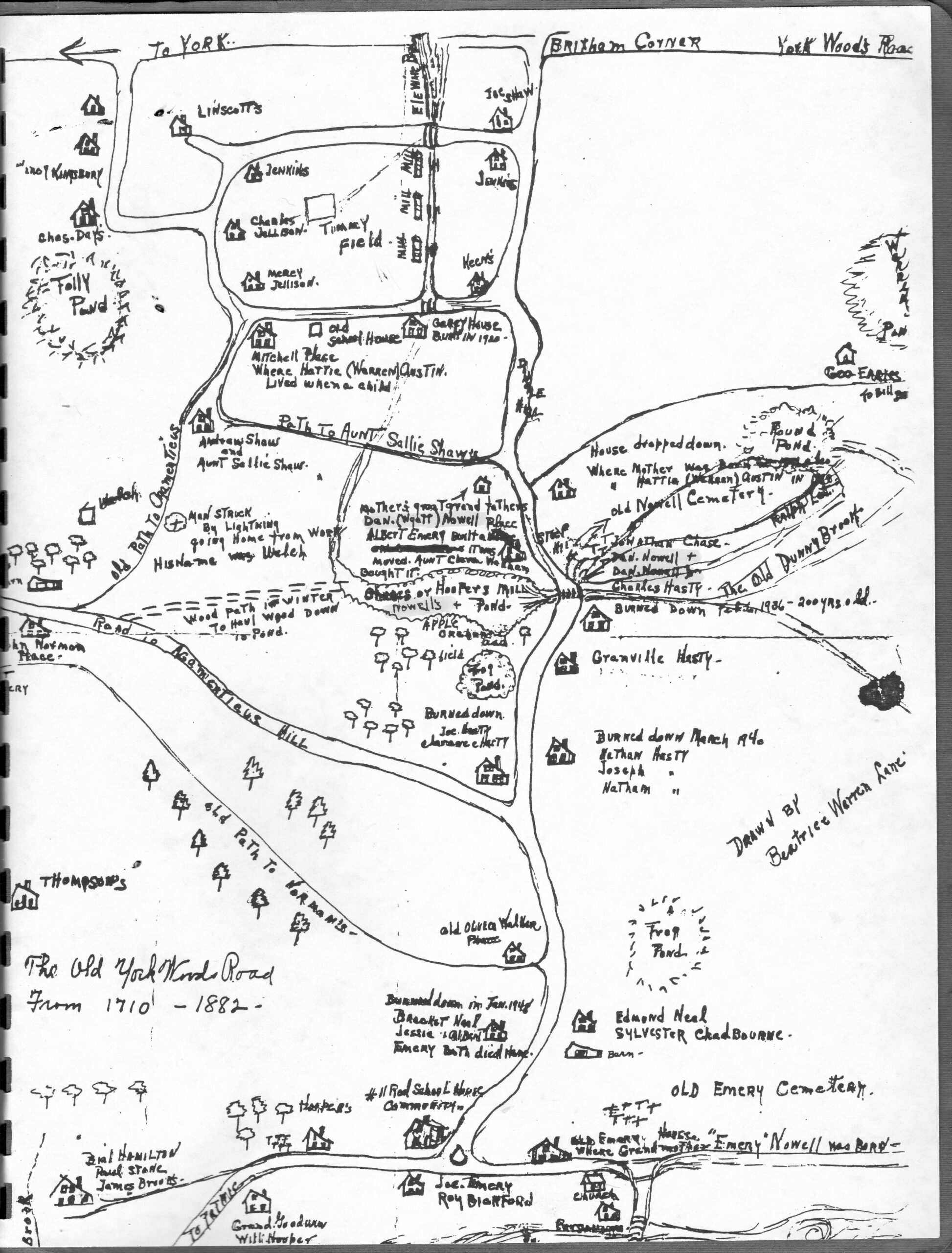
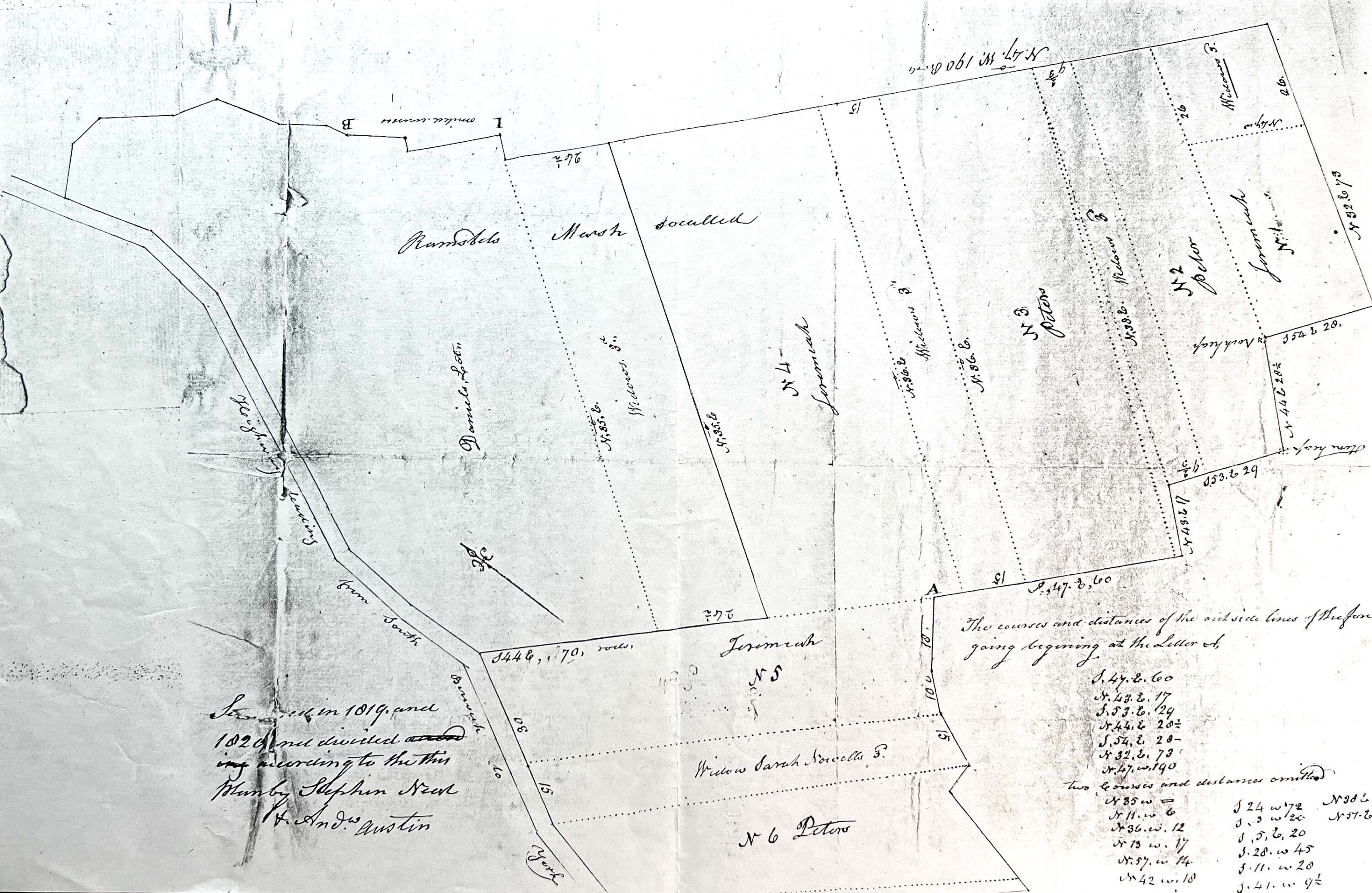
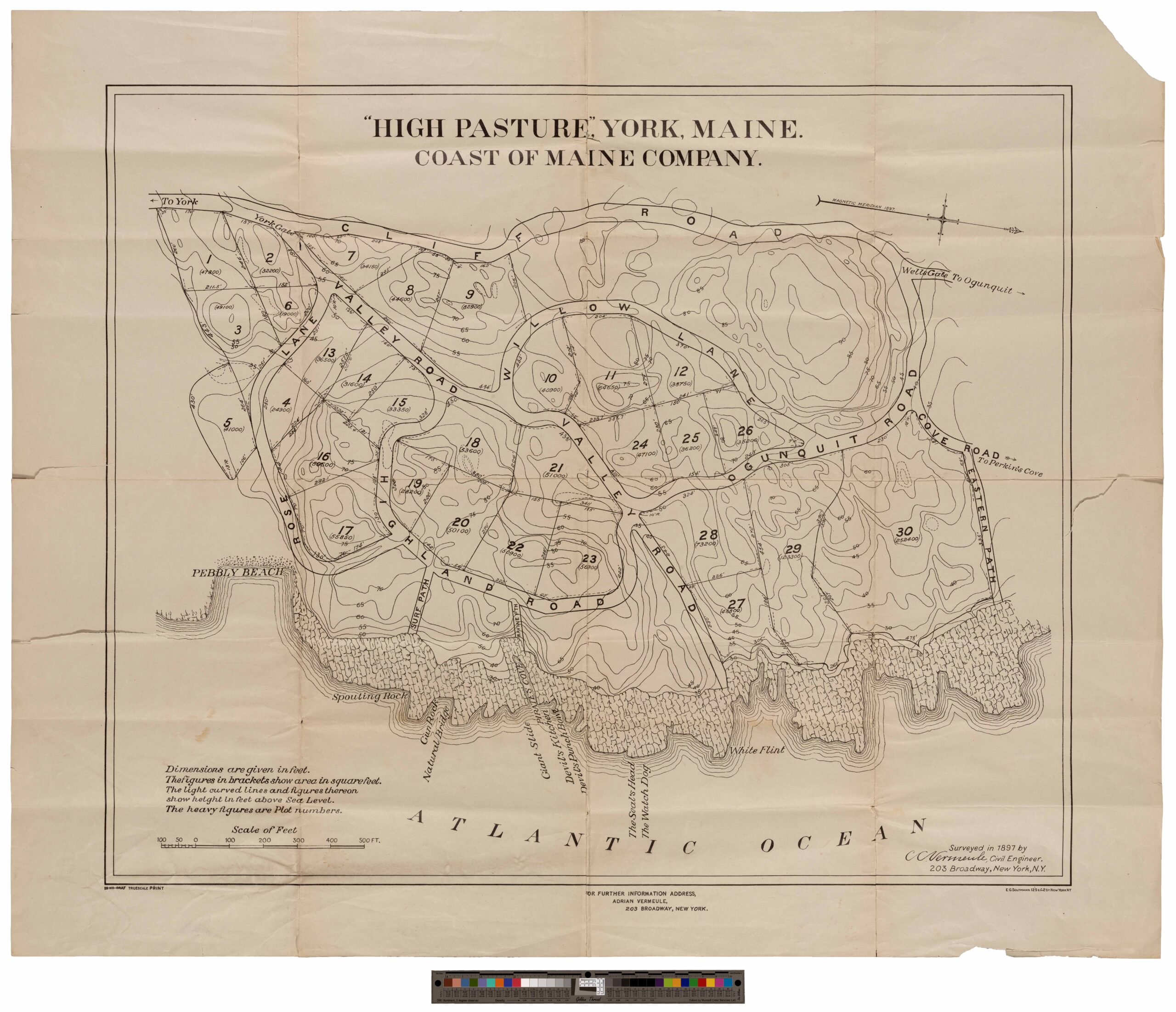
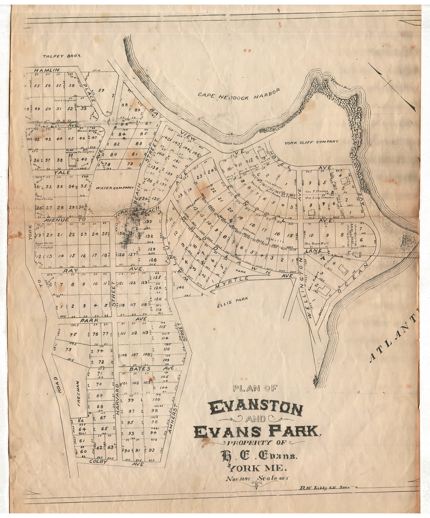
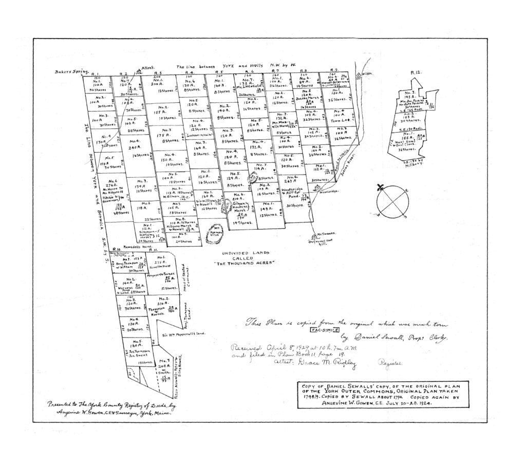
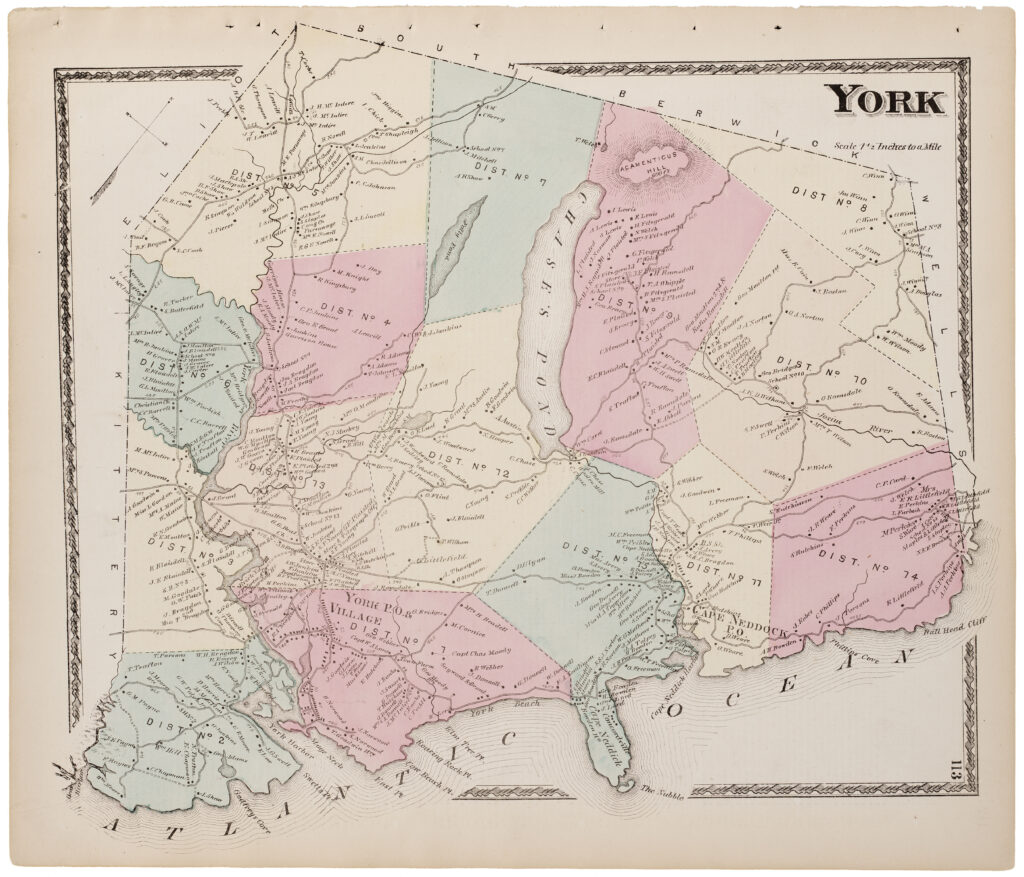
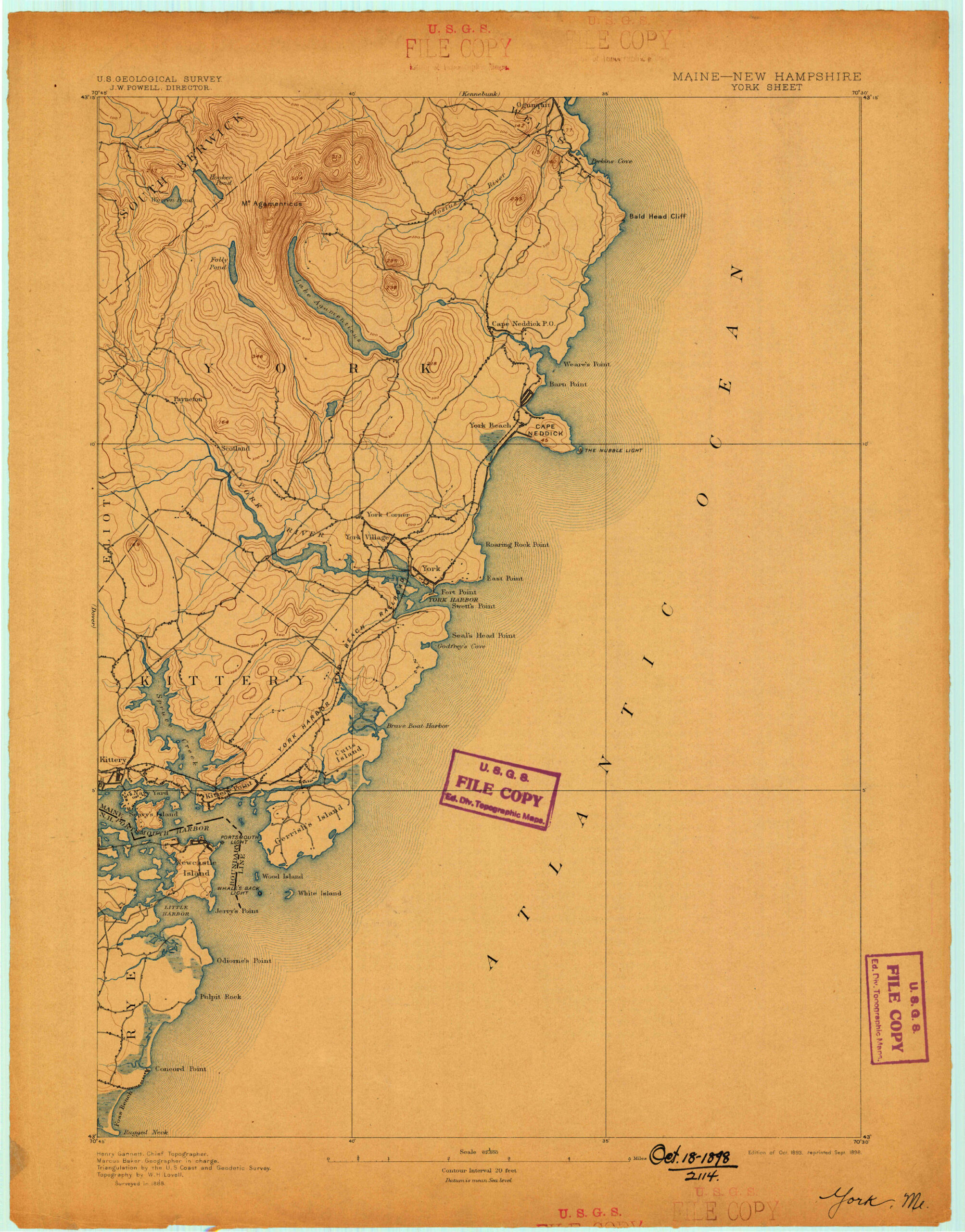
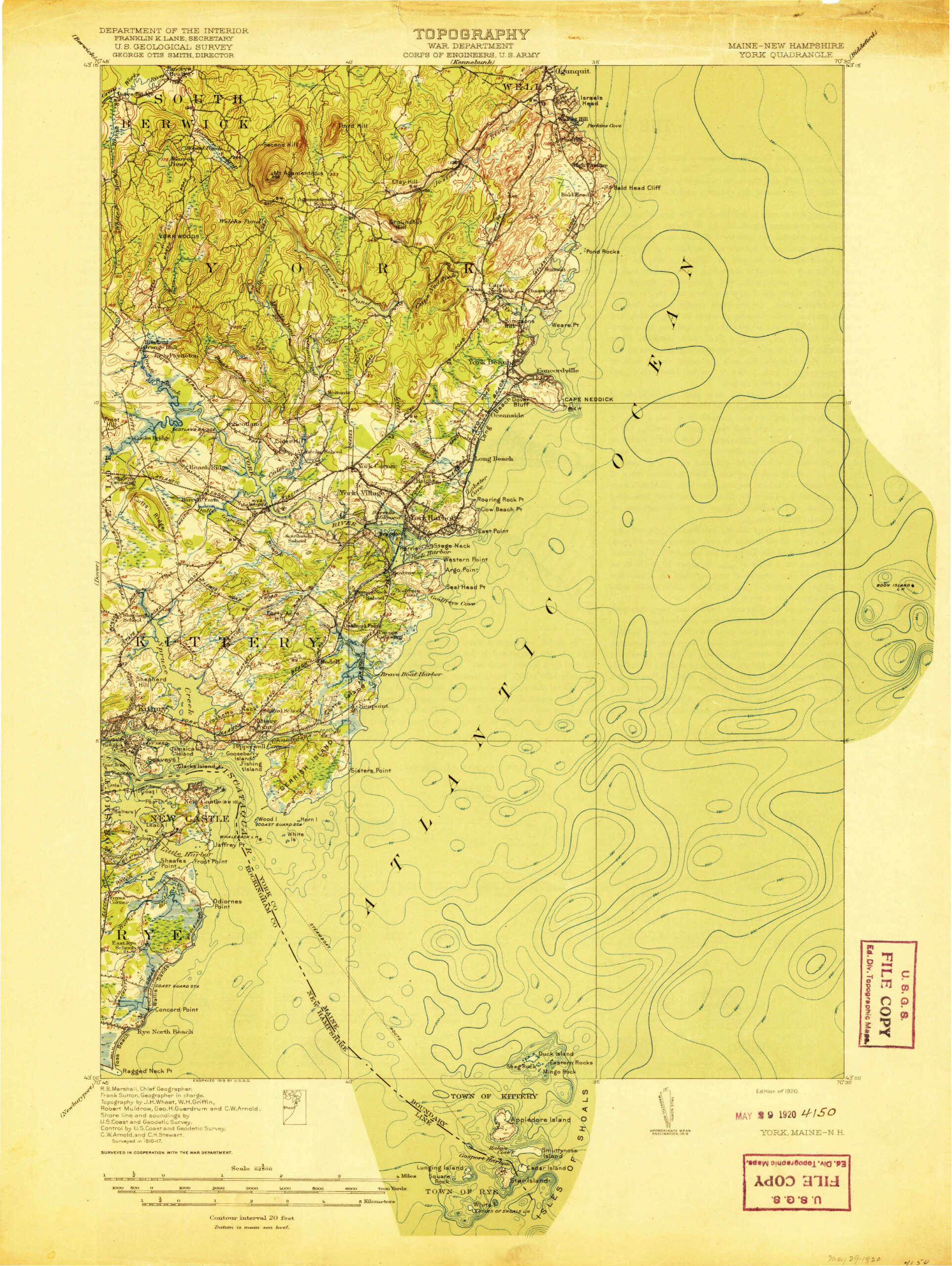
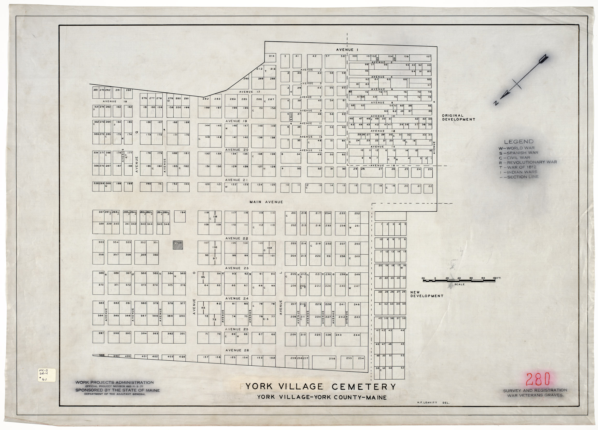
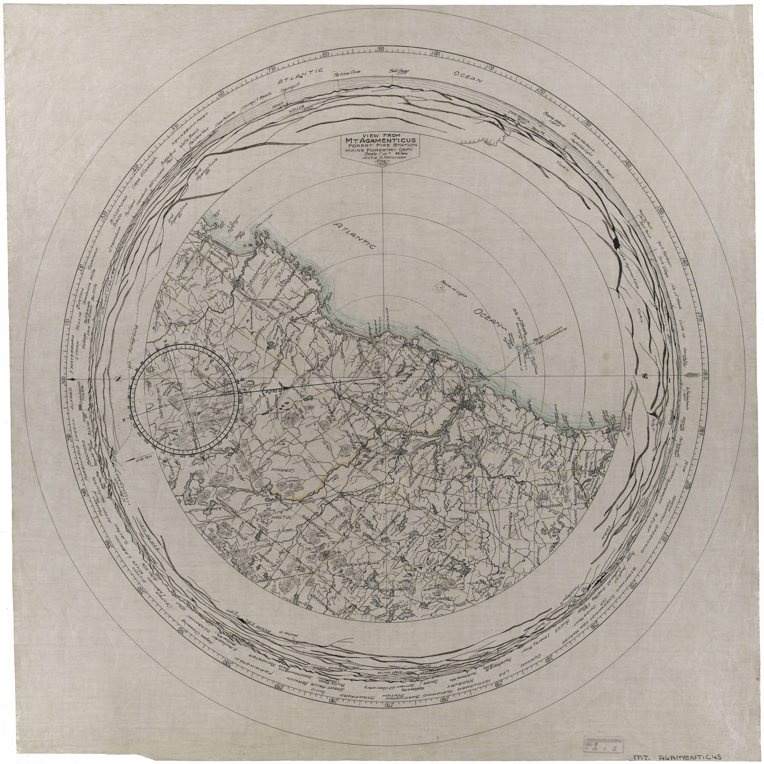
Pascatway River in New England, circa 1670 York Cliffs Improvement Company Plan 1893Map by A.W.Gowen of York Harbor, including the Shore Path, Cliff Walk, Cliff PathOuter Commons and the Stated Commons, York, Maine. This map seems suitable for reference only.Daniel Sewall map of York Maine – 1794Beatrice Warren Lane map of the Western portion of York, MaineRamsdell’s Marsh and Bell Marsh RoadEvanston and Evens Park in York BeachOuter Commons in York, Maine1872 Map of York, MaineHistorical Topographic Map Collection of York, MaineHistorical Topographic Map Collection of York, MaineFirst Parish Cemetery Plan, York Village, MaineMaine Forest Service, Mount Agamenticus map 1919