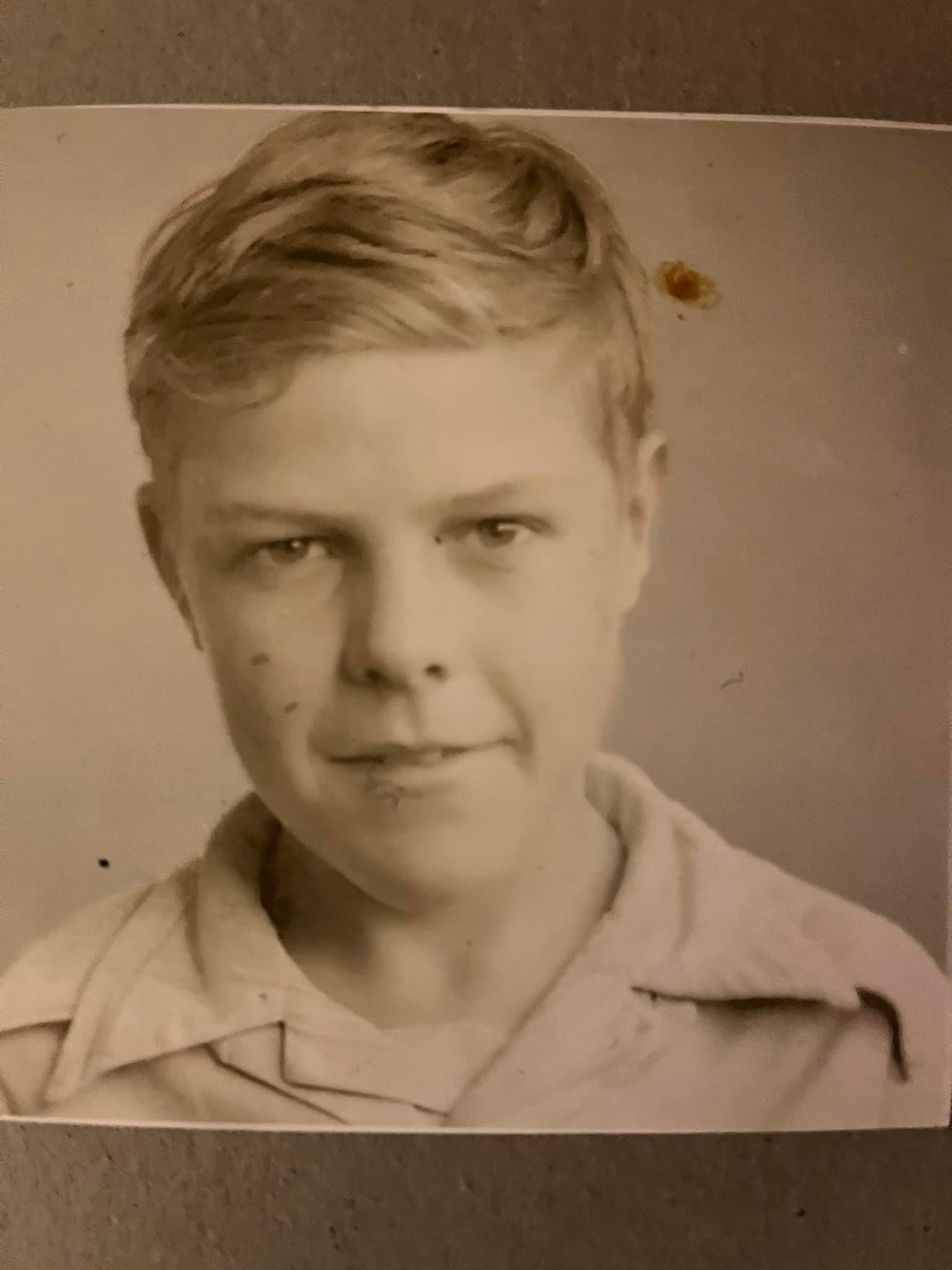
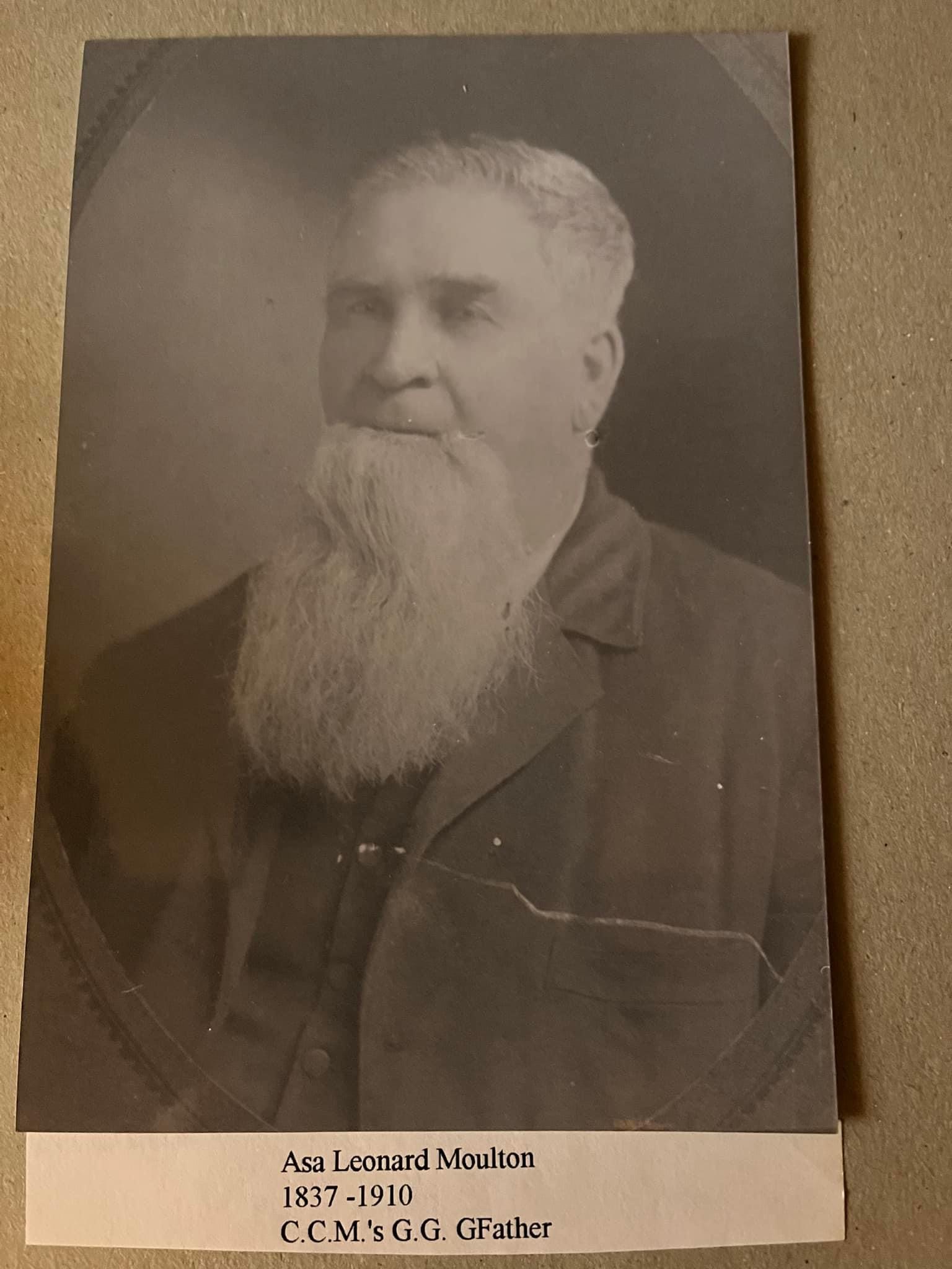
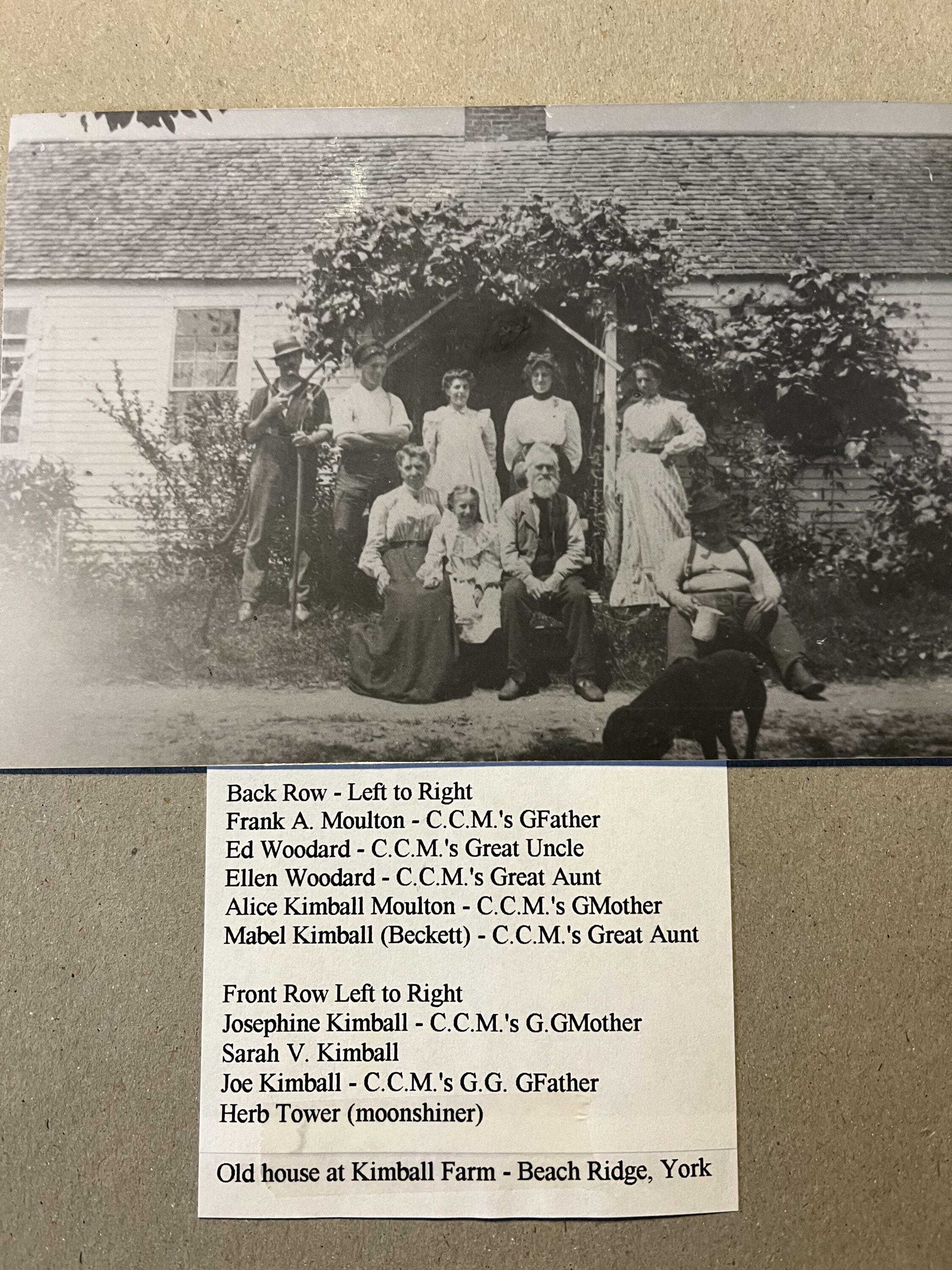
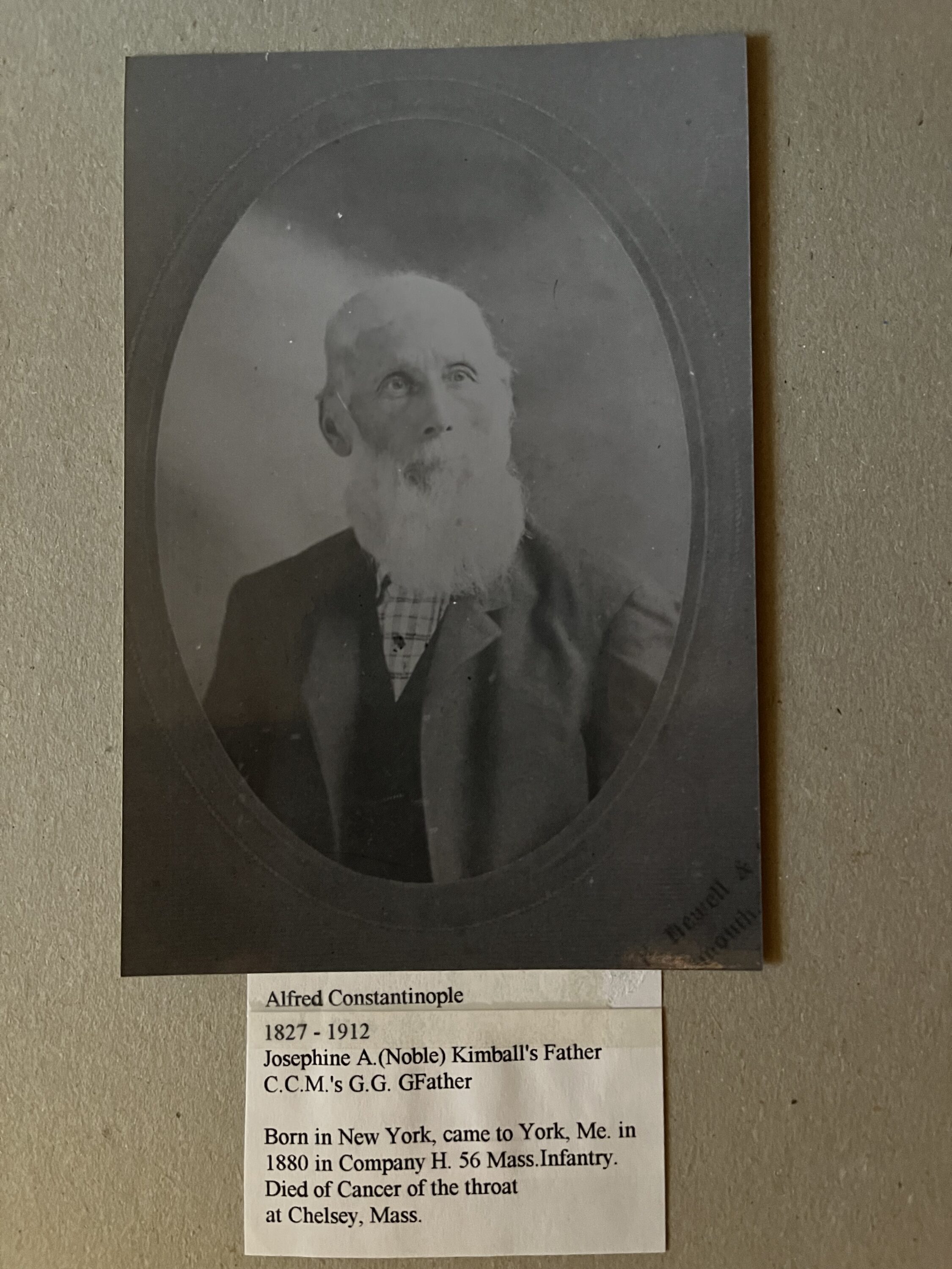
We thank Chris Moulton for opening the door on this project . Hopefully people will find us and add to the project
We thank Chris Moulton for opening the door on this project . Hopefully people will find us and add to the project
Ron Nowell and I began walking the area of Third Hill, in York, Maine, in the spring of 2022. We had been talking about documenting many of the points of historical interest around the Mount Agamenticus area for a few years. Ron’s knowledge of the area is extensive and rare. My role was to be an observer and recorder. Our first hike led to another and we documented many places, plants and features and we made some new discoveries.
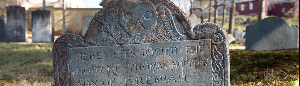
I was particularly interested in the Third, Second and First Hill (Mount Agamenticus) area. I could trace my grandmother, Edna May Perkins, back to the early settlers on Old Mountain Road and beyond. As Ron showed me the remains of dwellings, wells and graveyards and knew their names, I could follow these names in my family tree. I became fascinated. Among the names were Welch, Ramsdell, Lewis, Plaisted, Bracy, Moulton, Fitzgerald. Ron also had many stories to go with each of the places, some first hand and many second or third.
There was a dichotomy that developed in my mind. How could people survive out here and why, and why did they leave? As Ron led the way through countless miles we often stopped, Ron would find a dry stone, sit, twist off the top of his thermos, take a few sips of coffee and we would begin to hypothesize about the circumstances that created this strange place. Never did it occur to Ron to not reach into his backpack, find a Devil Dog or Yodel, withdraw it and bring it into the presence of our conversation. And there we would sit, mesmerized with the names leading back to the past, under the spell nature’s beauty.
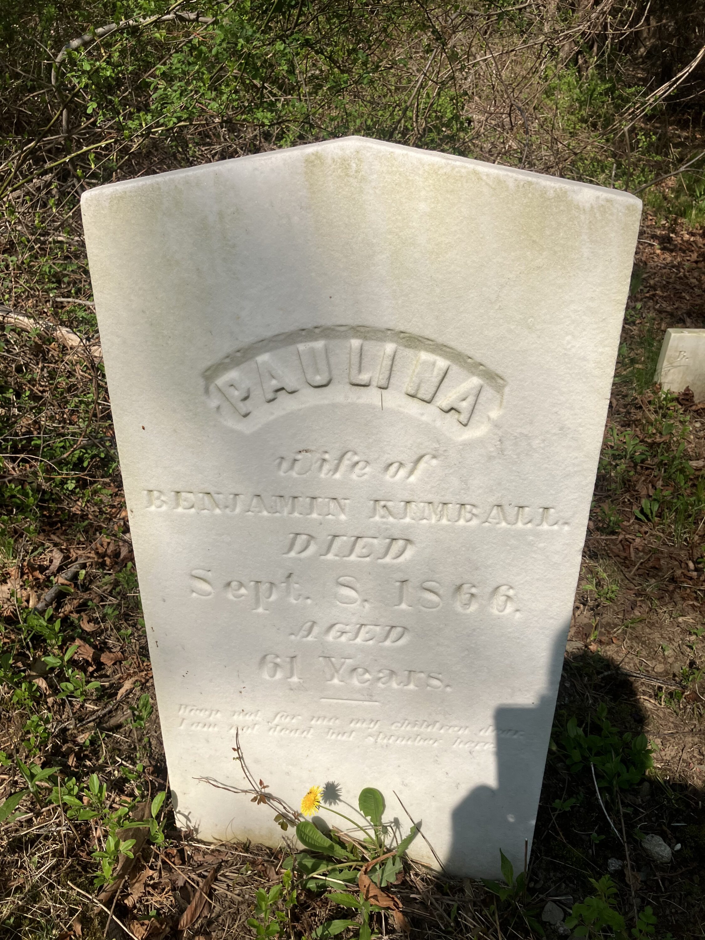
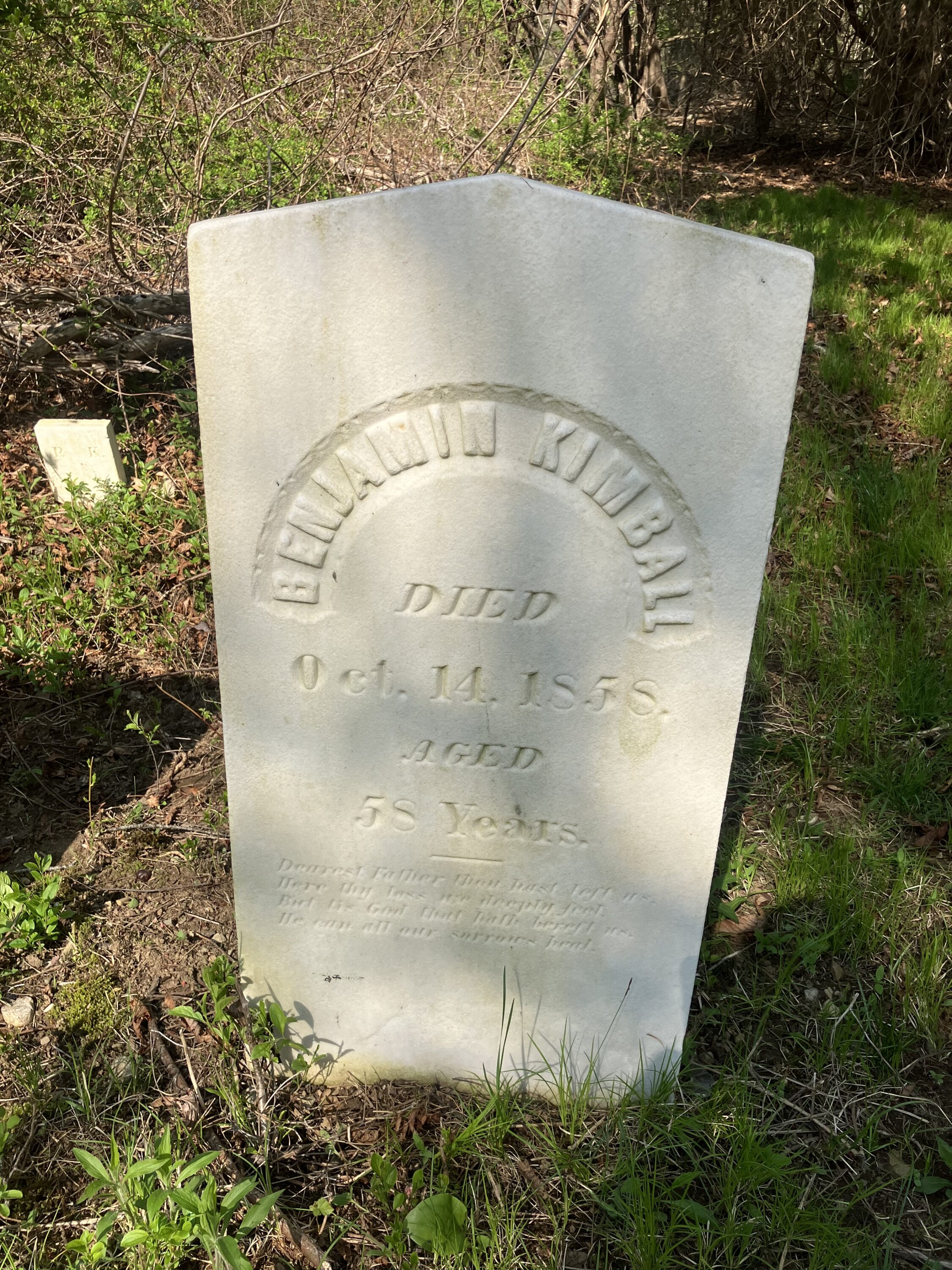
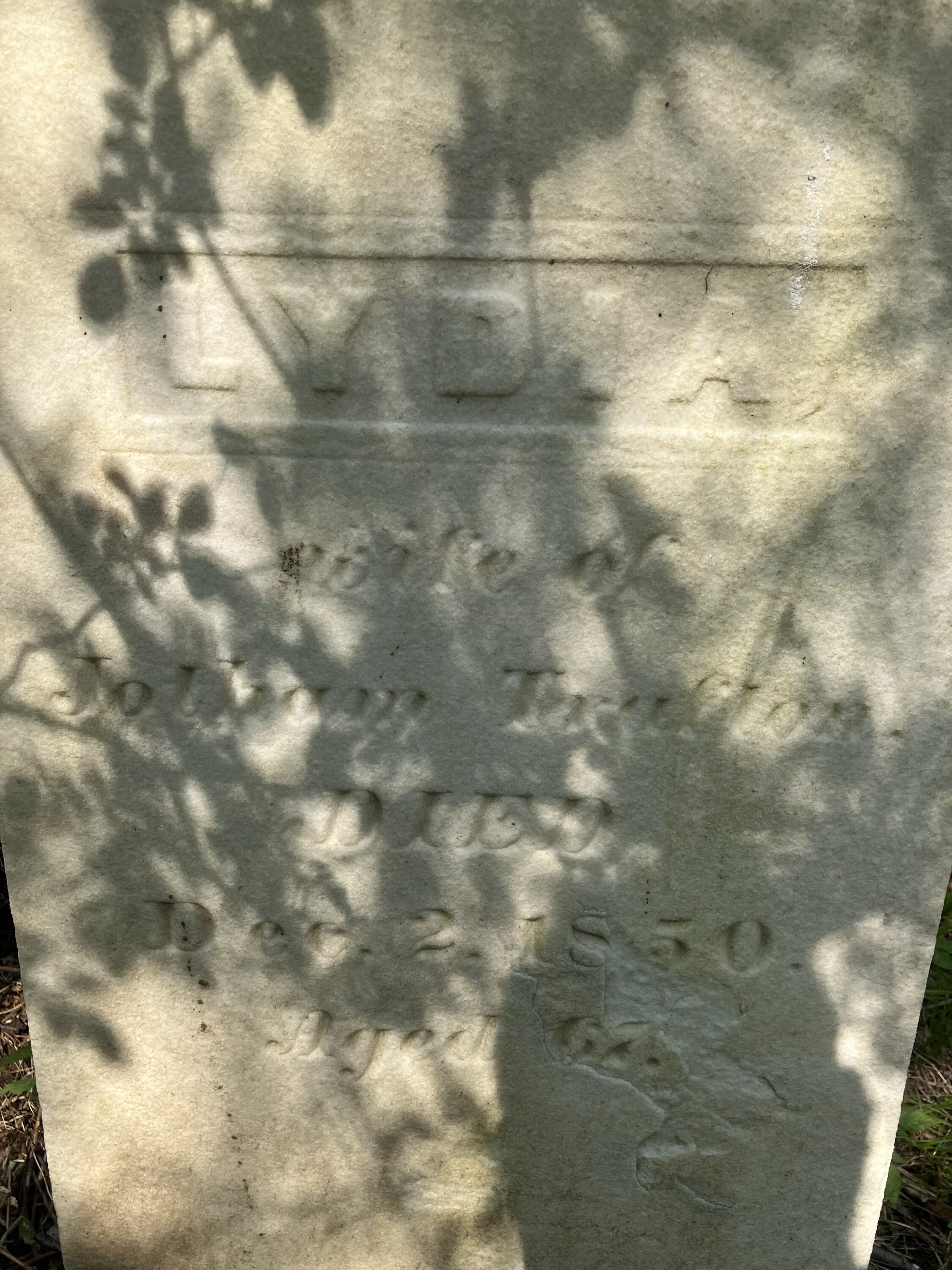
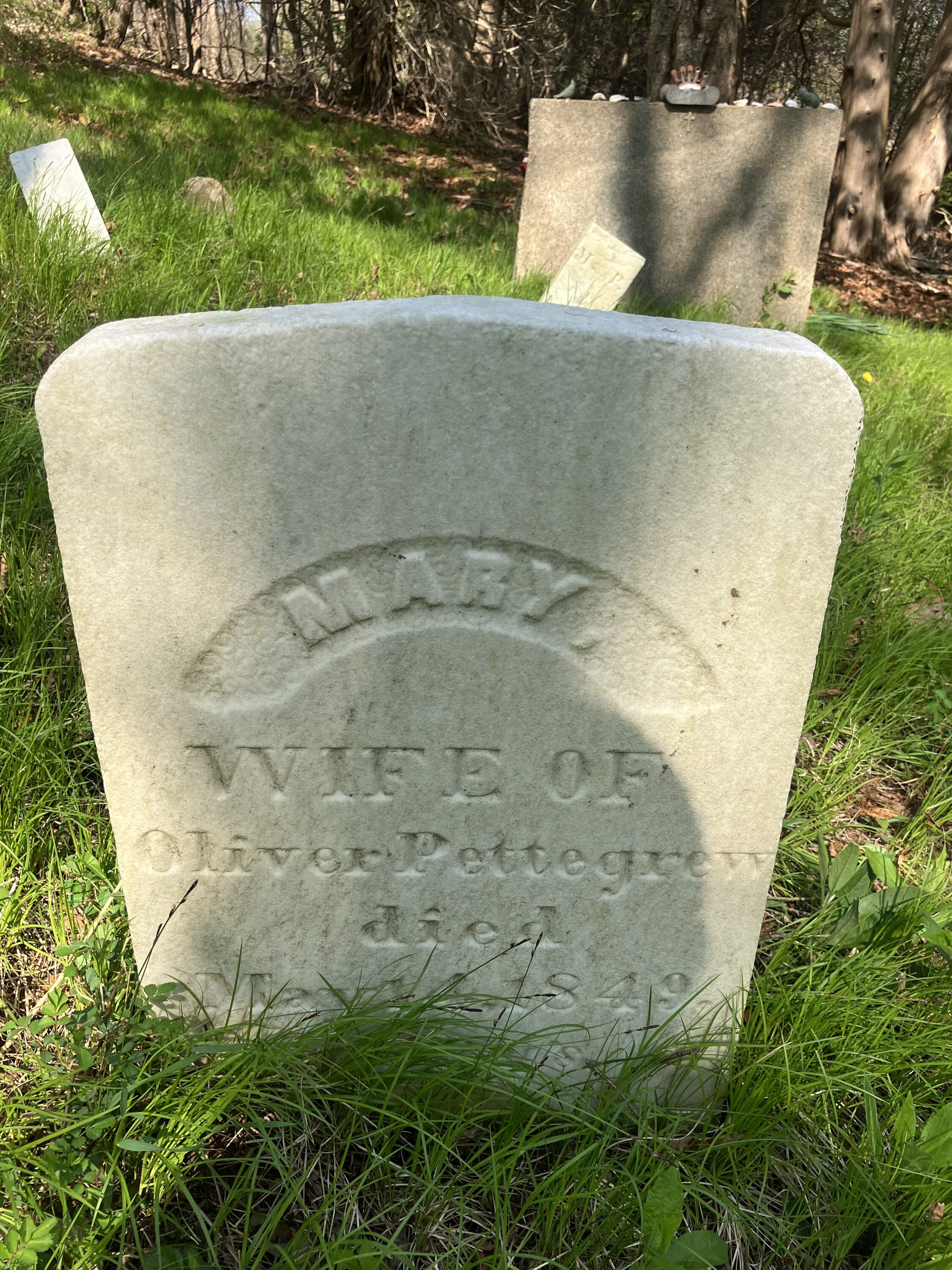
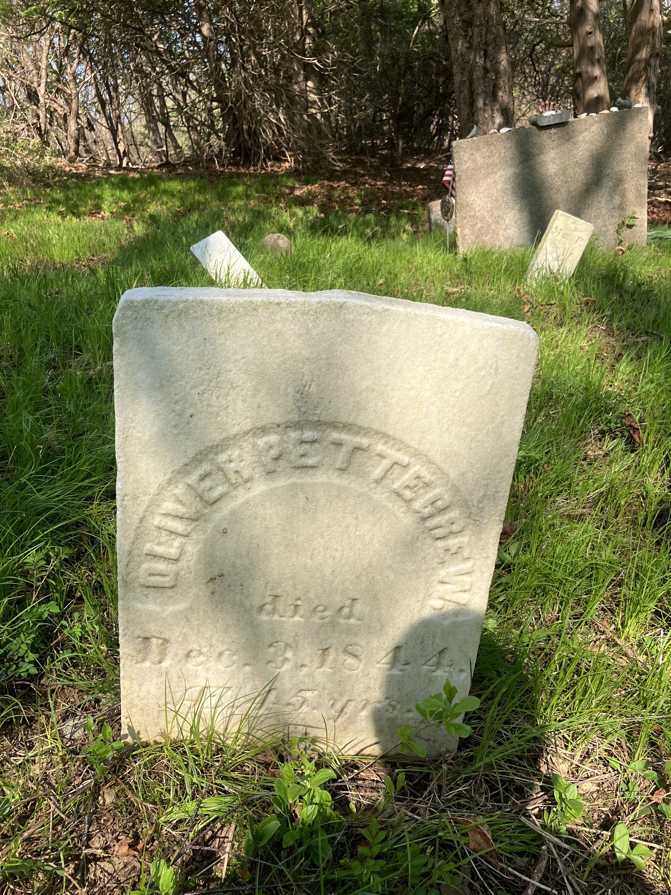
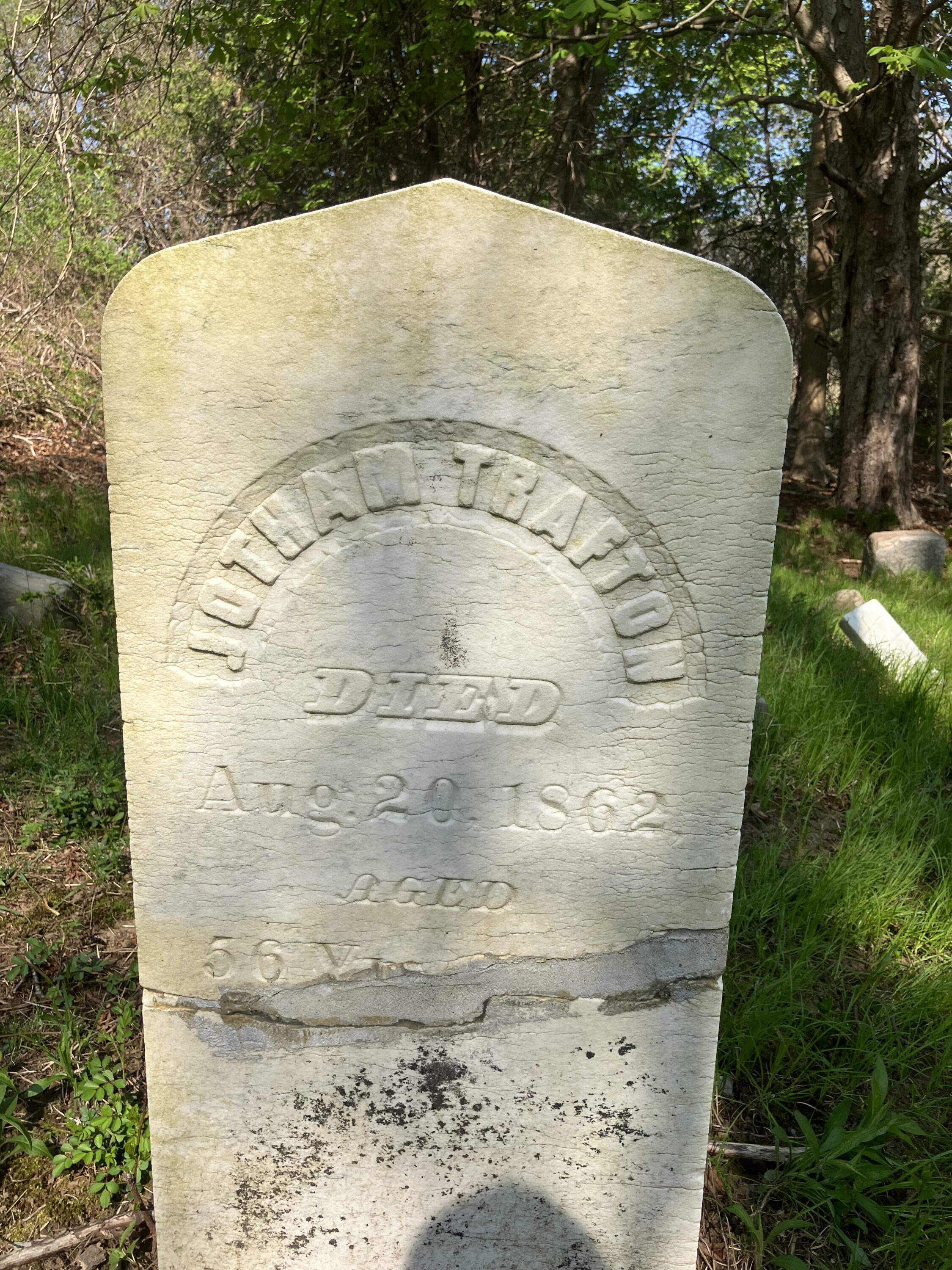
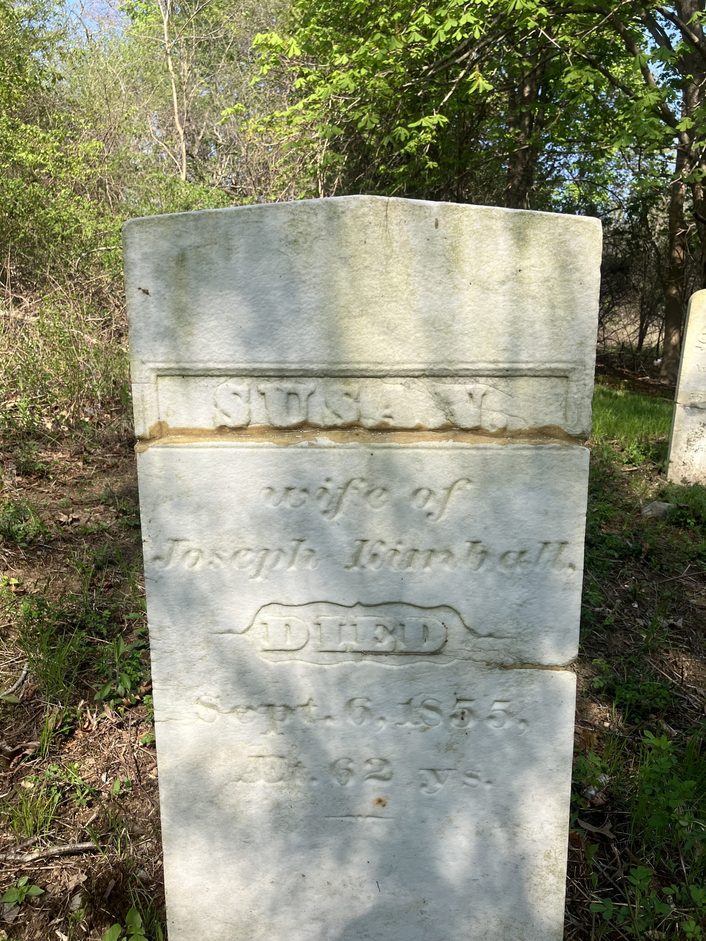
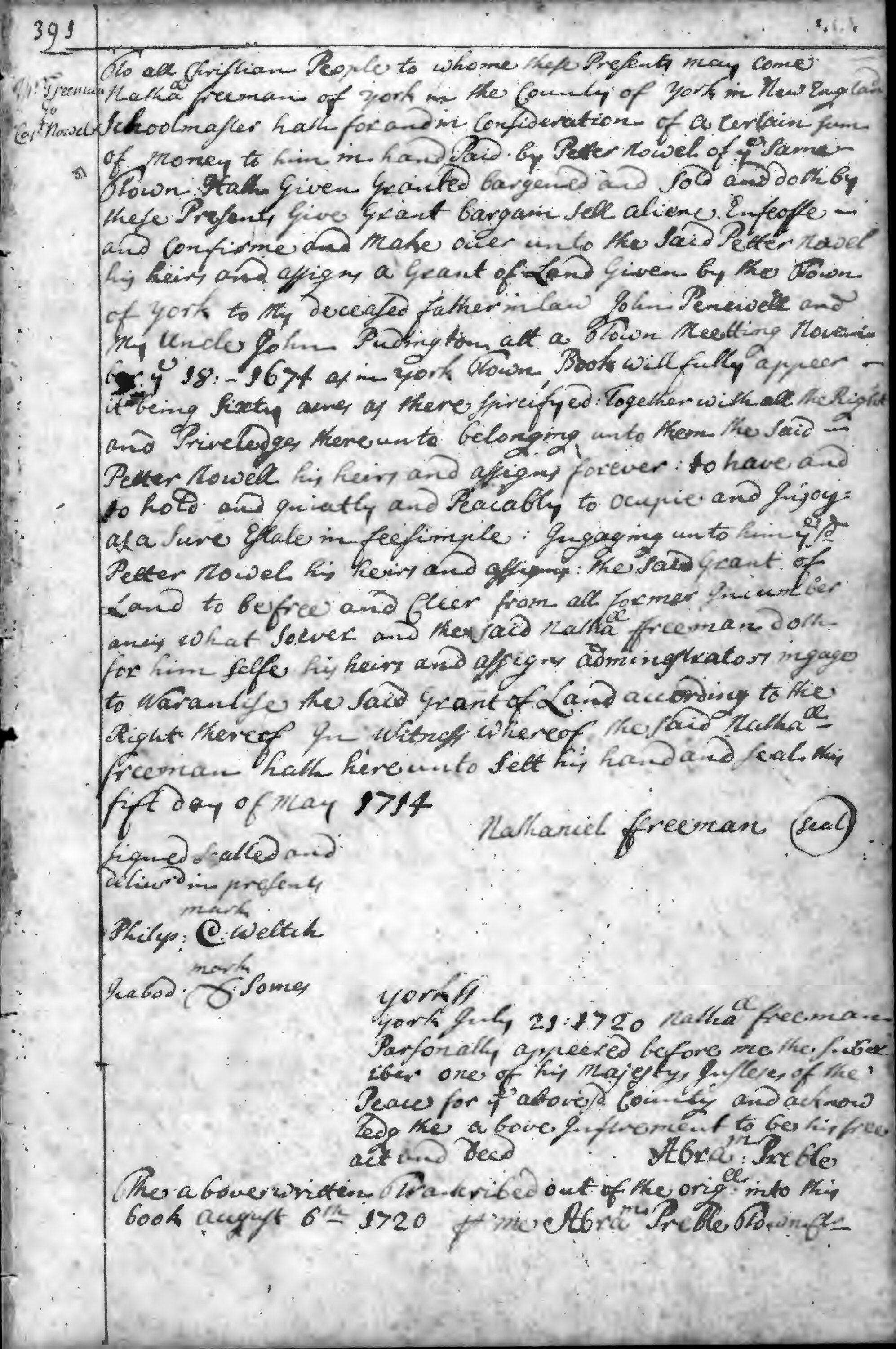
These walks eventually led us down to the Horse Hills, Old Bell Marsh Road, Linscott Road, Middle and Folly Pond, Smelt Brook, and the Second Parish Cemetery via Boston Post Road. As we moved our way south from Mount Agamenticus, Ron mentioned his seventh great grandfather, Peter Nowell1 had sold the Garey Mill to the Garey Family on Bell Marsh. We found the Garey graveyard and there were many headstones with no inscriptions. Ron naturally thought these may have been his ancestors.
Peter Nowell1 arrived in York in shortly after the Indian Raid in 1692. He purchased land in 1695. My sixth great grandfather, Nathaniel Freeman1 arrived in York, to teach school, in 1702. Ron and I realized we were likely related but my tree has no Nowells and his has no Freemans, otherwise we have many common ancestors that lived in early York.
As we hiked, Ron, would often refer to books that were in the vault at the York Town Hall. Among them the Proprietor’s book, the Constables’ book and the Town Clerk’s book. The Proprietor’s book is an early account of the division of the Stated and Outer Commons. The Constable’s book is a tally of town expenditures in the 18th century among other things and the Town Clerk’s book—I had never seen until recently. Nathaniel Marshall and George Plaisted, during their tenures as town clerk, had both created abstracts of the Clerk’s book. To my delight, a few weeks ago, James Kences, York Town Historian met Ron and I at the Town Clerk’s office and James assisted us with the Clerk’s book and the abstracts. Ron had an agenda, he was looking for roads on the McIntire property but I was there to browse. And browse I did. The handwriting of the early town clerks can be difficult to read quickly yet so compelling I could barely stop.
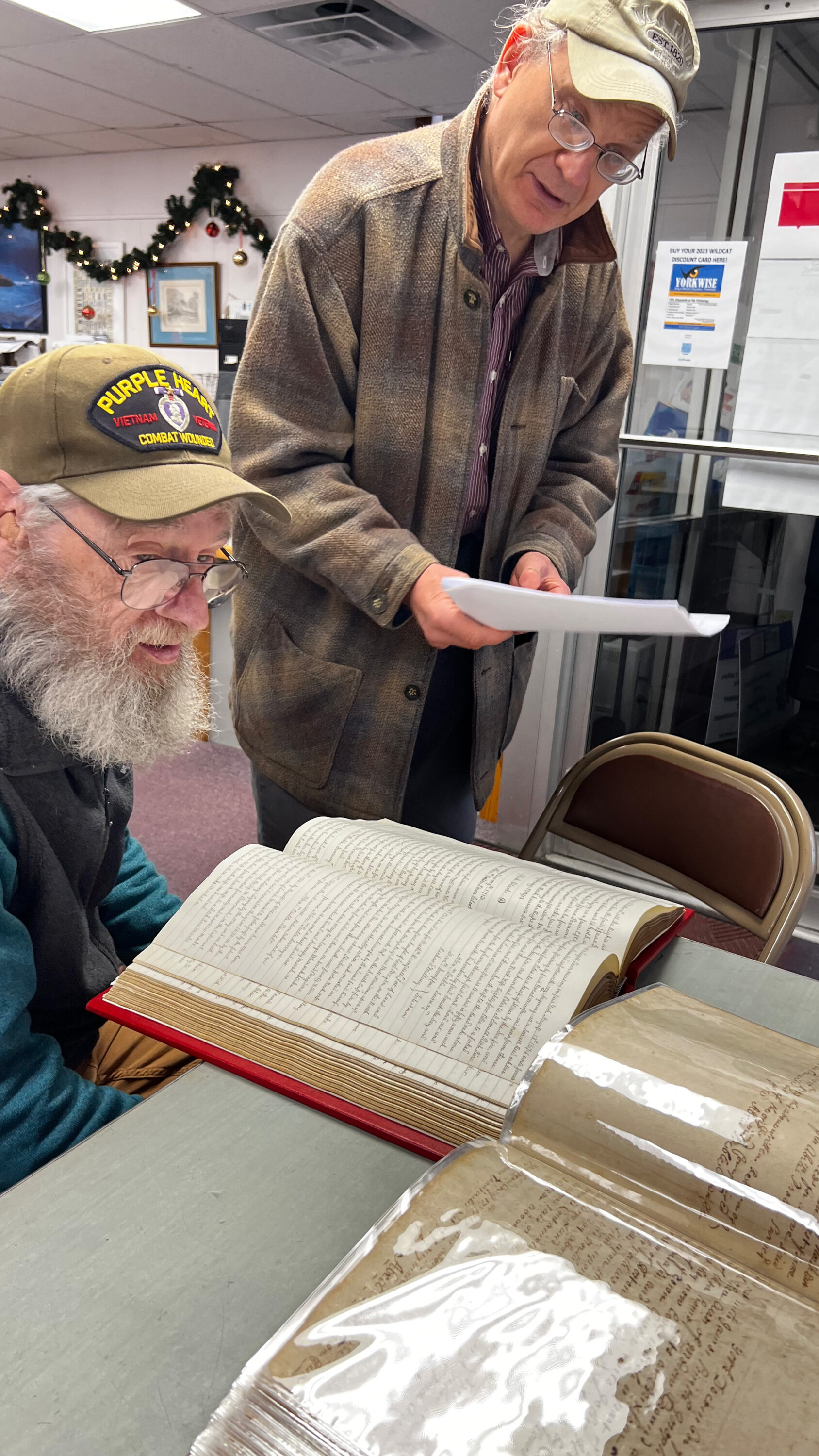
It was difficult to choose which to read; the abstract or the original (likely a copy) of the Clerk’s Book. The clock was moving closer to closing time for the Town Hall with each page I turned. It was impossible for me to consume so much information in such a short time. I knew I would be back and thought likely many more times. A few days had passed and I was reviewing some iPhone shots I had taken of the Clerk’s book. I saw a message from Town Clerk, Lynn Osgood. She wrote that her and James had completed uploading the clerk’s book to the Town of York website and included a link. I was enthralled and extremely excited. I called Lynn and James and asked if I could come to the clerk’s office and interview them both on video for York History Group. They were both excited and we proceeded with the interview.
As I pursue many interests in life, it is inevitable to make connections with like minded people. The field of local history is rich in this regard. Many acquaintances have become friends. Ron fits neatly into this category. After all, history is about our connection to something beyond ourself. Since the clerk’s records have been put online I began to browse over 500 of its pages. Soon, I saw that Capt. Peter Nowell had entered into a transaction with Nathaniel Freeman. Oh my! As I read I saw that my 6th great grandfather had sold Ron’s seventh great grandfather 60 acres of property in York that was previously owned by his father-in-law, John Peniwell and uncle, John Puddington. I had not seen this transaction previously documented in town deeds. There was no description of the property in the deed but another connection to Ron was made. Another connection to my community and I felt an even greater gratitude to Lynn Osgood and James Kences for providing the opportunity for me to discover this document with such ease, from my home.
Link to Early York Town Clerk’s Records
https://www.yorkmaine.org/635/York-Historical-Records
Link to Nathaniel Freeman to Capt. Peter Nowell deed https://www.yorkmaine.org/DocumentCenter/View/8633/0436_391
History has been made! Once again!
York Town Clerk, Lynn Osgood, has posted, online, the earliest documents (1646) from the clerk’s vault at York Town Hall. The original volume can be seen the town clerk’s office or viewed online here.
https://www.yorkmaine.org/635/York-Historical-Records
Lynn Osgood attributes her inspiration, to bring these documents to the public’s availability, from James Kences, Town Historian. James has been working tirelessly to create an abstract of the early records to help the viewer search the 500+ files more efficiently.
Friday, September 23, 2022
by Kevin Freeman
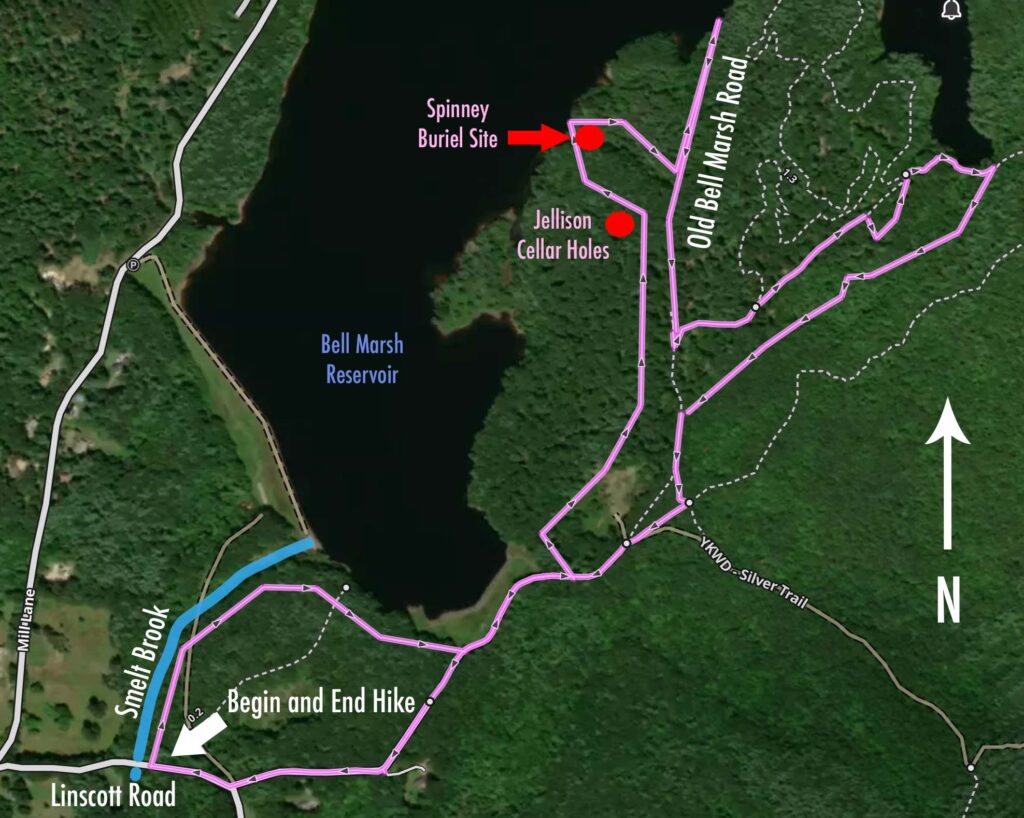
A perfect fall day! Temps in the low to mid 60’sF. A thermal shirt below a long sleeved shirt, a fleece vest and fall was comfortable. I packed a peanut butter and raspberry jam sandwich and drove up to the intersection of Linscott Road and Mill Lane in York, Maine. In a few minutes after I arrived, Ron Nowell rolled up in his Ford pick up and I followed him to Smelt Brook on Linscott Road. We pulled over near the old dam site that was built by Ron’s 7th great-grandfather, Peter Nowell. Although I have lived in York my entire life I have never been down this road, from this direction, and had no idea of how ambitious the mill site before me was.
As we approached the mill Ron and I admired the huge hewn stones stacked high upon each other, presumably to support a large but long gone mill building. Peter Nowell1 arrived in York in 1694 and by all indications got right to work. He was a blacksmith, carpenter and soldier sent to the frontier of York soon after the 1692 Raid. He helped work on garrisons and built a house on Cider Hill Road. He sold the house and moved to Linscott Road, very close to Mill Lane. Today, the house appears to have been renovated and modernized.
Ron and I proceeded up Smelt Brook in the direction of Bell Marsh Reservoir. We were looking for small cellar holes that Ron believed to be near the mill. They were the home of his ancestors Silas Nowell and Shadrach Nowell. We continued up Smelt Brook without seeing what we imagined to be small holes in the ground or depressions where a root cellar had filled with twiggy litter. Peter Nowell2, Jr., mentions in his will a house he bequeathed to Shadrach that is about 4 rods north of the pole bridge that is where the culvert now passes beneath Linscott Road. We keep moving up the hill, through the woods and come to a chain link fence with barb wire on top. We walk along the fence and connect to Old Bell Marsh Road. It is not exactly clear how we found it but referring to the map on my phone we were on course and our direction should take us to the water’s edge in about a half mile.
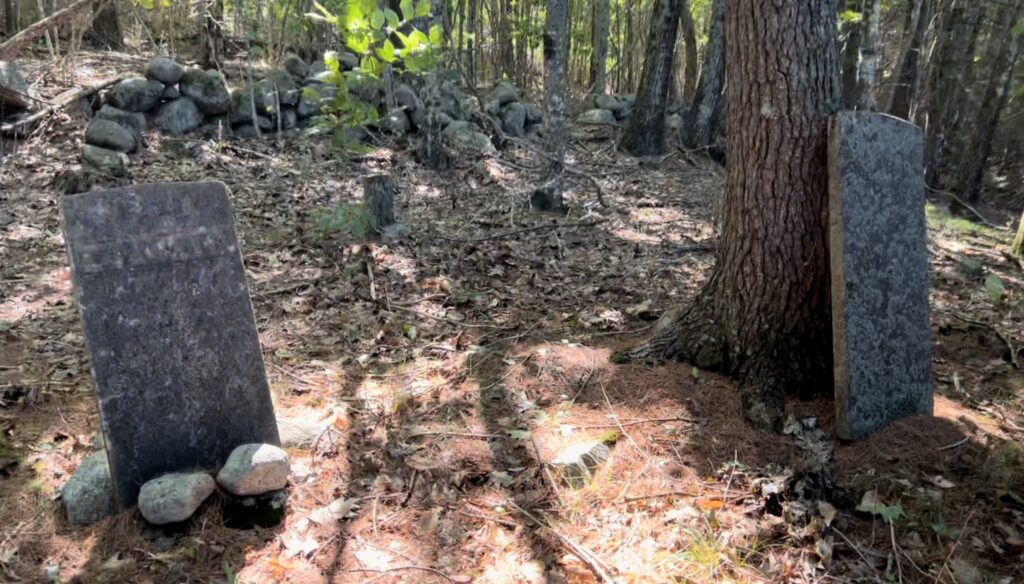
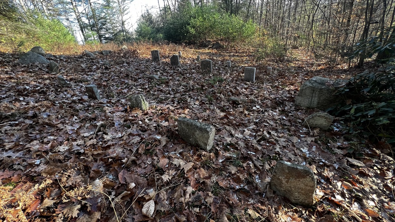
On Wednesday, two days before today, Ron called me with preliminary plans of the area he would like to cover. Included was “Timothy Field” and the Chas. Jellison cellar hole, both, according to our best guess are to the west of Old Bell Marsh Road. Often, on these walks, if we find a cellar hole, we find a gravesite or visa versa. Weather wise, today has been magnificent — the bright fall light was especially warm and saturated with color, the weather was cool and perfect for a long walk. But it is especially difficult to scan the woods for un-natural features as the sunlight becomes mottled as it filters through the foliage. Although the effect is quite stunning the landscape is slightly obscured with harsh contrast and requires extra diligence in discerning possible points of interest. None-the-less we found the Jellison cellar hole by a stroke of luck. Something caught our eye and off the road and into the woods we went. In less than 100 feet, we recognized a foundation for a home and a larger one for a barn. Ron was pretty certain that there would be a gravesite nearby. We split up and Ron headed southwest to the Bell Marsh Reservoir and I walked westerly. After 10 minutes or so, I could hear Ron exclaiming something through the trees. I walked toward his voice and sure enough he had come upon a gravesite. Initially we thought it must be a Jellison gravesite but realized it was the Spinney gravesite listed on the Town of York Cemetery Map as #6. There were two large stones with very eroded inscriptions. These stones were likely sandstone. We could make out Abigail on one but nothing on the second stone. Also, there were 5 or six other graves with nondescript field stone headstones and footstones. We were very close to the reservoir, maybe 100 feet.
As we walked away from the burial ground, through the pathless forest toward Old Bell Marsh Road, I felt a connection to the souls represented by the nondescript stones, if only as a witness to their existence here on earth. Likely a family, a generation or two, existed way out here, laid to rest in a line with no other story to tell. As we walked, Ron and I exchanged stories of our personal lives. I noticed we talked about life’s difficulties, oddities, concerns and celebrations — the kinds of things that I would share with a friend. For years, Ron has been an acquaintance that I have admired and enjoyed listening to. His vast knowledge of many topics has intrigued me. But now, as we were walking to the point where Old Bell Marsh Road submerges below the surface of the water and disappears, reemerging on the opposite shore, I listen closely to our conversation thinking it likely that those who lived and died here once conversed similarly, as Ron and me, walking this road in an exchange of thoughts, like us — an endless recurrence by humans, all the way back to the beginning.
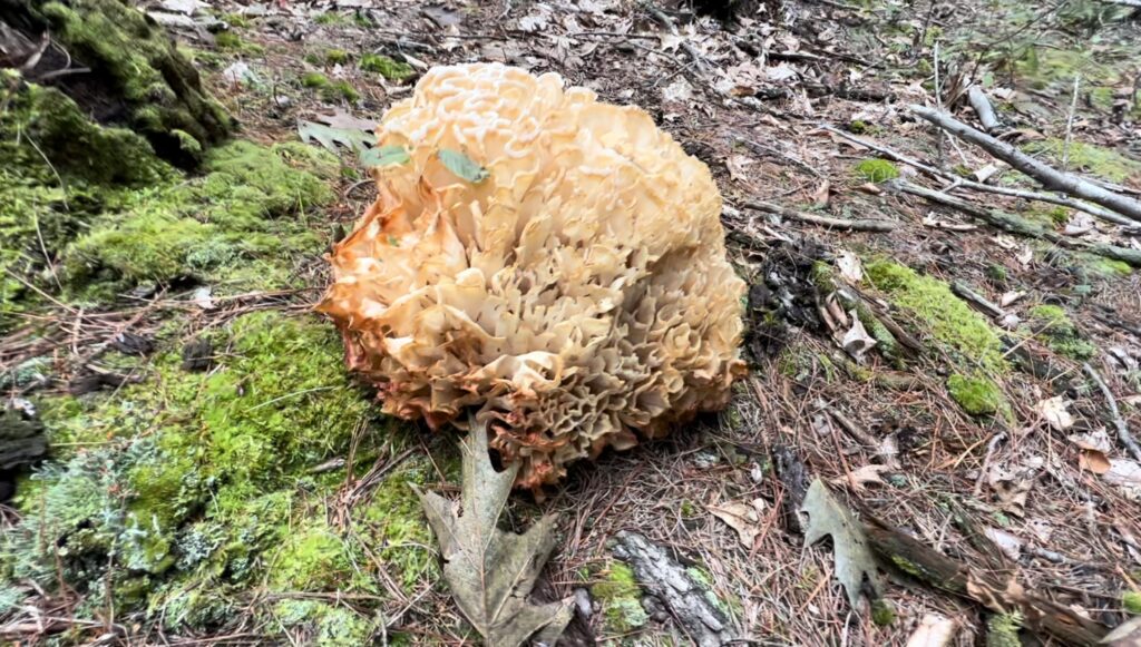
We walked to the point of where the road disappears into the water and then back tracked a bit. We turn east from Old Bell Marsh Road and ascend what we think may be one of the Horse Hills. As our elevation increased so did my heart rate. Ron’s third destination today is Beaver Dam Brook. He is fixated on finding the source of a brook which he has found on a survey plan that shows a stone causeway. The causeway is currently submerged but intuition tells us that the source of the brook is at the far east side of the reservoir. As we walk, I spot a soccer ball sized mushroom off in the distance. Wow, as an avid forager, I have never seen anything like this in the forest. We walk toward it, not certain it is a mushroom. At first it looks like a chicken of the woods but upon closer inspection it becomes a cauliflower mushroom (sparassis). I reach into and pull from my backpack a hunting knife. I slice away a small section of the mushroom and put it in my pack along with the knife. I am quite thrilled to add a new species to my expanding list of things foraged. Ron deliberated on taking a piece but decided not to. We ate our sandwiches, enjoyed warm coffee from our thermoses and basked in the fall sunlight. The woods were radiant and saturated with water from the recent rains after a long dry summer.
When we did proceed we kept moving easterly and arrived at a brook that Ron declared was Beaver Dam Brook. We were at the very southeastern point of the reservoir. The forest was comprised of many large hemlocks and pines. The hemlocks were in various states of decline. The brook went upward and we were both eager to follow it to the top and discover what may be. As we neared the top Ron asked our elevation. I looked at the map app on my phone and reported 207 feet above sea level. We arrived at a very large wetland on top of the hill. It was truly a wonderland. Carpeted by sphagnum moss we were enveloped by a primal ecosystem that was decorated with fall ferns — loosing their chlorophyll and turning various shades of yellow and gold. Above, there were large white maples trunks in various stages of decay and below pitcher plants and numerous bushes that provided a challenge to make one’s way through. We pushed through and then around, both giddy with what we discovered. But we realized we did not discover this after all. On one of the footpaths we crossed I noticed a long slender stone spanning the book. I jokingly said to Ron, this could the stone causeway referenced on the survey plan. He leaned over to discover drill marks along the edge of the stone. Sure enough, it was cut and placed to serve as a causeway by someone who had been here long before us.

As we begin the hike back, to where we began, I reflect on all that I have just experienced. Ron fills in the spaces with numerous stories of mutual friends and acquaintances, stories of his his time on the Board of Selectman and as a gunner in Vietnam. As we get closer to Linscott Road, Ron reaches down on the gravel road and picks up some shagbark hickory nuts. Many have been split by squirrels but there are so many others he gathers some to take home. He tells me of his grandmother making cinnamon buns using the hickory nuts as a garnish and how sweet they are. I begin to fill up a pocket as well. Cars and trucks begin to pass us on the old gravel road as we get closer to the mill site where we parked. We both instinctively walk over to the mill site. Ron sits on one of the huge hewn stones and reflects on Peter Nowell, Shadrach, Silas and others. We exchange questions with each other…how did they move these huge stones? What did they do with all the material they created? Where did it all end up? It became apparent that much would be unanswered for today although much was learned. I suggest to Ron that it would be appropriate to commemorate the Nowell Mill site with a plaque to recognize its historical value.
Reference: The Nowells of York and South Berwick, Maine by John E. Frost
York History Group began on Facebook. We have created this website to provide more content to a broader audience. This website is a work in progress, so please be patient as we share and create content relating to the History of York, Maine. Please reach out to us if you have questions or suggestions.
Please find us on Facebook
Check out our Youtube Channel https://www.youtube.com/channel/UCIExP9yaxDJRuso424K7c2Q