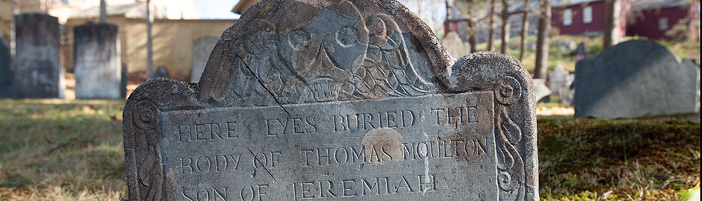
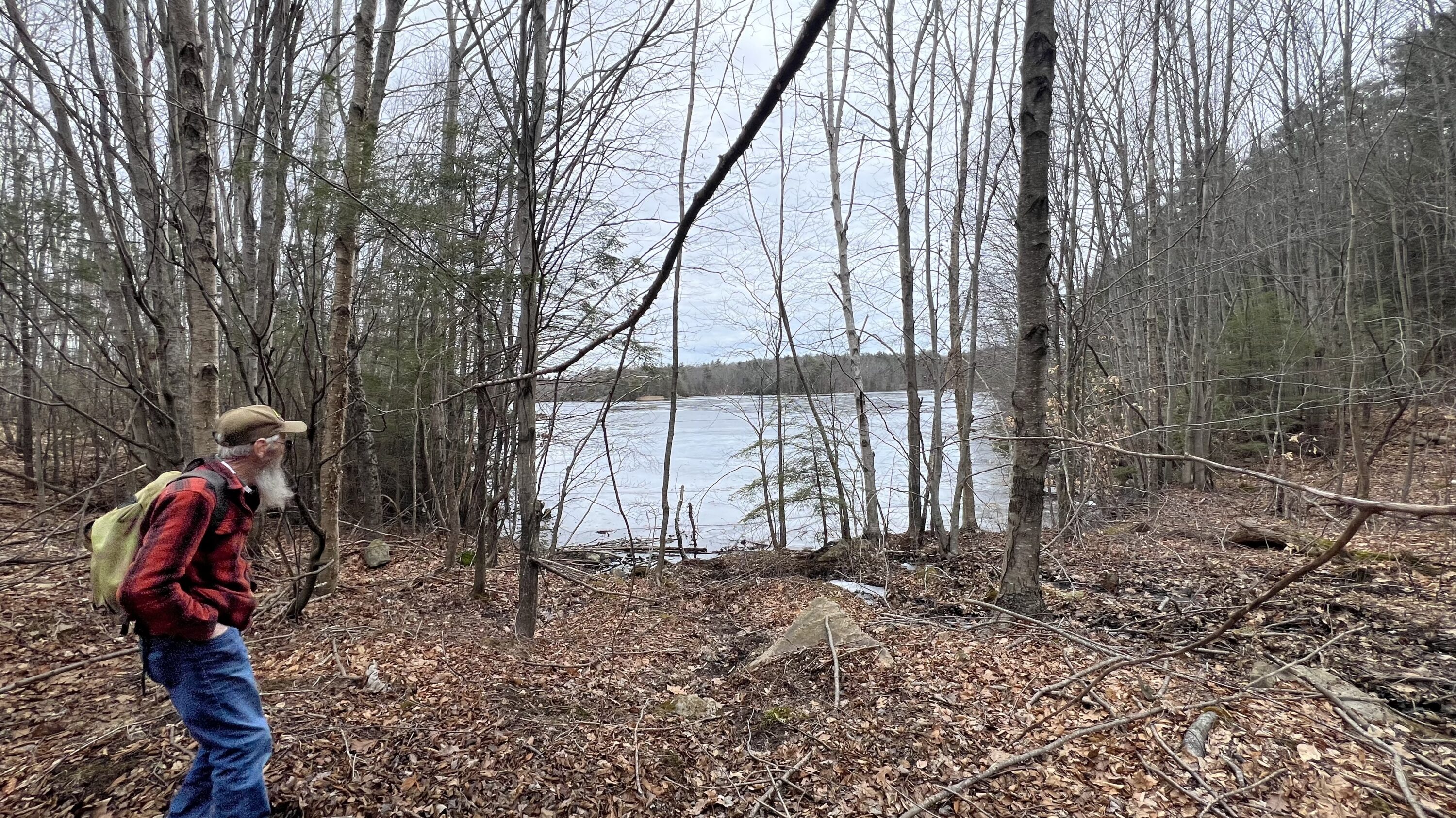
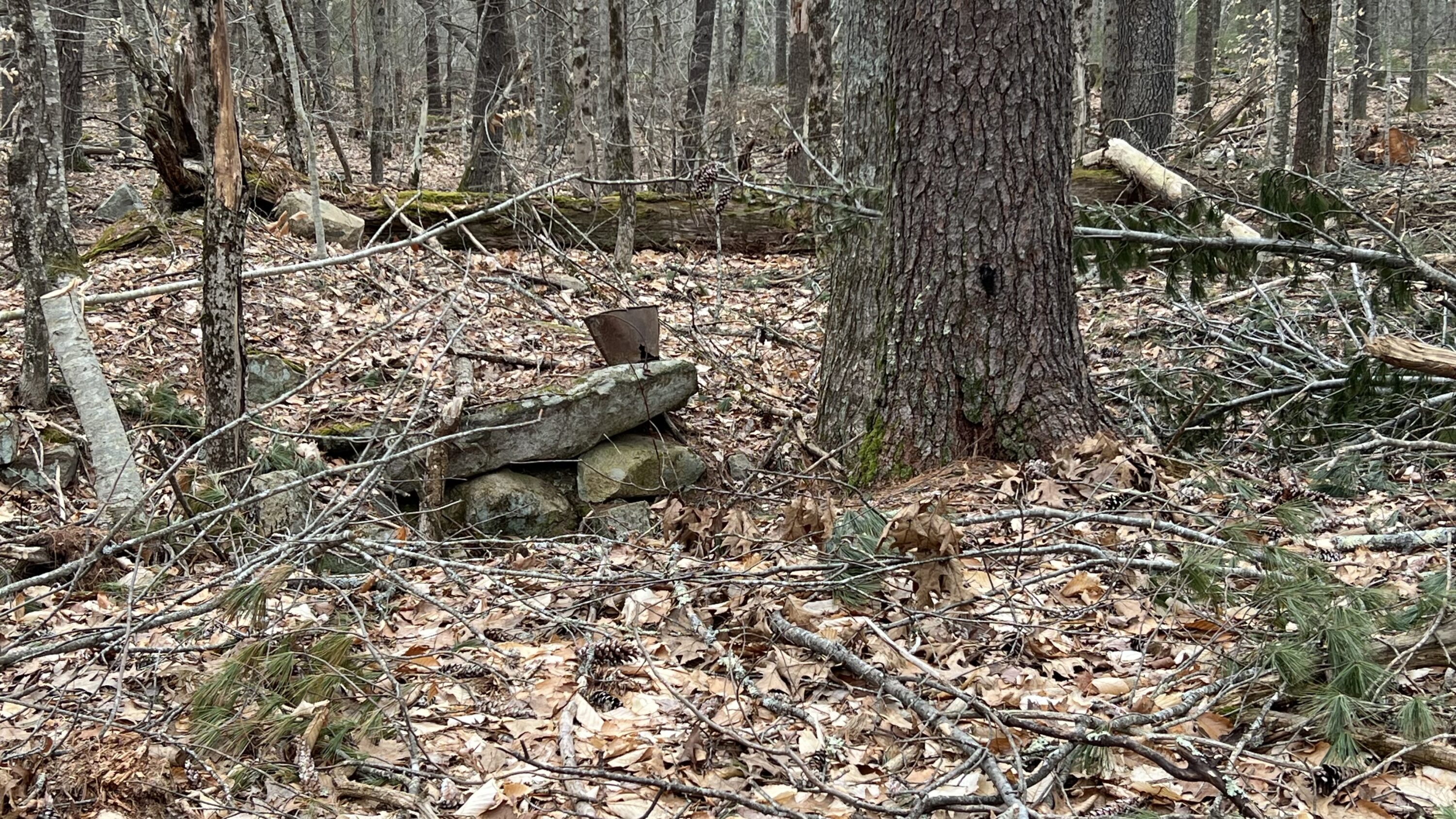
Ron Nowell and I took a walk along Old Bell Marsh Road, yesterday, looking for a Shaw cellar hole that we did not find. Jack Parsons told Ron of another cellar hole near a fresh cut by the York Land Trust. We found this cellar hole, quite small but very characteristic to others in the area. It appears to be on what is known as the Davis-McIntire Property, though a search through the registry of deeds reveals no names. It doesn’t appear on the 1872 cadastral map of York. If you have any information please let us know.
Ron Nowell observing Bell Marsh Reservoir from near Old Bell Marsh RoadUnknown cellar hole revealed along path with partial debris covering
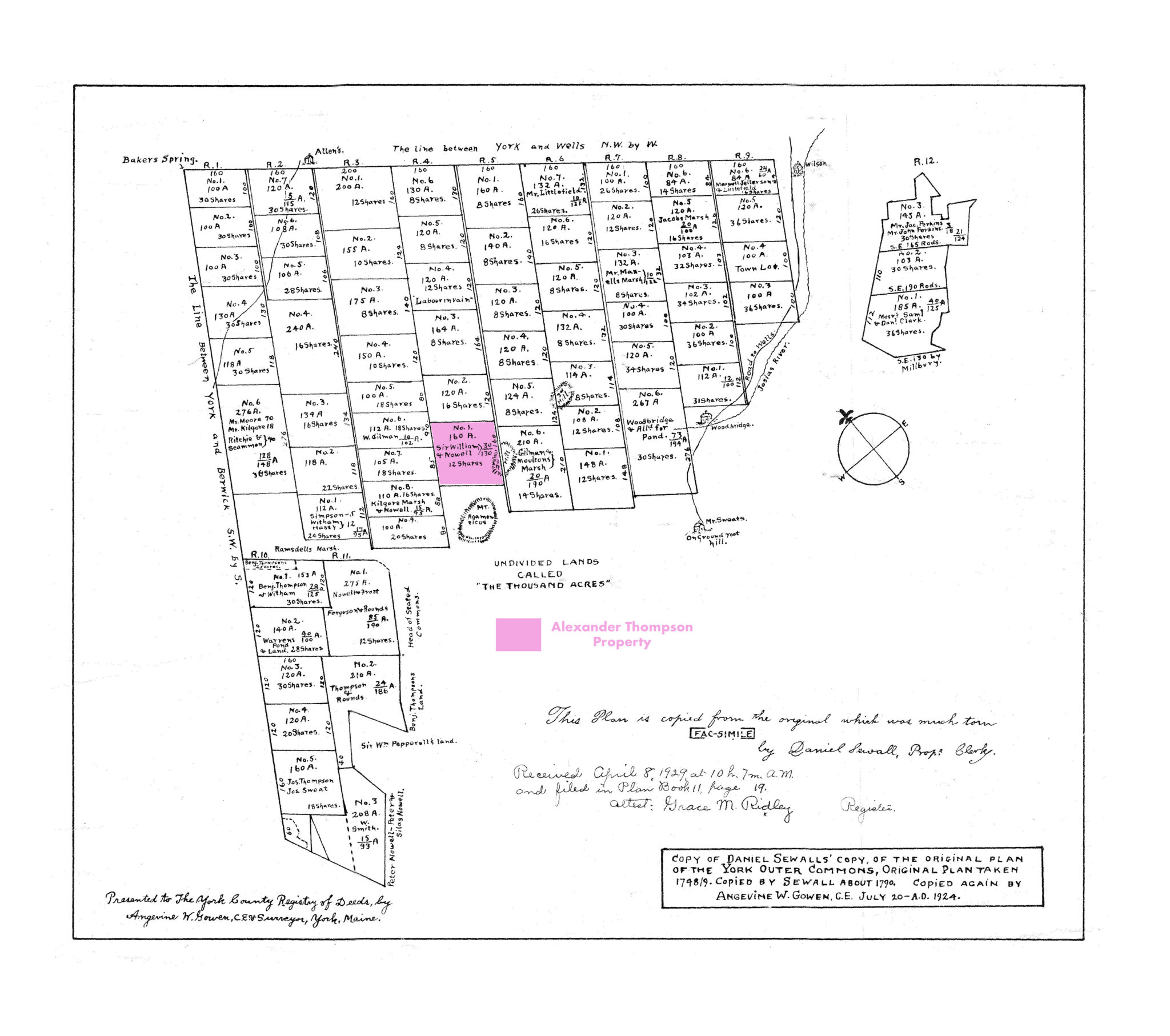
Mount Agamenticus in York, Maine, is rich in history. Not only does it serve as a landmark for mariners past and present but it was once inhabited by York’s early residents. The forefathers of the Town decided to sell parcels of this area to York residents who were over twenty one years of age and willing to pay the cost of administration. The dividing and selling was documented in a book titled the Book of Proprietors that is currently kept at the York Town Hall.
Today, it is difficult to imagine the attraction for early settlers in this area and yet, without a doubt, owning a piece of the Outer Commons elevated a persons social status, among other things. We assume that a lot of these shares were bought and sold for profit. But many of these lots were inhabited by families whose names are significant in York History. Among the families in this area listed on the highway tax maps for 1831 are Ramsdell, Welch, Fitzgerald, Lewis, Thompson, Dixon, Jellison and others.
In the spring of 2022, with Ron serving as a guide, we began extensive hikes in the First (Mount Agamenticus), Second and Third Hill area. Ron’s knowledge of botany, landmarks, monuments and history around the mountain is exceptional. Ron noted numerous points of interest and we discovered some new ones. Eventually we both became guided by curiosity as one discovery led to another. From caves that we walked through, to spring holes, to old foundations, to a mammoth White Pine tree, to burial sites that could have easily been passed by – it all became a wonder and puzzle.
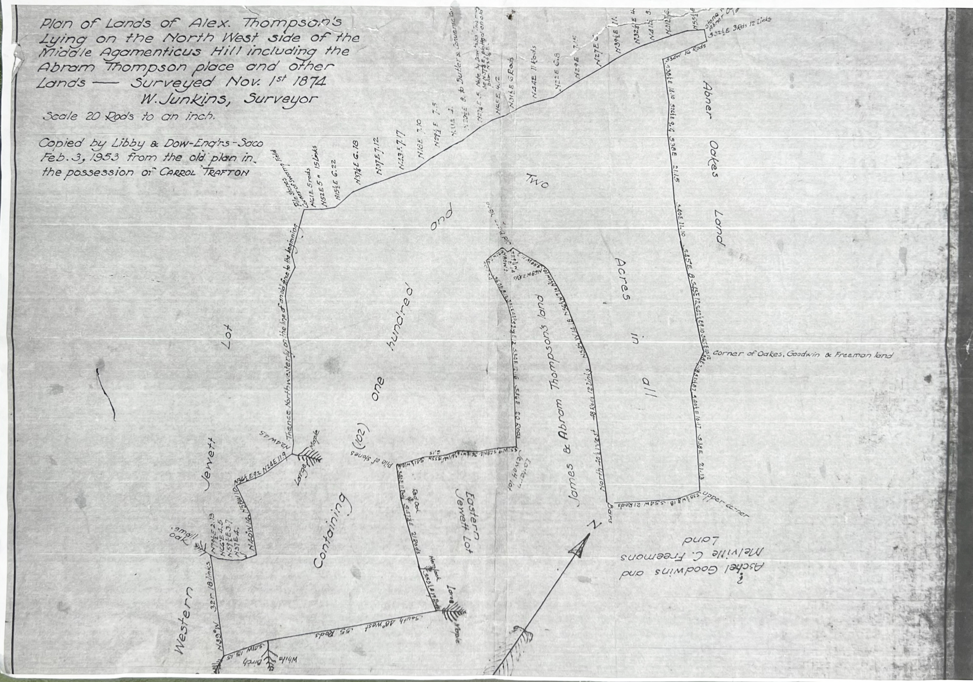
Our curiosity took us to land surveys and old deeds in a mission to find out more about those who lived there and why. Ron pointed out some unusually substantial stonewalls on the Northwest side of Second Hill. We instinctively began to follow them down hill. Ron had a survey plan titled, Plan of Lands of Alex.Thompson’s Lying on the North West Side of the Middle Agamenticus Hill Including Abram Thompson place and other Lands, 1874, in original possession of Carroll Trafton. Initially, regardless of orientation the plan made little sense. One feature on the plan compelled us both to discover more—an unusual shaped stonewall near an “old barn yard.”
In contrast to rough terrain found elsewhere on the mountain, the land was much more flat with a gentle slope. It was uncharacteristic of a first or second growth forest, rather it was smooth, perhaps made so by plowing. There are numerous piles of stones, varying from ten to fifteen feet in diameter and several feet high serving as collection sites when the fields were picked clean of rocks. Some of these piles are very close to the stonewalls. One wonders how it was decided for some of the rocks to have been turned into stonewalls rather than piles.
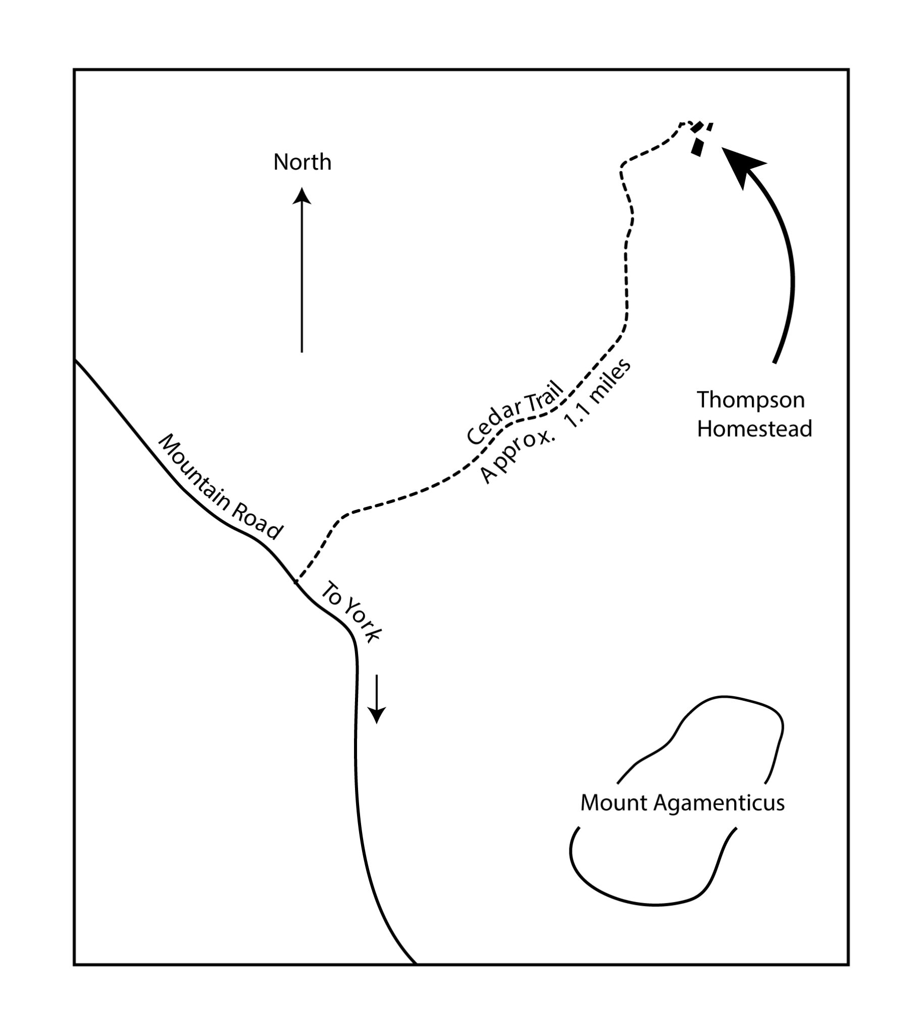
The area was too vast to be conclusive about how to find the exact location of the barn yard, though we tried during one afternoon of exhaustive hiking. A few days later Kevin hiked out to the area with a GPS trail mapping app on his phone and walked along the stonewalls creating a graphic route that was nearly identical to the stonewalls on the property plan. Ron was called and we met at the Cedar Trail head. After reaching our destination we also discovered a cellar hole for a home, At the deepest point the cellar hole was about 8 feet from top to bottom and made us more curious. Shortly thereafter, we pinpointed the location of a barn and an out building.
According to the survey plans we were at the Thompson homestead. Checking deeds at the York County Registry of Deeds further confirmed our assumption. Book 140, Page 221, dated September 21, 1831, describes brothers Abraham and Isaac Thompson dividing the property previously owned by their father, “Alexander Thompson late of York, deceased, the land lying a little bit to the North of Agamenticus.”
The deed describes marked trees, bearings and rods to secure boundaries. Most curiously the deed states, “said Abraham is to have the old barn and the south room in the house, or one half of the house and the said Isaac to have the new barn and the north part of the house as far as one room extends, and the said Abraham gives Isaac nine months from this date to occupy his part of the house, and take it off from his land; and both parties agree that there shall be a privilege for each party to pass and repass from their premises…”
We spent some time conversing about the significance of such an operation way out here in the woods. Though there were some neighbors on the mountain, unlike the community of York Village, the homes were spread far apart, evoking a feeling of isolation. The paths were steep and rough. Transportation would have been by foot or a springless horse or ox cart with steel rimmed wheels. Sheep farming became a craze with the introduction of Marino sheep in 1802 and at great cost to New England forests. The endless stonewalls that we see today were created to contain the lucrative commodity. We speculated that sheep farming would have provided enough income to support this homestead.
In many families the given names of members are repeated for many generations, Alexander Thompson is no exception. William Thompson was living in Kittery when he died at 43 years of age in 1676. George Ernst wrote that William’s younger children, one being Alexander (1671-1720), were left to the Selectmen of Kittery to provide for. Ernst speculates the children went to various families and their names may have became that of their foster parents, confusing a clear genealogy. None-the-less, we see that the above Alexander had two sons, referred to in the above noted deed as Isaac and Abraham.
We are unclear as to the progression of who owned exactly what but have begun to unravel a web of information that inspires us to look farther. Ron is quite sure there were Abrams as well as Abrahams in this area though a survey report done for Land For Maine’s Future by Titcomb Associates refers to Abraham as “aka Abram.”
We have found at least three recorded tracts of land owned by Thomson family members on the North side of Mount Agamenticus.
York County Registry of Deeds, Book 43, Page 182, February 28, 1775
Joseph Linscot to Joseph and Curtis Thompson for about 55 acres, 13 acres and one
third of an acre.
2. York County Registry of Deeds, Book 42, Page 110, August 1, 1772
James Junkins to Alexander Thompson containing eight shares of lot one in the fourth
range.
3. York County Registry of Deeds, Book 58, Page 30A, November 29, 1781
James Junkins sells remaining shares of lot one in the fourth range to Alexander Thompson.
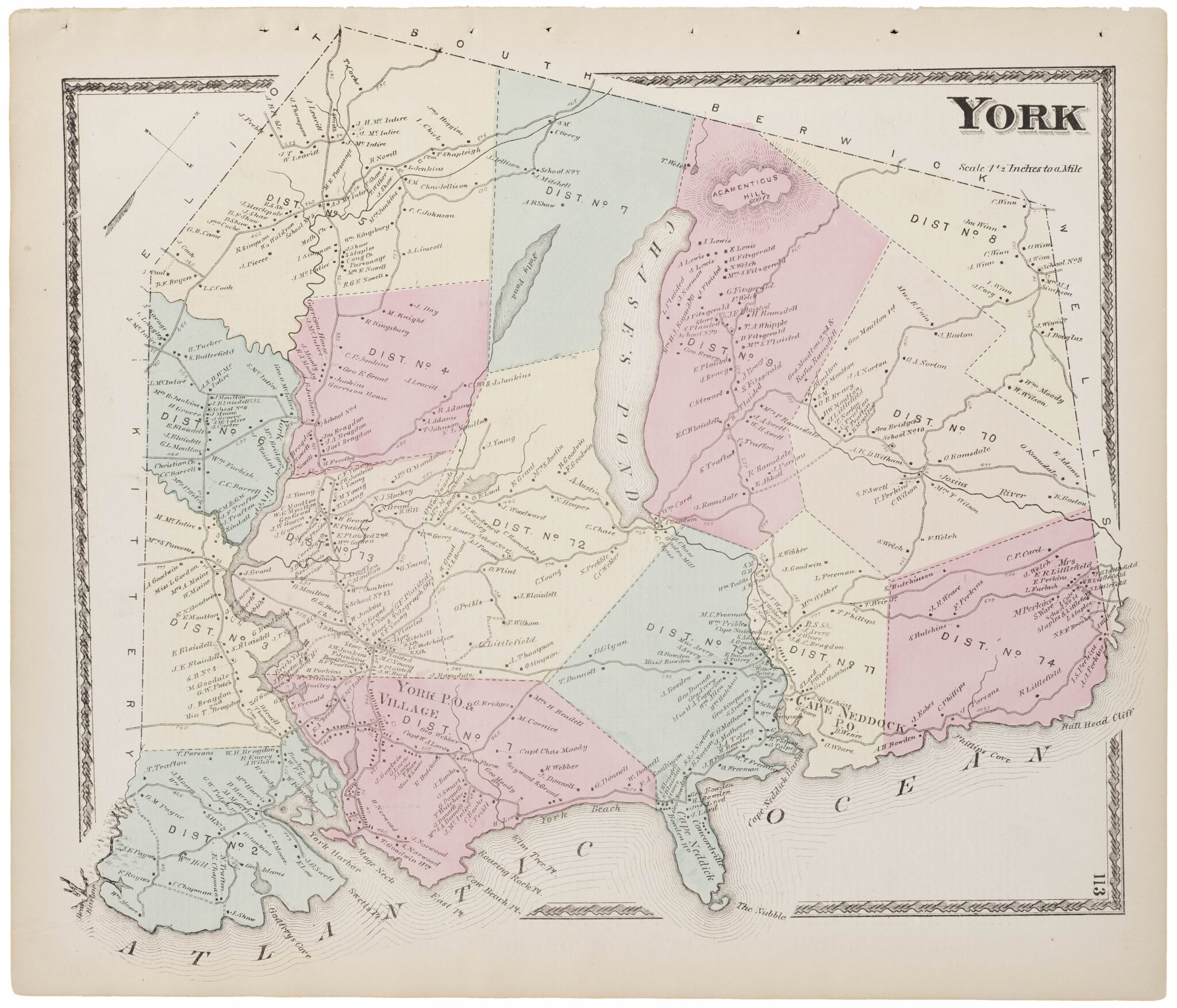
The plan of the Outer Commons copied by Angevine Gowen from Daniel Sewall, W. Junkins Survey Map of 1874 and a York Town Map are included as attachments to this document.
It may be of interest for the reader to notice the contrast of the rectilinear format of the division of the Outer Commons versus the wandering boundaries in the Junkins Survey.
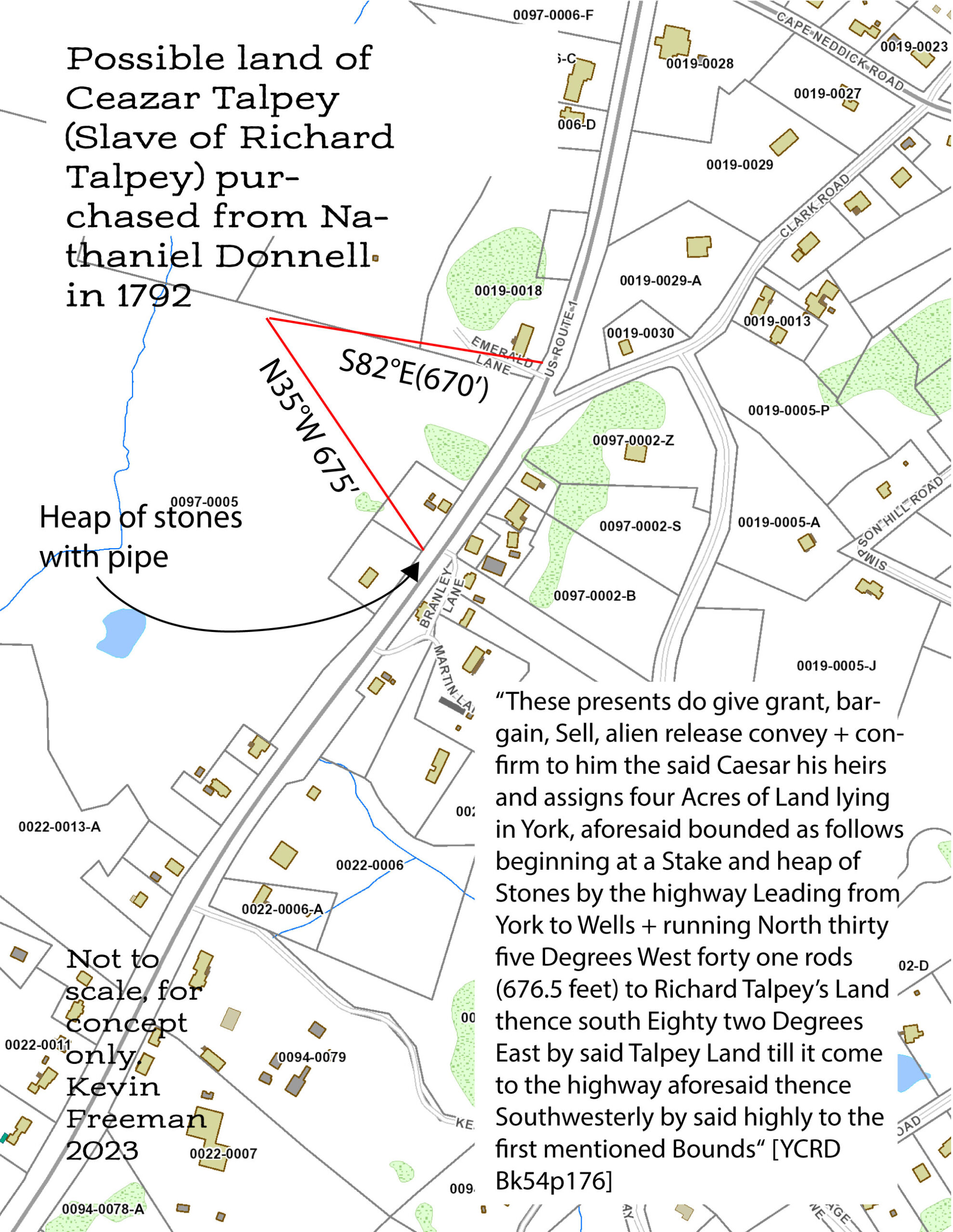
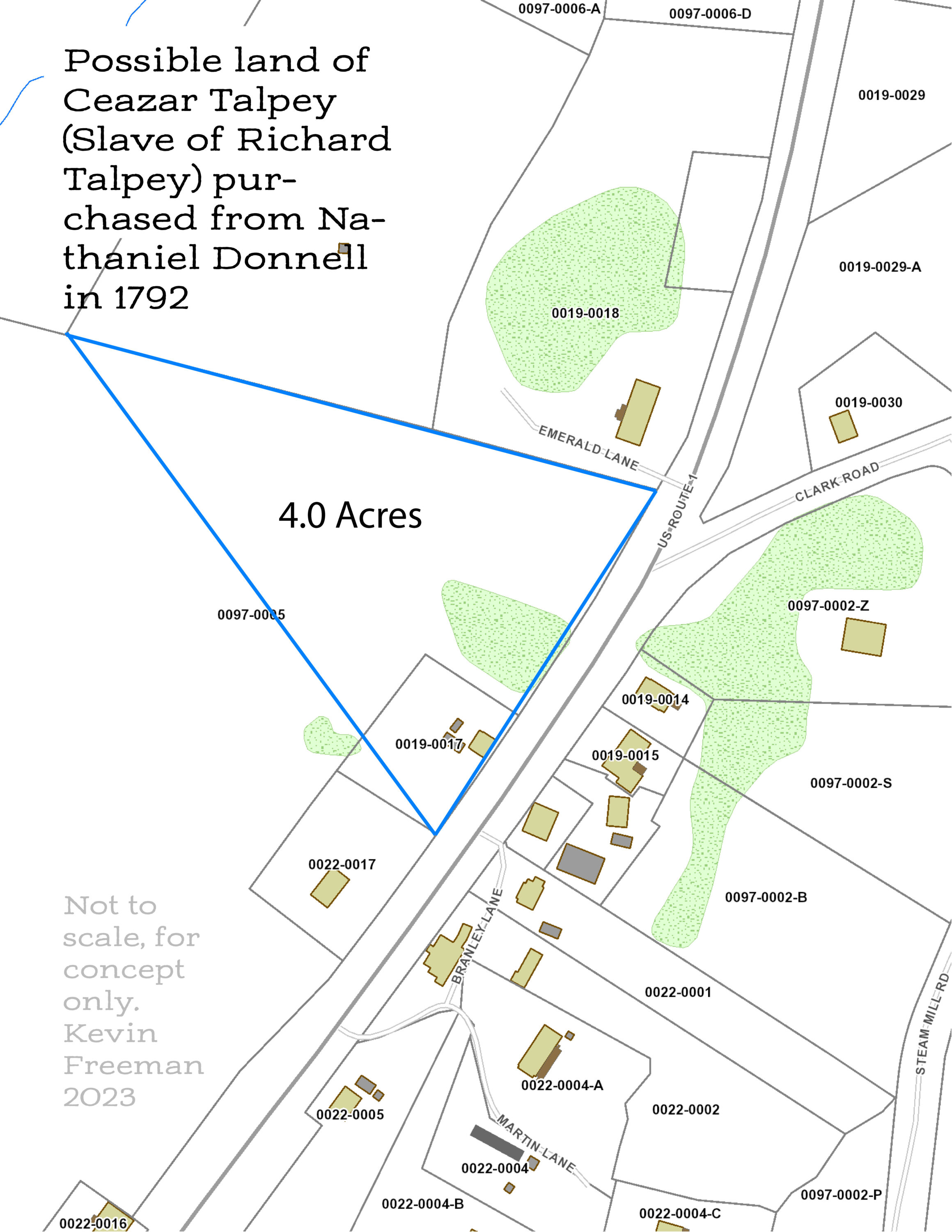
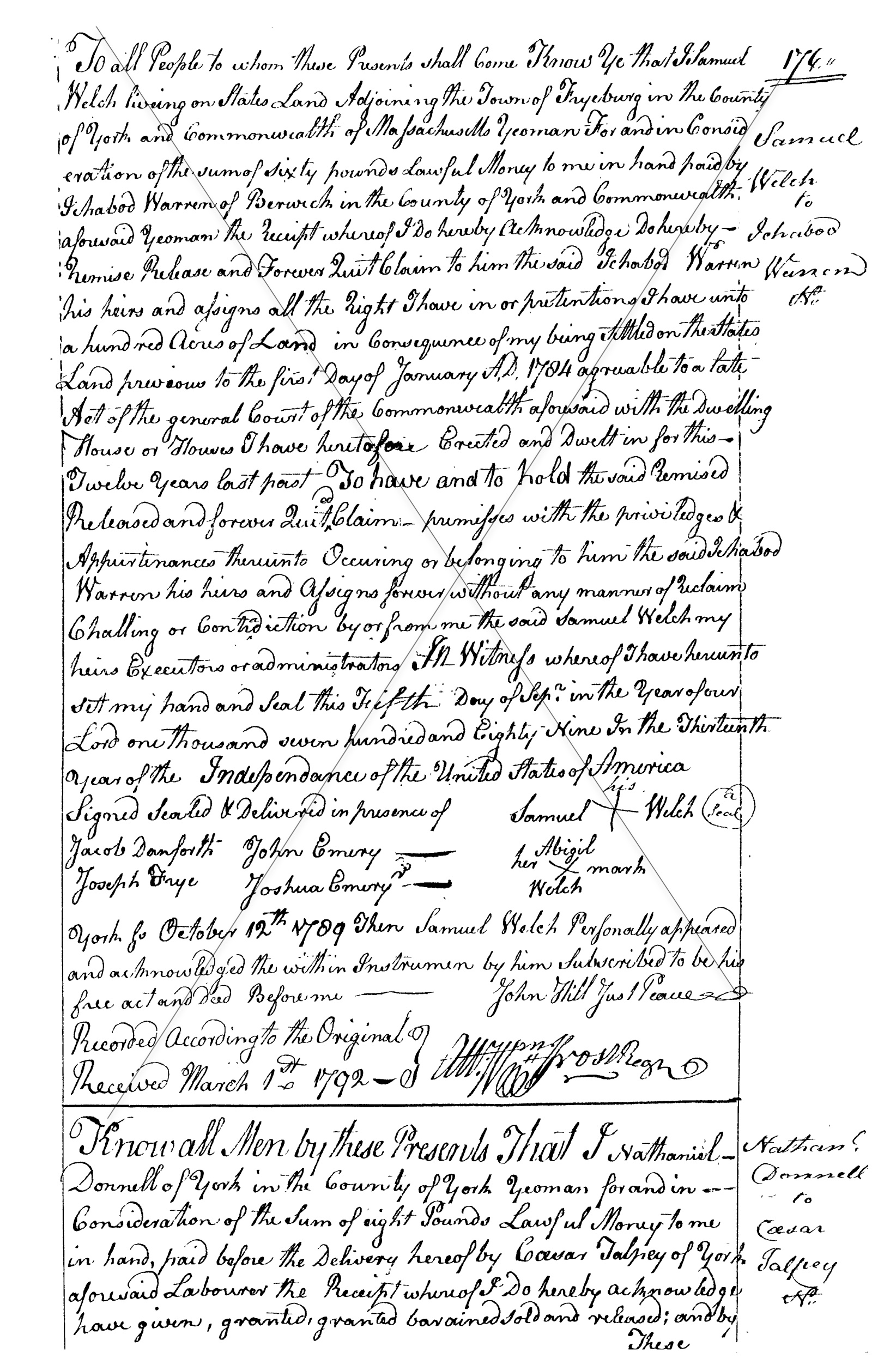
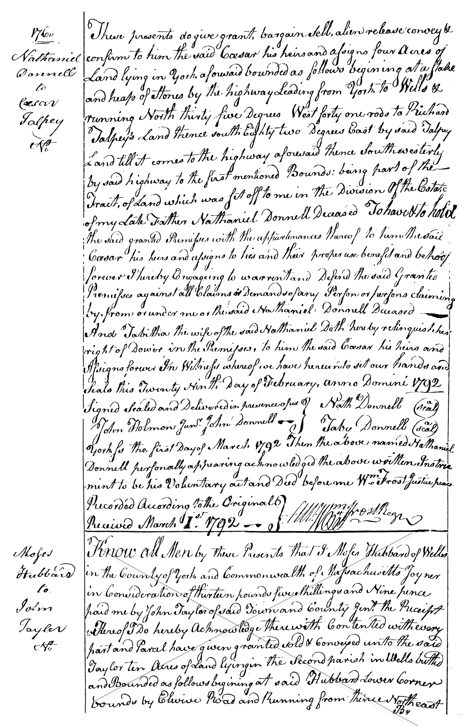
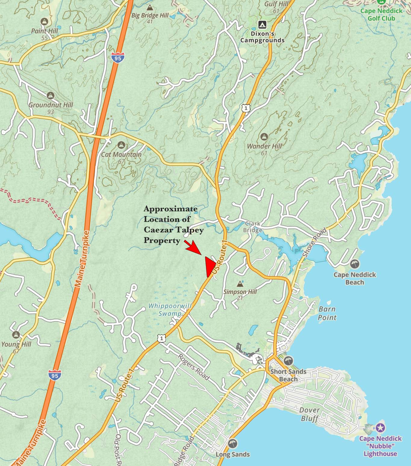
Ron Nowell and I have been compiling a list of Slaves in York, Maine and one Slave, Caezar Talpey has caught our imagination. Caezar purchased land from Nathaniel Donnell in 1792, bounded by his owner, Richard Talpey, to the North. We can assume Caezar was freed when Slavery became illegal in Massachusetts in the 1780’s. From the deed (YCRD book 54 page 176) I have used the tools on the Town of York tax maps to draw the location of the property lines taken from the deed. The first drawing represents the measurements as accurately as possible from the deed reference. The second drawing shows 4 acres with a slight liberty to tweak the triangle into conforming. This effort is preliminary and not conclusive but it gives us a general idea of where a Slave owned property and lived in Cape Neddick in the later part of the 18th Century. Here is the description in the the deed… “These presents do give grant, bargain, Sell, alien release convey + confirm to him the said Caesar his heirs and assigns four Acres of Land lying in York, aforesaid bounded as follows beginning at a Stake and heap of Stones by the highway Leading from York to Wells + running North thirty five Degrees West forty one rods (676.5 feet) to Richard Talpey’s Land thence south Eighty two Degrees East by said Talpey Land till it come to the highway aforesaid thence Southwesterly by said highly to the first mentioned Bounds”