The Devil’s Invention

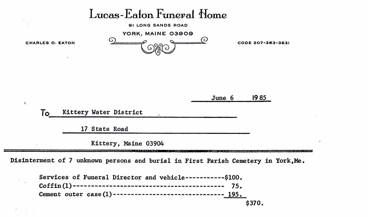
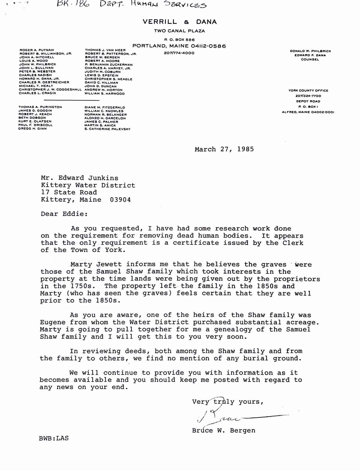
This is the tragic story of a kidnapping in Colonial York, Maine. The below can be found in Cider Hill Annals and Miscellaneous Sketches, by Angevine W. Gowen. He hand wrote what appears to be a court document. The source of this document is currently unknown. A copy of Gowen’s book can be seen at Old York Historical Society’s Archive.

Several members of York History Group joined together to transcribe the above account, as follows…

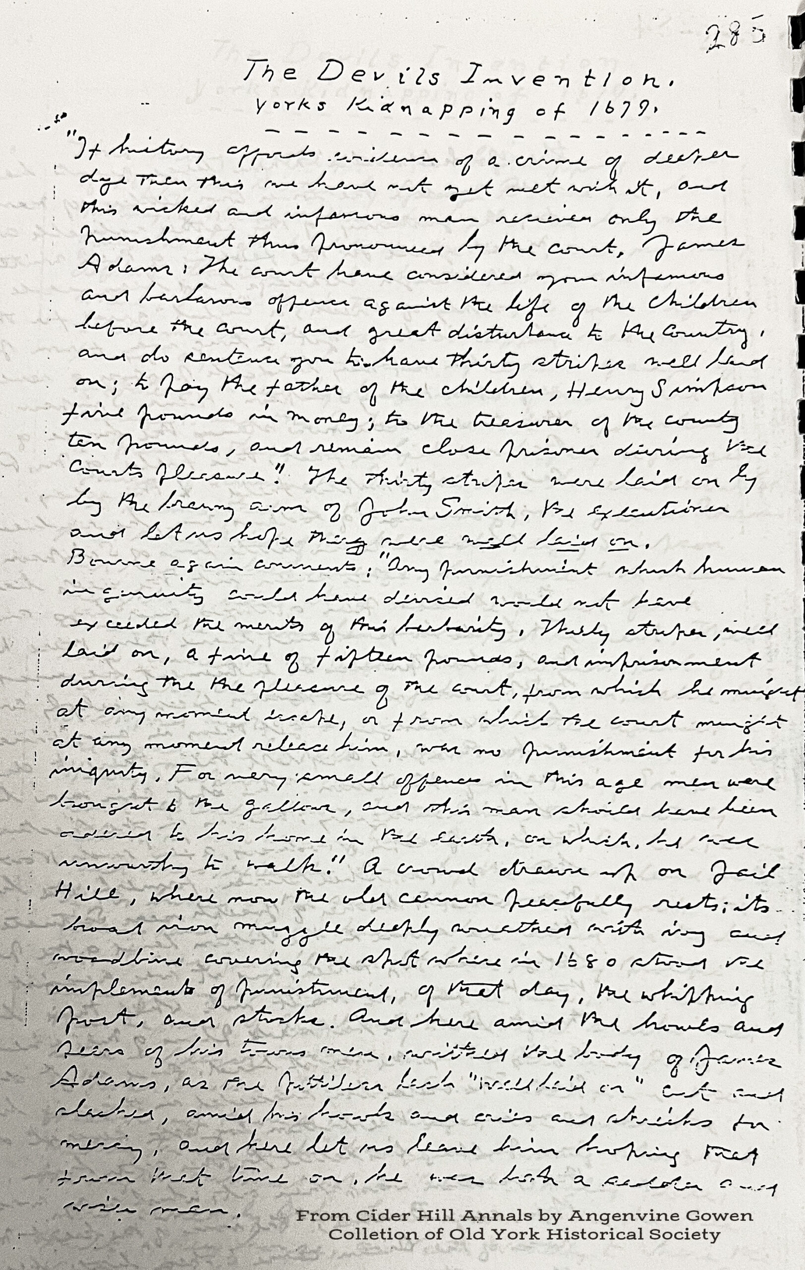
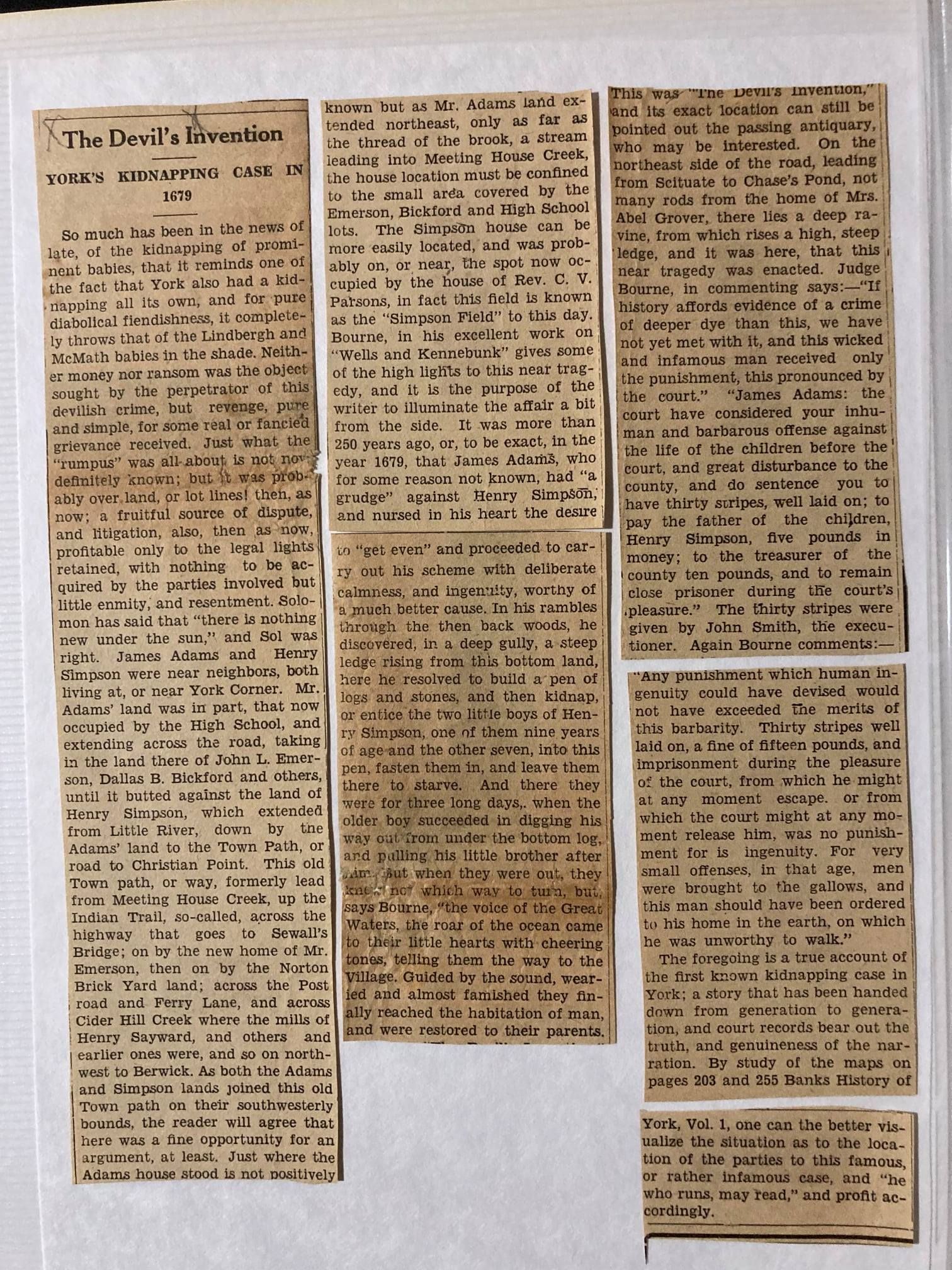
“If history affords evidence of a crime of deeper [dye?] than this we have not yet met with it, and this wicked and infamous man receives only the punishment thus summoned by the court. James Adams: the court has considered your infamous and barbarous offenses against the life of the children before the court, and great disturbance to the county, and so sentences you to have thirty stripes well laid on; £ pay the father of the children, Henry Simpson, five pounds in money; to the treasurer of the county ten pounds, and remain close prisoner during the courts pleasure.” The thirty stripes were laid on by the brawny arm of John Smith, the executioner and let us hope they were well laid on. Bourne again comments: “Any punishment which human ingenuity could have devised would not have exceeded the merits of this barbarity, thirty stripes, well laid on, a fine of fifteen pounds, and imprisonment, during the pleasure of the court, from which he might at any moment escape, or from which the court might at any moment release him, were no punishment for his iniquity. For very small offences in this age men were brought to the gallows, and this man should have been added to his home in the earth, on which, he was unworthy to walk.” A crowd draws up on Jail Hill, where now the old common peacefully rests, its broad [?] [?] deeply wreathed with ivy and woodline covering the spot where in 1680 stood its implements of punishment, of that day, the whipping past, and stocks. And here amid the howls and jeers of his townsmen, withers the body of James Adams, as the [?] lash “well laid on” out and stacked, amid his howls and cries and shrieks for mercy, and here let us leave him hoping that from that time on, he was both a sadder and wiser man.” 

Thanks to Juanita Trafton Reed, Kathy Cawrse, Racheal Bottino, Danny Bottino, Joanne Weiss Curran, for assisting with this transcription. Juanita commented on the Facebook post…My transposition matches most of what you have here (above), with these few exceptions… I believe it is “strikes” not stripes./ Whipping post. (instead of “past”) Instead of common — I think it is “cannon”. / lash “well laid on” cut and slashed ( rather than cut and stacked) and where you have the £ sign I read it as “to”…”to the father”

Contributed to York History Group by Karl Hanson. Unknown Newspaper and unknown date.

York in American History: Fate of Ensign Henry Simpson

Notes: During the late 17th Century, life in early colonial York was daunting, short, often brutish, terrifying and unpredictable. Based on research from original documents, such as court records, James Kences paints just such a portrait in this essay.

This story is published on Seacoast Online and provides additional information on the Simpson Family of York.

By James Kences

One of the final events in the life of Ensign Henry Simpson was his participation at a court of sessions of the peace on Dec. 29, 1691. Within a month, he would be among the victims of a Native American raid upon the town. Simpson and his wife were presumed to have been killed, and two of their sons, Henry and Jabez, were taken into captivity.

Simpson was married to Abigail Moulton, sister to Joseph Moulton, who on the day of the attack also perished with his wife. Their son Joseph was captured. Jeremiah Moulton, who was only three or four years of age in 1692, was to become one of the military and political leaders of 18th Century York.

The reconstructed list of casualties from the raid, included in total number, three other married couples: in addition to Simpson and Moulton, Nathaniel Masterson and his wife, Elizabeth; Philip Cooper, and his wife, Anne; Thomas Paine and his wife, Elizabeth. In each of the three instances, some of their children were taken prisoners and accompanied the raiding party upon its return to Canada

And what of the fates of those children? Masterson’s daughter Abiel, Mary Cooper, and Bethiah Paine, eventually returned, but only after a period of years. Mary Cooper was redeemed in 1695, together with Henry Simpson and seven other persons. Three years later, Bethia Paine was brought back. A decade had passed, Jabez Simpson was apparently still inside French Canada.

The documentary sources are quite spare, and often only names have survived, but with effort a deeper dimension to the slight details is possible. Ensign Henry Simpson can be profiled more richly than the others. The story begins with his childhood. He was about four when his father, afflicted by illness drafted his will in March of 1647. An only child at the time, a portion of the estate was apportioned to him.

Shortly after his father’s death in the summer of 1648, Simpson’s mother remarried, and became the wife of Nicholas Bond. In May of 1650, Henry Simpson, only six years old, testified at the trial of Robert Collins, who was charged with assault upon his mother. The man he knew as “fat Robert,” had attacked her at night inside their house.

“She being in her house, her children in bed, she was making a cake for them against the next day to leave them,” she recounted at the trial. It was midnight, and she required some firewood, and was at the door when Collins forced his way in. The testimony is somewhat confusing, but it described multiple incidents that involved Collins. In one confrontation, she declared to him, “leave my company and meddle not with me, if not I will make you a shame to all New England!”

Jane Bond acknowledged, “she could not save herself,” her husband at the moment, was absent “to the East.”  The jury found Collins guilty of the crime. He was “to receive forty stripes save one, and fined ten pounds,” as punishment. As a glimpse into life here in the early period, the trial is of considerable value. The five witnesses had included Henry Norton, who was not only a close neighbor, but also a relative. Norton had heard Henry Simpson’s mother call for him, “Cousin Norton!” “Cousin Norton!” but he failed to respond.

The Norton family were prominent and well connected. Henry Simpson’s grandfather was the veteran soldier Walter Norton who was killed by the Native Americans in Connecticut in 1634. His grandmother upon his death married William Hooke, who belonged to a family of merchants at Bristol, a city in the southwest of England. This town for a brief period was named Bristol, and the influence of the Hookes was expressed through the choice of the name.

Henry Simpson could claim high social standing as kindred to the two families. He was elected to various town offices, constable, and served as a selectman. He held a military rank, and was frequently a member of juries, and as mentioned, was part of the grand jury only weeks before the raid in 1692.

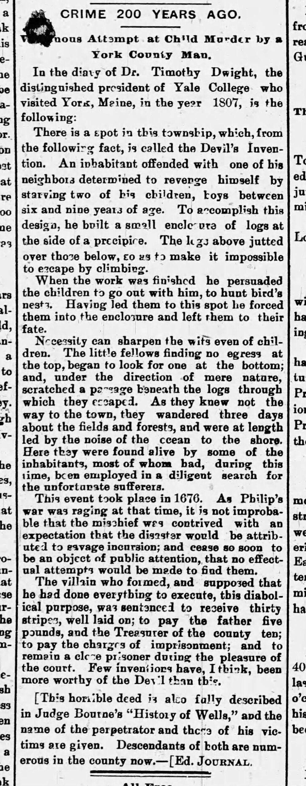
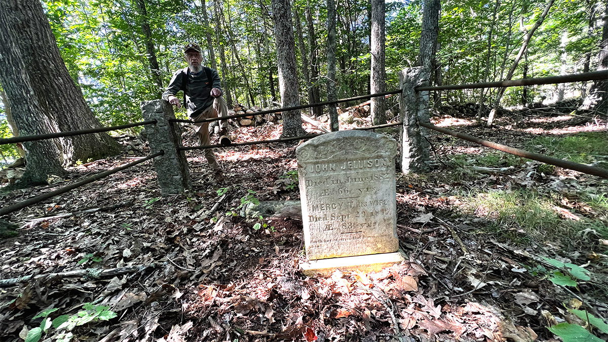
Whatever provoked James Adams to kidnap and imprison Simpson’s children inside an improvised enclosure that was to be known henceforth as “The Devil’s Invention,” is unfortunately lost to history. But the record has survived for the court session of July 1679. For the “barbarous offense against the life of the children,” Adams received a sentence of a severe whipping, “thirty stripes well laid on,” and was also to pay Simpson, “the father of the said children,” five pounds in damages.

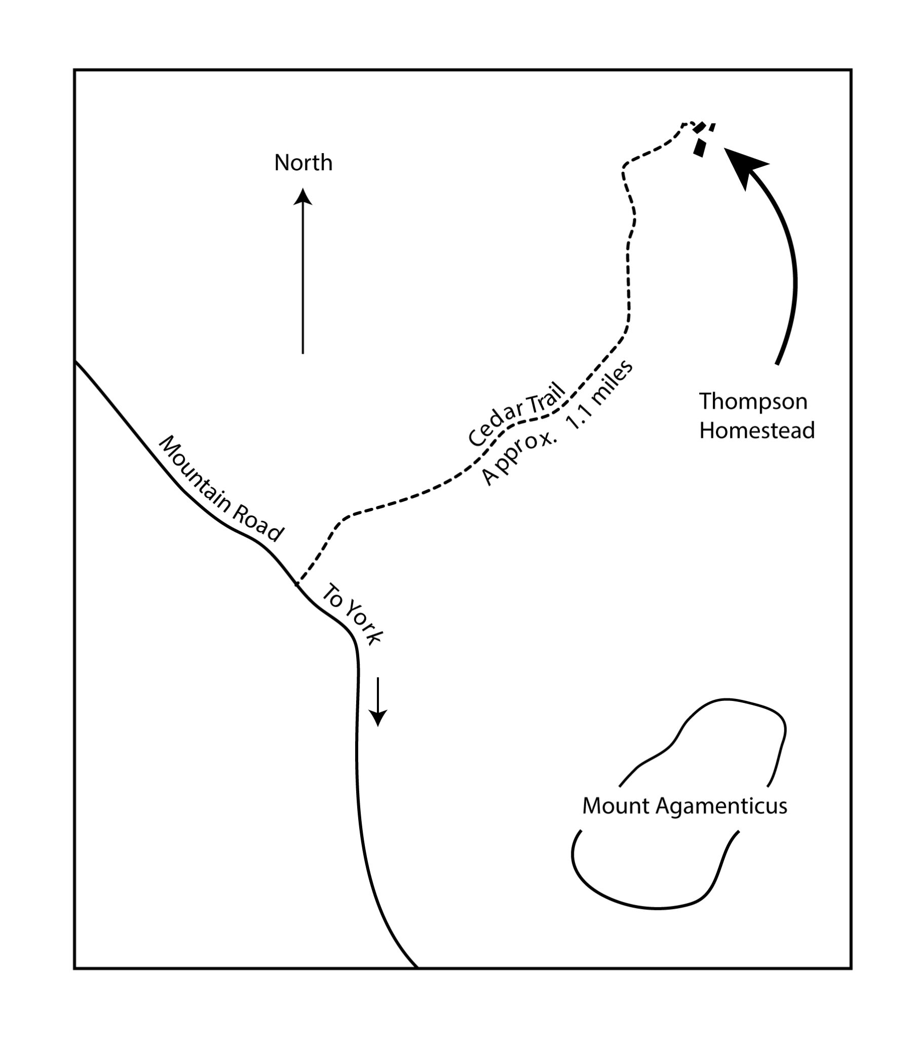
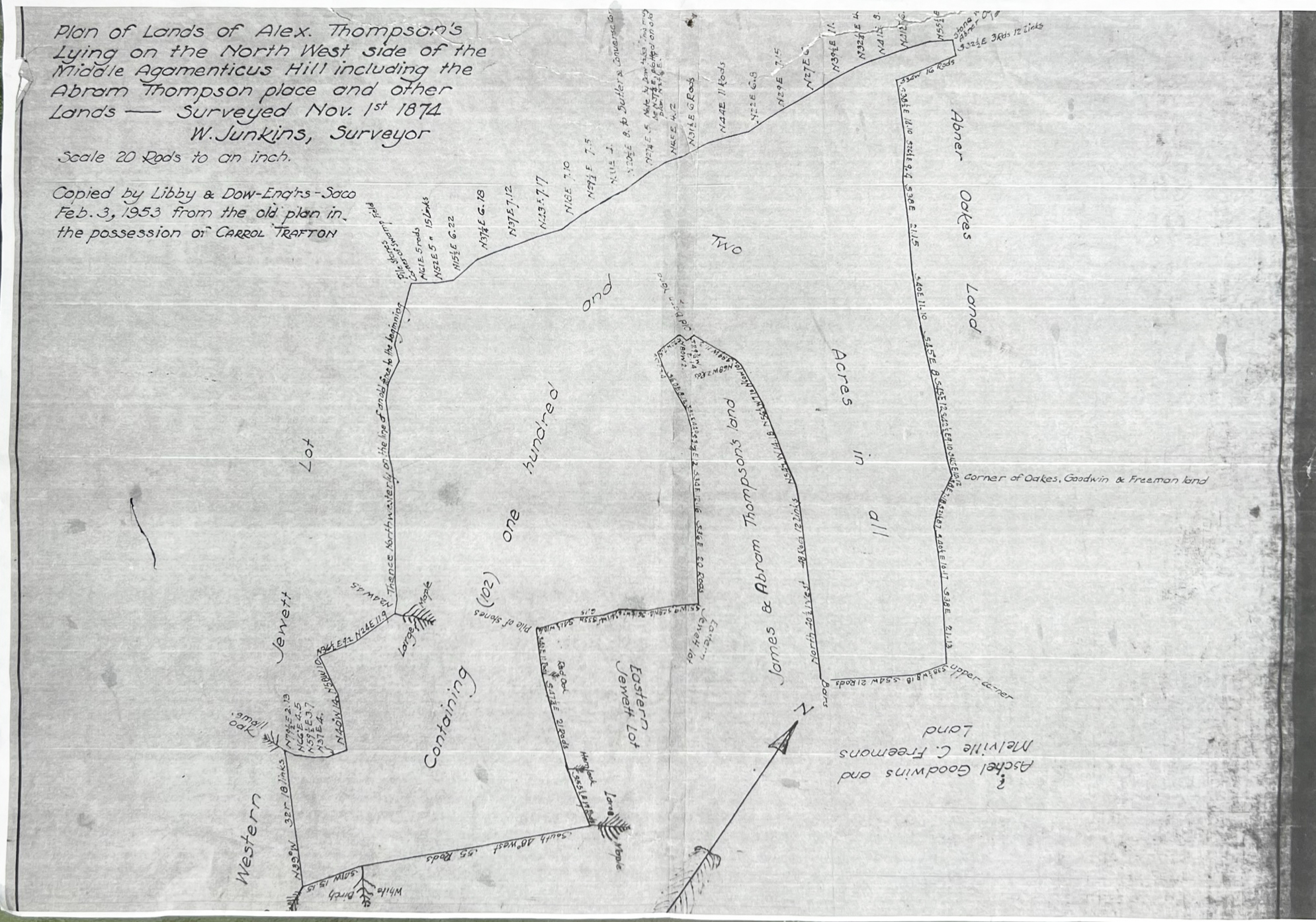
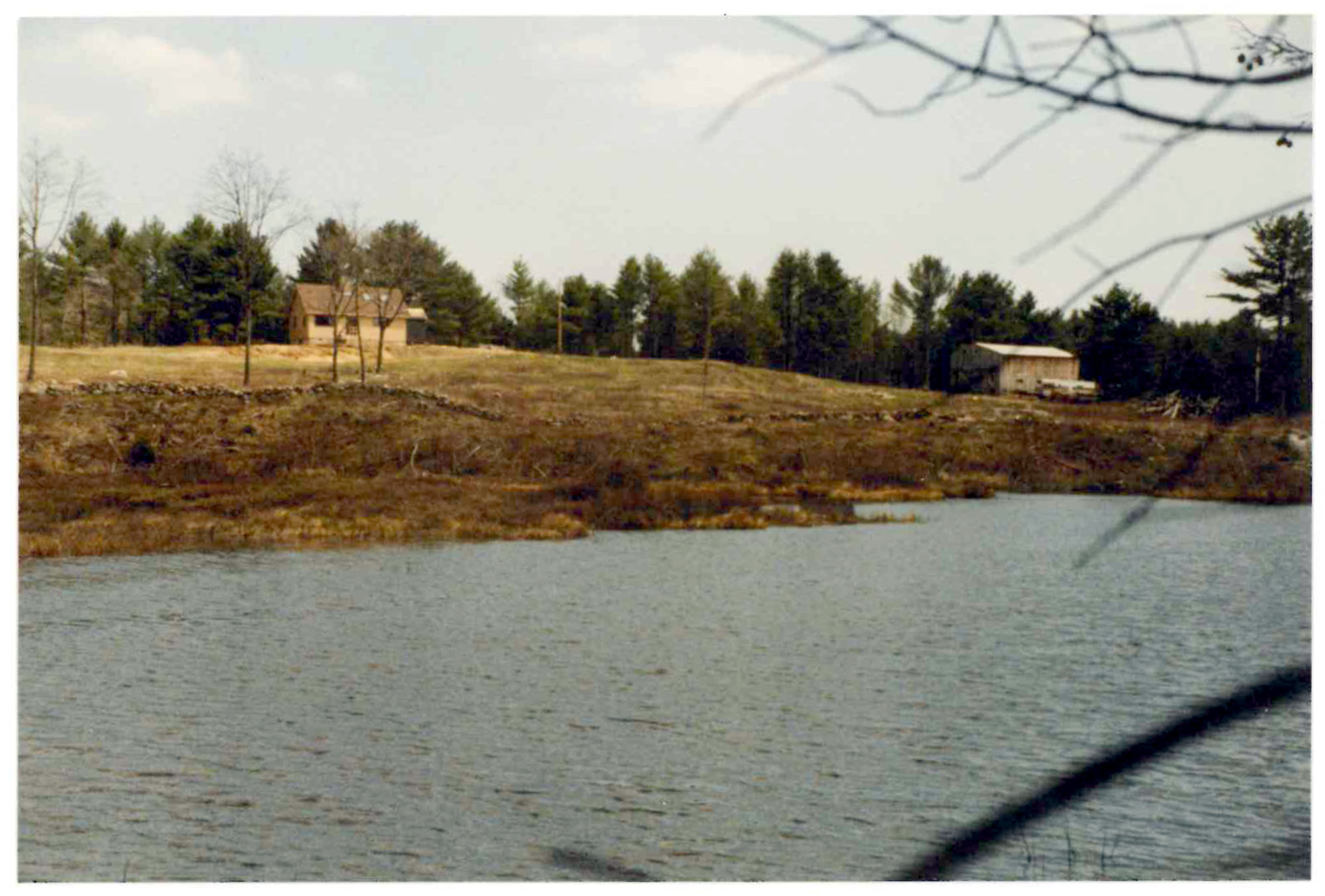
The site of the notorious structure, was according to Charles Banks, “in the region of Scituate, easterly from the main highway through that settlement.” Philip and Nathaniel Adams, the father and brother of James, appear to have been among the victims of the 1692 raid.

Devil‘s Invention article in the Biddeford Saco Journal July 18, 1893

The Outer Commons and the Alexander Thompson Homestead

Kevin Freeman and Ronald Nowell

Mount Agamenticus in York, Maine, is rich in history. Not only does it serve as a landmark for mariners past and present but it was once inhabited by York’s early residents. The forefathers of the Town decided to sell parcels of this area to York residents who were over twenty one years of age and willing to pay the cost of administration. The dividing and selling was documented in a book titled the Book of Proprietors that is currently kept at the York Town Hall.

Today, it is difficult to imagine the attraction for early settlers in this area and yet, without a doubt, owning a piece of the Outer Commons elevated a persons social status, among other things. We assume that a lot of these shares were bought and sold for profit. But many of these lots were inhabited by families whose names are significant in York History. Among the families in this area listed on the highway tax maps for 1831 are Ramsdell, Welch, Fitzgerald, Lewis, Thompson, Dixon, Jellison and others. 

In the spring of 2022, with Ron serving as a guide, we began extensive hikes in the First (Mount Agamenticus), Second and Third Hill area. Ron’s knowledge of botany, landmarks, monuments and history around the mountain is exceptional. Ron noted numerous points of interest and we discovered some new ones. Eventually we both became guided by curiosity as one discovery led to another. From caves that we walked through, to spring holes, to old foundations, to a mammoth White Pine tree, to burial sites that could have easily been passed by – it all became a wonder and puzzle. 

Our curiosity took us to land surveys and old deeds in a mission to find out more about those who lived there and why. Ron pointed out some unusually substantial stonewalls on the Northwest side of Second Hill. We instinctively began to follow them down hill. Ron had a survey plan titled, Plan of Lands of Alex.Thompson’s Lying on the North West Side of the Middle Agamenticus Hill Including Abram Thompson place and other Lands, 1874, in original possession of Carroll Trafton. Initially, regardless of orientation the plan made little sense. One feature on the plan compelled us both to discover more—an unusual shaped stonewall near an “old barn yard.”

In contrast to rough terrain found elsewhere on the mountain, the land was much more flat with a gentle slope. It was uncharacteristic of a first or second growth forest, rather it was smooth, perhaps made so by plowing. There are numerous piles of stones, varying from ten to fifteen feet in diameter and several feet high serving as collection sites when the fields were picked clean of rocks. Some of these piles are very close to the stonewalls. One wonders how it was decided for some of the rocks to have been turned into stonewalls rather than piles. 

The area was too vast to be conclusive about how to find the exact location of the barn yard, though we tried during one afternoon of exhaustive hiking. A few days later Kevin hiked out to the area with a GPS trail mapping app on his phone and walked along the stonewalls creating a graphic route that was nearly identical to the stonewalls on the property plan. Ron was called and we met at the Cedar Trail head. After reaching our destination we also discovered a cellar hole for a home, At the deepest point the cellar hole was about 8 feet from top to bottom and made us more curious. Shortly thereafter, we pinpointed the location of a barn and an out building.

According to the survey plans we were at the Thompson homestead. Checking deeds at the York County Registry of Deeds further confirmed our assumption. Book 140, Page 221, dated September 21, 1831, describes brothers Abraham and Isaac Thompson dividing the property previously owned by their father, “Alexander Thompson late of York, deceased, the land lying a little bit to the North of Agamenticus.”

The deed describes marked trees, bearings and rods to secure boundaries. Most curiously the deed states, “said Abraham is to have the old barn and the south room in the house, or one half of the house and the said Isaac to have the new barn and the north part of the house as far as one room extends, and the said Abraham gives Isaac nine months from this date to occupy his part of the house, and take it off from his land; and both parties agree that there shall be a privilege for each party to pass and repass from their premises…”

We spent some time conversing about the significance of such an operation way out here in the woods. Though there were some neighbors on the mountain, unlike the community of York Village, the homes were spread far apart, evoking a feeling of isolation. The paths were steep and rough. Transportation would have been by foot or a springless horse or ox cart with steel rimmed wheels. Sheep farming became a craze with the introduction of Marino sheep in 1802 and at great cost to New England forests. The endless stonewalls that we see today were created to contain the lucrative commodity. We speculated that sheep farming would have provided enough income to support this homestead.

In many families the given names of members are repeated for many generations, Alexander Thompson is no exception. William Thompson was living in Kittery when he died at 43 years of age in 1676. George Ernst wrote that William’s younger children, one being Alexander (1671-1720), were left to the Selectmen of Kittery to provide for. Ernst speculates the children went to various families and their names may have became that of their foster parents, confusing a clear genealogy. None-the-less, we see that the above Alexander had two sons, referred to in the above noted deed as Isaac and Abraham.

We are unclear as to the progression of who owned exactly what but have begun to unravel a web of information that inspires us to look farther. Ron is quite sure there were Abrams as well as Abrahams in this area though a survey report done for Land For Maine’s Future by Titcomb Associates refers to Abraham as “aka Abram.”

We have found at least three recorded tracts of land owned by Thomson family members on the North side of Mount Agamenticus.


Map of York, Maine Outer Commons
  1. York County Registry of Deeds, Book 43, Page 182, February 28, 1775

Joseph Linscot to Joseph and Curtis Thompson for about 55 acres, 13 acres and one

third of an acre.

2. York County Registry of Deeds, Book 42, Page 110, August 1, 1772

James Junkins to Alexander Thompson containing eight shares of lot one in the fourth

range.

3. York County Registry of Deeds, Book 58, Page 30A, November 29, 1781

James Junkins sells remaining shares of lot one in the fourth range to Alexander Thompson.

The plan of the Outer Commons copied by Angevine Gowen from Daniel Sewall, W. Junkins Survey Map of 1874 and a York Town Map are included as attachments to this document.

It may be of interest for the reader to notice the contrast of the rectilinear format of the division of the Outer Commons versus the wandering boundaries in the Junkins Survey.  

Raymond “Jakey” Weare

Tuesday, January 15, 2013
Kevin Freeman

Jakey Weare standing next to York Beach Fish Market truck and trailer. Location unknown.
Jakey Raymond Weare standing next to York Beach Fish Market delivery truck and trailer. Found on Legends of Cape Neddick Facebook group. photo credit unknown.

Today I ventured to the home of “Jakey” Raymond Weare (1921-2016) and Iris Weare (1923-2015), husband and wife who live in Cape Neddick. I intended to ask Jakey if I could interview him for a book that I am helping to write on Cape Neddick. He agreed and I came away with the following.

Jakey’s family was one of the first to arrive in Cape Neddick. His first European ancestor to arrive in Cape Neddick did so via Massachusetts, New Hampshire and finally Georgiana. Peter Weare died in an Indian attack in the 1690’s. His homestead was located someplace on the north side of the Cape Neddick River, perhaps the home on Shore Road in which Jakey grew up.

I have known Jakey only slightly during my life. He hauled some boards out to my home in or around 1985. My driveway is almost a half mile long and at the time it was riveted with stumps. For some reason I was at odds with my father whose tractor I often borrowed and I asked Jakey to help me get them home. I intended to pay him but once he dumped the lumber from his 4×4 pickup he declined any payment.

He is very easy to talk to but doesn’t always speak clear. He didn’t mind me saying “what” until I understood what he was saying.

Jakey sat in a chair opposite his entry door right next to a large cookstove. To the right was a table and further was a counter and the kitchen. The wood stove was hot. He told me to pull up a chair. I was very unprepared to interview him and only intended to ask him if it would be possible, so I just started asking the basic questions.

He was born in 1921. His father was Raymond Weare. His father, Raymond owned the York Beach Fishmarket. He bought the fish market from (Otis) O.W. Avery. Jakey said O.W. could not read or right which helped facilitate his father’s purchasing of the business.

Jakey went to school at York Beach, where the the police station is now. It is the same school I went to for K, 3,4,5,6. Jakey’s classmates were Frank Hancock, Russel Philbrook, Herman Chase, John Garfield, Virginia Freeman and Gloria Eldredge. His teacher was his aunt, Mrs. Belmont. I have heard through other sources he was of particular interest to her when it came to discipline and likely had more than his share of the ruler.

When I asked what it was like growing up in Cape Neddick, if the economy was robust he said it was the way it was. They were busy all the time. I asked him if the Passaconaway Hotel was open when he was a kid. He said it was not in business but he and his friend Arthur Philbrick would go into the building and collect the urinal pots which were supplied to each room and cary them to the top of the elevator shaft and drop them all the way down. He took much delight in sharing this with me and mimicked the loud crashing the pots made on impact.

After Jakey graduated from York High School, in 1940, he moved to Dexter, Maine where he took a job in a machine shop. He worked on a milling machine. Jakey became very homesick and wanted to go home, which he did.

Once he got back to York he worked at Kidder Press and shared rides with his best friend Leonard Freeman, the son of Abbott Freeman. Leonard got placed on the night shift and did not like it. He intentionally took something which he had to purchase from the drug store that caused him to vomit. He did this enough times on the nightshift that his foreman allowed him to go back to working days. Leonard and Jakey resumed commuting together.

Iris Hilton moved to York in 1941 from Andover, Maine. Her father worked at the Portsmouth Naval Shipyard. Iris worked at Garfield’s in York Beach, next door to the fish market where Jakey worked for his father. Jakey joined the Navy in 1942. He studied at Wentworth Institute in Boston before being commissioned on an amphibious carrier. At Wentworth Institute he learned to work on steam engines. The boat he was commissioned to was USS Sumter APA-52. http://en.wikipedia.org/wiki/USS_Sumter_(APA-52)

While in the Navy Jakey and Iris married. Jakey didn’t see his first daughter Pam until she was 18 months old.

After leaving the Navy Iris and Jakey settled in a cottage near Shore Road. Iris said when the wind blew the linoleum on the floor would lift right up. She added, “We didn’t care, we were young.” Jakey had saved $2,000 while in the Navy and built the house on Old County Road where he lives today. The total cost was $8,000 which included furniture, in 1948.

As I was standing near the door and ready to leave Iris told me that she and Jakey already had their headstone. The graveyard in which the stone was waiting was across their lawn in a family plot which contained Jakey’s father and grandfather. As I looked out the window across the yard and toward the headstones there was an old stone out of place. It was on the outside of the plot leaning inward on an iron rail. I couldn’t imagine how it got there but quickly realized it was for Iris and Jakey. Iris said, “this way the kids don’t have to figure out what to do.”

Slave Property in Cape Neddick

Ron Nowell and I have been compiling a list of Slaves in York, Maine and one Slave, Caezar Talpey has caught our imagination. Caezar purchased land from Nathaniel Donnell in 1792, bounded by his owner, Richard Talpey, to the North. We can assume Caezar was freed when Slavery became illegal in Massachusetts in the 1780’s. From the deed (YCRD book 54 page 176) I have used the tools on the Town of York tax maps to draw the location of the property lines taken from the deed. The first drawing represents the measurements as accurately as possible from the deed reference. The second drawing shows 4 acres with a slight liberty to tweak the triangle into conforming. This effort is preliminary and not conclusive but it gives us a general idea of where a Slave owned property and lived in Cape Neddick in the later part of the 18th Century. Here is the description in the the deed… “These presents do give grant, bargain, Sell, alien release convey + confirm to him the said Caesar his heirs and assigns four Acres of Land lying in York, aforesaid bounded as follows beginning at a Stake and heap of Stones by the highway Leading from York to Wells + running North thirty five Degrees West forty one rods (676.5 feet) to Richard Talpey’s Land thence south Eighty two Degrees East by said Talpey Land till it come to the highway aforesaid thence Southwesterly by said highly to the first mentioned Bounds”

Deed of Nathaniel Donnell to Caezar Talpey, Slave of Richard Talpey. 1792
Deed from Nathaniel Donnell to Caezar Talpey, Slave of Richard Talpey. 1792 (page 2)
Locus map of Caezar Talpey Property in Cape Neddick, Maine

Bell Marsh Reservoir Gravesite

The exhumation of a gravesite by the Kittery Water District in York, Maine.

by Kevin Freeman

1985 Property Plan of Bell Marsh Reservoir showing approximate site of an unknown gravesite that was exhumed before the flooding of Bell Marsh Reservoir.

Almost weekly, for the last year, Ron Nowell has invited me out into the woods around the Mount Agamenticus area and southerly towards the York River. I have been an eager beneficiary of Ron’s love of local history and nature, listening with great interest to Ron’s renderings of local lore. Many stories have caught my imagination, leading me to pursue a deeper understanding through additional research. Between hikes, Ron and I will often talk on the phone, exchanging additional information, adding further interest and curiosity.

After we had covered a lot of area east of Mountain Road, our attention turned to the southwest of Mountain Road leading us to the Horse Hills and Bell Marsh. We followed cart paths, streams, bushwhacked and stumbled a few times on the lookout for ancient dwelling sites, dams, natural anomalies and native orchids, especially the illusive Small Whorled Pogonia.

Although the old tote roads we traveled were not marked, Ron guided me on several trips from Mountain Road to Beechwood Road to near Bell Marsh. At some point and after crisscrossing other trails we arrived at Old Bell Marsh Road. I don’t know exactly where these paths become Old Bell Marsh Road. Old Bell Marsh Road was replaced by Bell Marsh Road as recently as the mid 19th Century. Both roads lie parallel to each other, the old road on the eastern side of the reservoir and the newer road on the west. The Old Bell Marsh Road, an early town three rod road, is lined on both sides with stone walls. When followed to Bell Marsh Reservoir it submerges into the reservoir and disappears making it appear to be an ideal boat launch, though boats are not allowed. As one stands on the north shore and looks about 300 yards across the water, the road reemerges on the opposite shoreline and the old road continues to Linscott Road. The newer Bell Marsh Road begins at a point on Mill Lane, ending Mill Lane, off Route 91. 

The forest in this area has been cut many times since the first colonizers arrived. There are some large trees in some places though I am quite certain they are not virgin. We have stopped at many and just marveled at them. Solitary and towering above the others, they are a testimony of what happens when nature is left alone for one or two hundred years. Ron and I ponder how these trees were spared the axe or saw. The diversity of terrain between Mountain Road and Bell Marsh is quite spectacular. There are many vernal pools, dramatic ledges including Hedgehog Hills, rolling hills and a forest with a multiplicity of species. I am sad to say the forest is spotted with many Hemlock trees in varying states of disease and decay from the invasion of the woolly adelgid.  The old stone walls, often but not always prolific, are a constant reminder that humans occupied this area with the interest of raising sheep. 

As I researched the deeds in this area, property owners included the families of Paul, Shaw, Nowell, Junkins, Parsons, Ramsdell, Mitchell, Garey and Hooper who were likely recipients of land divisions when the Town of York began breaking it up for private ownership in the early eighteenth century. Today, a big portion is owned by the Kittery Water District, York Land Trust, and the State of Maine and fortunately it is mostly conserved for the future. 

Ron Nowell leans on gravesite rail of John and Mercy Jellison. Cemetery #198

In John Eldridge Frost’s, The Nowells of York and South Berwick, Ron had read about some places that he hadn’t seen before in the Bell Marsh area. Ron was especially interested in a Jellison Cemetery, #198 on the York Cemeteries and Family Burial Grounds Map, and the homestead of Samuel Shaw. Frost also mentioned School House Number 7 that captured my imagination and can be seen on Sanford, Everts, & Co 1872 map of York. But it wasn’t as easy as just walking into the woods and finding these places. A typical hike, with Ron, is from four to eight miles. We would be in the woods walking and resting for about five or six hours. We each carried a back pack with our lunch, desert and coffee. We never knew exactly what to expect and after I once witnessed Ron tumble off a cliff and get pretty roughed up, I began carrying a fifty foot rope that could serve in a dramatic rescue attempt as well as in the many caves we searched for. Whether we found anything or not, I felt a natural kinship to Ron. It was obvious to me, that we both loved being in the woods, enjoying nature — everything else was icing on the cake. 

During the summer of 1983, plus or minus a year or two, I worked with my best buddy building a stone foundation for Larry Willey’s home on Garey Mill Lane, off Bell Marsh Road. We also built a large fireplace in his living room that had a cathedral ceiling. We consumed a lot of rocks for both projects. We picked stones from the Garey Mill dam site and from the many stone walls that were at the time on the Willey property. From my first encounter I was impressed seeing the large hewn stones placed in a way that created the skeleton of a mill that would have turned raw materials into economic viability.

Garey Mill Bell Marsh York, Maine
Kevin Freeman standing at the Garey Mill site off Garey Mill Lane, circa 1983

More than 40 years later, I returned to this remote area once inhabited by families whose names I listed above. As we walked, Ron’s stories of those who had lived here in the 19th century inspired me. The only evidence of settlement was stonewalls and a few cellar holes that are settling back into the earth and names on a few old maps that listed a few inhabitants. Mostly however, on the old map, staring back at me, I was captivated by School House Number 7. We were fairly certain of its likely general location but not conclusively. None-the-less, I used my imagination to fill in all that I could not see. In my mind the building was modest in size and I painted it white, a bell near the door, children frolicking around the yard, the teacher calling the children back into class, all on a warm sunny fall day. I couldn’t resist this romanticized version though in reality it didn’t exist. In reality there was a road leading from the schoolhouse that disappeared into a reservoir.

Additionally, there was one graveyard that haunted us and it was from another reference by John Frost in his, The Nowells of York and South Berwick. He wrote the graves had been exhumed and the bodies moved. When the Bell Marsh Reservoir was built and flooded, it was likely the gravesite had been submerged. We began examining the property plans that are available online (York County Registry of Deeds). When we weren’t hiking in the woods, Ron would often be hunting down “old timers” and picking their brains about what they knew of the area we were exploring. This would add more interest and clarity to what we were observing on our hikes. Ron made inquiries at the Kittery Water District. After a few months of inquiry and research, we began to piece things together and better understand what had happened at the grave site and the hopeful final resting place of the bodies. Frustrated that we could not locate the burial site we assumed it was underwater and that we would never see it.  

Old Bell Marsh Road, York, Maine
This photo was taken when the water had receded exposing more of Old Bell Marsh Road. The old wall can be seen here cresting above the water surface.

Back at the northern submersion site of Old Bell Marsh Road, standing, facing south at the water’s edge, Ron pointed to what appears to be a rock, or two, cresting just above the surface about 150 feet in front of us. He said that is part of the stone wall that lines the road. The idea of submerging a road and all the history it keeps secret becomes extraordinary in my mind. What is implied? School House Number 7 was directly behind us, the old road submerged in front of us. We sit down on the edge of the reservoir, in the shade of a maple tree and we eat the lunch we carried in. We sip coffee and Ron tells me more stories about the Shaw Family and the Nowell family each living here, making a living, generation after generation. 

It was a hot summer day as we walked back, towards our vehicles parked on Bell Marsh Road. The road was dusty as our feet scuffed along the gravel surface. Part of the road was resurfaced by the Kittery Water Department to better access a logging yard toward the Horse Hills. This part of the road is wide and packed hard with stone and gravel, enabling it to support large logging trucks coming and going. As we walk out carrying our empty packs, we also carry out our heads full of questions and exchange hypotheticals with each other, reviewing from memory what he have read in old deeds and trying to recreate what this place must have been like when it was inhabited. The bigger question, that I always returned to was, why did people live out here and why did they leave?  

Ron called a few days after our hike and said that he had spoken with a local who told him School House Number 7 was at the intersection of Old Bell Marsh Road and Gerry Mill Lane, in the triangular section of the crossroads. I felt satisfaction that the exact location was known. After studying a map by Beatrice Warren Lane, we discovered there were likely three mill sites that were also submerged that would have been on Bell Marsh Stream, also called Smelt Brook. Ron then spoke with the retired Superintendent of the Kittery Water District, who was in charge of the creation of the Reservoir. He had been present at the exhumation of the graveyard and told Ron the bodies had been taken to the First Parish Cemetery in York Village. Ron checked with the Superintendent at the First Parish Cemetery and no records existed for the internment of the bodies.

It is difficult to get a grasp on the size of the Bell Marsh Reservoir project and the reasons for its creation, that is a story unto itself. As Ron and I pursued more information, I was hopeful that we might come across some photos of the construction site in progress. That maybe we could see what the Bell Marsh Brook liked before it was flooded and if indeed the three dams we suspect were present before the flooding would be visible. Our hiking continued and we eventually covered the area around Bell Marsh Reservoir and discovered an absolutely stunning water fall whose sources begin in the Horse Hills. We also found a stone causeway near a very large wetland. As we were making more discoveries our determination persisted to better understand the exhumed gravesite. We talked about waiting for the reservoir to freeze over and if the ice was clear enough and supportive, we could look through it, following the old road below.

Over the end of summer and early fall the mystery of the gravesite, the exhumed bodies and the internment at First Parish Cemetery fueled our research interest. Ron had requested more information from the Kittery Water District but went without a reply until we thought it would be a dead end. That is when Ron received a packet with most, if not all of the information about the research and action taken to exhume the bodies as reported from the Kittery Water District. When Ron shared the packet with me it was quite a revelation. We had nearly given up hope about the many details that we assumed had been recorded for the exhumations but doubted we would ever see. Key, was a plan titled, Condemnation Plan of Kittery Water District Bell Marsh Reservoir, York, Maine, March 5, 1985, Rooney E. Chadbourne, 1125, Registered Land Surveyor. This plan (see above) was not found in the York County Registry of Deeds, by me, after much searching. It was the revelation that we had hoped for. The approximate location of the submerged gravesite is represented in about the center of the plan, though the description is vague. It seemed reasonable to assume that since the gravesite was in the center of the plan it would be in the center of the reservoir, so I thought. By chance, and as the plan didn’t show anticipated water levels, I decided to scan the plan and overlay an arial image of the reservoir into place upon the plan using Photoshop. To my surprise I found that the gravesite may or may not be submerged and it is very close to the Spinney gravesite, lot 6 on the Cemeteries and Family Burial Grounds map for the Town of York’s  Comprehensive Plan 2006.

As of today, April 6, 2023, I am not certain if the gravesite, with the exhumed bodies is accessible or submerged below the water’s surface but I am looking forward to hiking out there and looking closely. I feel this story is important due to the fact that the seven persons buried at the gravesite are now unknown. With the small amount of information we do have, we cannot be certain of who they were, when thy were buried or other facts that are critical to a better understanding of the past. Below are a few documents provided by the Kittery Water District.

By the account told to Ron Nowell by Ed Junkins, the Kittery Water District Superintendent at the time of exhumation, the bodies were removed with a tractor and placed into a plastic container and interred in the First Parish Cemetery very near the Pauper Cemetery which is along the gravel road on the Eastern side. A cement liner was used and the body parts were all placed together. The exact location is not known.


Ron Nowell’s determination to find the details presented above have made this paper possible. Without Ron’s relentless pursuit and sharing of York, Maine history, myself and many others would be far less informed. Thanks to Ron, to whom I have dedicated this paper.

Also, the Kittery Water District has been forthcoming and considerate in providing information, documents and photos that have aided our research. We are grateful to them and for their friendly demeanor.